
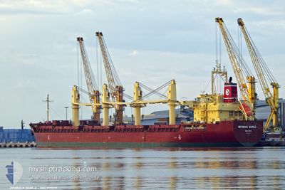
DEVBULK DAMLA
Cargo
Current Trip
| Time Travelled | 29 days |
|---|---|
| Remaining Time | 10 days |
| Distance Travelled | 4052.31 nm |
| Remaining Distance | 2664.76 nm |
| AVG Speed | 9.9 Knots |
| MAX Speed | 14.3 Knots |
| AVG Wind | 12.6 knots |
| MAX Wind | 27.9 knots |
| MIN Temp | -0.7°C / 30.74°F |
| MAX Temp | 14.9°C / 58.82°F |
| Draught | 10.7 m |
| Position Received | 1 d ago |
Current Position
| Longitude | -5.40966° |
|---|---|
| Latitude | 59.73243° |
| Status | Under way using engine |
| Speed | 12.1 Knots |
| Course | 278.8° |
| Area | North Atlantic Ocean |
| Station | T-AIS |
| Position Received | 1 d ago |
Info
Information
The current position of DEVBULK DAMLA is in North Atlantic Ocean with coordinates 59.73243° / -5.40966° as reported on 2024-05-16 02:56 by AIS to our vessel tracker app. The vessel's current speed is 12.1 Knots and is heading at the port of BALTIMORE. The estimated time of arrival as calculated by vessel tracking app is 2024-05-28 16:11 LT
The vessel DEVBULK DAMLA (IMO: 9711717, MMSI: 538006340) is a Cargo It's sailing under the flag of [MH] Marshall Is.
In this page you can find informations about the vessels current position, last detected port calls, and current voyage information. If the vessels is not in coverage by AIS you will find the latest position.
The current position of DEVBULK DAMLA is detected by our AIS receivers and we are not responsible for the reliability of the data. The last position was recorded while the vessel was in Coverage by the Ais receivers of our vessel tracking app.
The current draught of DEVBULK DAMLA as reported by AIS is 10.7 meters
Weather
| Temperature | 10.5°C / 50.9°F |
|---|---|
| Wind Speed | 19 knots |
| Direction | 237° WSW |
| Pressure | 1019.2 hPa |
| Humidity | 95.4 % |
| Cloud Coverage | 100 % |
Featured Company
Last Port Calls
| Port | Arrival | Departure | Time In Port |
|---|---|---|---|
| 2024-04-12 05:32 | 2024-04-18 20:51 | 6 d | |
| 2024-03-01 03:14 |
Most Visited Ports (Last year)
| Port | Arrivals | |
|---|---|---|
| 2 | ||
| 2 | ||
| 2 | ||
| 2 | ||
| 1 | ||
| 1 |
Last Trips
| Origin | Departure | Destination | Arrival | Distance | |
|---|---|---|---|---|---|
| 2024-03-01 00:14 | 2024-04-12 07:32 | 9006.09 nm |
Events
| Time | Event | Details | Position / Dest | Info |
|---|---|---|---|---|
| 2024-05-16 03:02 | Status Changed | Default Under way using engine |
59.73604 / -5.45343
US BAL
|
Speed: 12.1 kn Course: 278.8° |
| 2024-05-16 02:56 | OUT of Coverage |
59.73243 / -5.40966
North Atlantic Ocean
US BAL
|
Speed: 12.1 kn Course: 278.8° |
|
| 2024-05-16 02:45 | Status Changed | Under way using engine Default |
59.72659 / -5.33786
US BAL
|
Speed: 12.2 kn Course: 278° |
| 2024-05-16 02:38 | IN Coverage |
59.72729 / -5.34668
North Atlantic Ocean
US BAL
|
Speed: 12.2 kn Course: 279° |
|
| 2024-05-16 01:22 | Status Changed | Default Under way using engine |
59.69336 / -4.80424
US BAL
|
Speed: 11.7 kn Course: 278.6° |
| 2024-05-16 01:15 | Status Changed | Under way using engine Default |
59.68991 / -4.75505
US BAL
|
Speed: 11.7 kn Course: 278° |
| 2024-05-16 01:15 | OUT of Coverage |
59.68991 / -4.75505
North Atlantic Ocean
US BAL
|
Speed: 11.7 kn Course: 278.6° |
|
| 2024-05-16 00:55 | Status Changed | Default Under way using engine |
59.68011 / -4.62805
US BAL
|
Speed: 11.7 kn Course: 278.6° |
| 2024-05-16 00:48 | Detected in Sea | United Kingdom part of the North Atlantic Ocean |
59.67692 / -4.58911
North Atlantic Ocean
US BAL
|
Speed: 11.7 kn Course: 278.6° |
| 2024-05-16 00:48 | Status Changed | Under way using engine Default |
59.67692 / -4.58911
US BAL
|
Speed: 11.7 kn Course: 278° |