
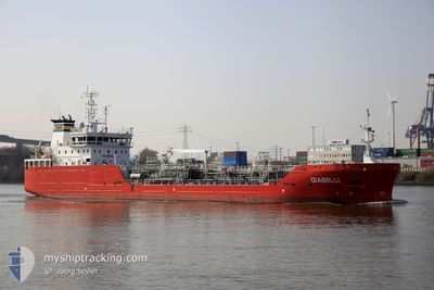
DIABELLI
Tanker B
Current Trip
| Time Travelled | 1 day |
|---|---|
| Remaining Time | --- |
| Distance Travelled | 195.37 nm |
| Remaining Distance | --- |
| AVG Speed | 9.1 Knots |
| MAX Speed | 12.6 Knots |
| AVG Wind | 13.9 knots |
| MAX Wind | 19 knots |
| MIN Temp | 11.6°C / 52.88°F |
| MAX Temp | 15°C / 59°F |
| Draught | 4.4 m |
| Position Received | 3 m ago |
Current Position
| Longitude | 1.42222° |
|---|---|
| Latitude | 51.41660° |
| Status | At anchor |
| Speed | |
| Course | 99° |
| Area | North Sea |
| Station | T-AIS |
| Position Received | 3 m ago |
Info
Information
The current position of DIABELLI is in North Sea with coordinates 51.41660° / 1.42222° as reported on 2024-05-23 21:40 by AIS to our vessel tracker app. The vessel's current speed is 0 Knots
The vessel DIABELLI (IMO: 9866964, MMSI: 210336000) is a Tanker B It's sailing under the flag of [CY] Cyprus.
In this page you can find informations about the vessels current position, last detected port calls, and current voyage information. If the vessels is not in coverage by AIS you will find the latest position.
The current position of DIABELLI is detected by our AIS receivers and we are not responsible for the reliability of the data. The last position was recorded while the vessel was in Coverage by the Ais receivers of our vessel tracking app.
The current draught of DIABELLI as reported by AIS is 4.4 meters
Weather
| Temperature | 13.4°C / 56.12°F |
|---|---|
| Wind Speed | 9 knots |
| Direction | 323° NW |
| Pressure | 1016 hPa |
| Humidity | 81.7 % |
| Cloud Coverage | 24 % |
Featured Company
Last Port Calls
| Port | Arrival | Departure | Time In Port |
|---|---|---|---|
| 2024-05-22 09:33 | 2024-05-22 10:24 | 50 m | |
| 2024-05-20 19:14 | 2024-05-21 17:27 | 22 h | |
| 2024-05-18 14:16 | 2024-05-19 19:34 | 1 d | |
| 2024-05-14 17:16 | 2024-05-15 21:55 | 1 d | |
| 2024-05-12 13:07 | 2024-05-13 13:41 | 1 d | |
| 2024-05-10 16:23 | 2024-05-11 11:22 | 18 h | |
| 2024-05-10 08:41 | 2024-05-10 08:44 | 3 m | |
| 2024-05-09 22:14 | 2024-05-09 22:43 | 29 m | |
| 2024-05-07 16:40 | 2024-05-08 15:37 | 22 h | |
| 2024-05-04 09:11 | 2024-05-04 22:39 | 13 h |
Last Trips
| Origin | Departure | Destination | Arrival | Distance | |
|---|---|---|---|---|---|
| 2024-05-21 19:27 | 2024-05-22 11:33 | 3.95 nm | |||
| 2024-05-19 21:34 | 2024-05-20 21:14 | 269.04 nm | |||
| 2024-05-15 23:55 | 2024-05-18 16:16 | 61.89 nm | |||
| 2024-05-13 15:41 | 2024-05-14 19:16 | 313.98 nm | |||
| 2024-05-11 13:22 | 2024-05-12 15:07 | 136.99 nm | |||
| 2024-05-10 10:44 | 2024-05-10 18:23 | 80.71 nm | |||
| 2024-05-10 00:43 | 2024-05-10 10:41 | 51.22 nm | |||
| 2024-05-08 17:37 | 2024-05-10 00:14 | 306.36 nm | |||
| 2024-05-05 00:39 | 2024-05-07 18:40 | 278.14 nm | |||
| 2024-05-03 04:07 | 2024-05-04 11:11 | 334.89 nm |
Events
| Time | Event | Details | Position / Dest | Info |
|---|---|---|---|---|
| 2024-05-23 16:43 | Status Changed | At anchor Default |
51.41685 / 1.42548
GB LON
|
Speed: Course: -1° |
| 2024-05-23 16:38 | Status Changed | Default At anchor |
51.41667 / 1.42500
GB LON
|
Speed: 0.1 kn Course: 274° |
| 2024-05-23 08:28 | Status Changed | At anchor Default |
51.41627 / 1.42526
GB LON
|
Speed: 0.1 kn Course: 353° |
| 2024-05-23 08:24 | Status Changed | Default At anchor |
51.41625 / 1.42541
GB LON
|
Speed: 0.1 kn Course: 351° |
| 2024-05-23 07:12 | Status Changed | At anchor Default |
51.41698 / 1.42745
GB LON
|
Speed: Course: 281° |
| 2024-05-23 07:03 | Status Changed | Default At anchor |
51.41694 / 1.42741
GB LON
|
Speed: Course: 288° |
| 2024-05-23 07:00 | Status Changed | At anchor Default |
51.41681 / 1.42744
GB LON
|
Speed: 0.1 kn Course: 284° |
| 2024-05-23 06:51 | Status Changed | Default Under way using engine |
51.41658 / 1.42688
GB LON
|
Speed: 0.7 kn Course: 271° |
| 2024-05-23 06:51 | STOP Moving | 5.46 nm, North of RAMSGATE |
51.41658 / 1.42688
GB LON
|
Speed: 0.3 kn Course: 302° |
| 2024-05-23 02:52 | Change Sea Area | United Kingdom part of the North Sea French part of the North Sea |
51.06099 / 1.60905
North Sea
GB LON
|
Speed: 9.7 kn Course: 45.7° |