
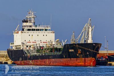
DIEGO
Oil/Chemical Tanker
Current Trip
| Time Travelled | 19 mins |
|---|---|
| Remaining Time | --- |
| Distance Travelled | 1.63 nm |
| Remaining Distance | --- |
| AVG Speed | 11.9 Knots |
| MAX Speed | 11.9 Knots |
| AVG Wind | 8.5 knots |
| MAX Wind | 8.6 knots |
| MIN Temp | 24.9°C / 76.82°F |
| MAX Temp | 25°C / 77°F |
| Draught | 4.8 m |
| Position Received | 1 m ago |
Current Position
| Longitude | 24.12302° |
|---|---|
| Latitude | 37.76791° |
| Status | Under way using engine |
| Speed | 11.7 Knots |
| Course | 36° |
| Area | Aegean Sea |
| Station | T-AIS |
| Position Received | 1 m ago |
Info
Information
The current position of DIEGO is in Aegean Sea with coordinates 37.76791° / 24.12302° as reported on 2024-06-09 04:49 by AIS to our vessel tracker app. The vessel's current speed is 11.7 Knots
The vessel DIEGO (IMO: 9279850, MMSI: 247104500) is a Oil/Chemical Tanker that was built in 2004 ( 20 years old ). It's sailing under the flag of [IT] Italy.
In this page you can find informations about the vessels current position, last detected port calls, and current voyage information. If the vessels is not in coverage by AIS you will find the latest position.
The current position of DIEGO is detected by our AIS receivers and we are not responsible for the reliability of the data. The last position was recorded while the vessel was in Coverage by the Ais receivers of our vessel tracking app.
The current draught of DIEGO as reported by AIS is 4.8 meters
Weather
| Temperature | 24.4°C / 75.92°F |
|---|---|
| Wind Speed | 8 knots |
| Direction | 1° N |
| Pressure | 1010.1 hPa |
| Humidity | 50.5 % |
| Cloud Coverage | 13 % |
Featured Company
Last Port Calls
| Port | Arrival | Departure | Time In Port |
|---|---|---|---|
| 2024-06-08 04:16 | 2024-06-09 04:32 | 1 d | |
| 2024-06-07 07:49 | 2024-06-07 22:23 | 14 h | |
| 2024-06-01 15:37 | 2024-06-03 05:59 | 1 d | |
| 2024-05-30 12:44 | 2024-05-30 18:16 | 5 h | |
| 2024-05-29 06:36 | 2024-05-30 08:37 | 1 d | |
| 2024-05-22 09:00 | 2024-05-23 18:42 | 1 d | |
| 2024-05-18 04:04 | 2024-05-18 11:28 | 7 h | |
| 2024-05-16 06:07 | 2024-05-17 04:34 | 22 h | |
| 2024-05-13 13:10 | 2024-05-14 16:20 | 1 d | |
| 2024-05-10 03:40 | 2024-05-11 13:00 | 1 d |
Last Trips
| Origin | Departure | Destination | Arrival | Distance | |
|---|---|---|---|---|---|
| 2024-06-08 01:23 | 2024-06-08 07:16 | 47.11 nm | |||
| 2024-06-03 07:59 | 2024-06-07 10:49 | 1211.38 nm | |||
| 2024-05-30 20:16 | 2024-06-01 17:37 | 571.37 nm | |||
| 2024-05-30 10:37 | 2024-05-30 14:44 | 19.55 nm | |||
| 2024-05-23 20:42 | 2024-05-29 08:36 | 1645.13 nm | |||
| 2024-05-18 13:28 | 2024-05-22 11:00 | 1246.55 nm | |||
| 2024-05-17 06:34 | 2024-05-18 06:04 | 224.64 nm | |||
| 2024-05-14 18:20 | 2024-05-16 08:07 | 419.85 nm | |||
| 2024-05-11 15:00 | 2024-05-13 15:10 | 394.61 nm | |||
| 2024-05-08 18:11 | 2024-05-10 05:40 | 376.23 nm |
Events
| Time | Event | Details | Position / Dest | Info |
|---|---|---|---|---|
| 2024-06-09 04:33 | Draught Changed | 4.8 5.2 |
37.73970 / 24.07695
TRALI
|
Speed: 6.8 kn Course: 112° |
| 2024-06-09 04:33 | Destination Changed | TRALI GRLAV |
37.73970 / 24.07695
TRALI
|
Speed: 6.8 kn Course: 112° |
| 2024-06-09 04:33 | ETA Changed | 2024/06/10 06:00 2024/06/08 04:00 |
37.73970 / 24.07695
TRALI
|
Speed: 6.8 kn Course: 112° |
| 2024-06-09 04:32 | PORT DEPARTURE |
|
37.73980 / 24.07662
GRLAV
|
Speed: 6 kn Course: 109° |
| 2024-06-09 04:30 | START Moving |
37.74132 / 24.07166
[GR] SYRI
|
Speed: 4.9 kn Course: 109° |
|
| 2024-06-09 04:23 | Status Changed | Under way using engine Default |
37.74229 / 24.06634
[GR] SYRI
|
Speed: Course: 353° |
| 2024-06-09 04:06 | IN Coverage |
37.74234 / 24.06674
Aegean Sea
[GR] SYRI
|
Speed: 1 kn Course: 75° |
|
| 2024-06-08 11:07 | Status Changed | Default Moored |
37.74213 / 24.06619
[GR] SYRI
|
Speed: Course: 354° |
| 2024-06-08 11:01 | Status Changed | Moored Default |
37.74213 / 24.06619
[GR] SYRI
|
Speed: Course: 352° |
| 2024-06-08 11:01 | OUT of Coverage |
37.74213 / 24.06619
Aegean Sea
[GR] SYRI
|
Speed: Course: 10° |