
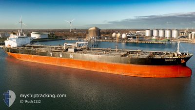
DIMITRIS P
Crude Oil Tanker
Current Trip
| Time Travelled | 8 days |
|---|---|
| Remaining Time | --- |
| Distance Travelled | 2555.51 nm |
| Remaining Distance | --- |
| AVG Speed | 11.8 Knots |
| MAX Speed | 14.7 Knots |
| AVG Wind | 13.1 knots |
| MAX Wind | 23 knots |
| MIN Temp | 12.5°C / 54.5°F |
| MAX Temp | 24.8°C / 76.64°F |
| Draught | 9.3 m |
| Position Received | 3 d ago |
Current Position
| Longitude | -27.75591° |
|---|---|
| Latitude | 37.14759° |
| Status | Under way using engine |
| Speed | 12.3 Knots |
| Course | 223.3° |
| Area | North Atlantic Ocean |
| Station | T-AIS |
| Position Received | 3 d ago |
Info
Information
The current position of DIMITRIS P is in North Atlantic Ocean with coordinates 37.14759° / -27.75591° as reported on 2024-06-01 22:12 by AIS to our vessel tracker app. The vessel's current speed is 12.3 Knots and is heading at the port of GEORGETOWN. The estimated time of arrival as calculated by vessel tracking app is 2024-06-10 18:00 LT
The vessel DIMITRIS P (IMO: 9565950, MMSI: 636015302) is a Crude Oil Tanker that was built in 2011 ( 13 years old ). It's sailing under the flag of [LR] Liberia.
In this page you can find informations about the vessels current position, last detected port calls, and current voyage information. If the vessels is not in coverage by AIS you will find the latest position.
The current position of DIMITRIS P is detected by our AIS receivers and we are not responsible for the reliability of the data. The last position was recorded while the vessel was in Coverage by the Ais receivers of our vessel tracking app.
The current draught of DIMITRIS P as reported by AIS is 9.3 meters
Weather
| Temperature | 24.7°C / 76.46°F |
|---|---|
| Wind Speed | 6 knots |
| Direction | 145° SE |
| Pressure | 1021.1 hPa |
| Humidity | 75.6 % |
| Cloud Coverage | 50 % |
Featured Company
Last Port Calls
| Port | Arrival | Departure | Time In Port |
|---|---|---|---|
| 2024-05-25 00:59 | 2024-05-27 03:22 | 2 d | |
| 2024-05-16 13:17 | 2024-05-18 01:01 | 1 d | |
| 2024-05-04 22:16 | 2024-05-07 03:23 | 2 d | |
| 2024-04-15 13:52 | 2024-04-16 08:19 | 18 h | |
| 2024-04-14 00:10 | 2024-04-14 01:41 | 1 h |
Most Visited Ports (Last year)
| Port | Arrivals | |
|---|---|---|
| 2 | ||
| 2 | ||
| 2 | ||
| 1 | ||
| 1 | ||
| 1 |
Last Trips
| Origin | Departure | Destination | Arrival | Distance | |
|---|---|---|---|---|---|
| 2024-05-18 02:01 | 2024-05-25 02:59 | 1678.86 nm | |||
| 2024-05-07 05:23 | 2024-05-16 14:17 | 1874.55 nm | |||
| 2024-04-16 11:19 | 2024-05-05 00:16 | 3847.99 nm | |||
| 2024-04-14 04:41 | 2024-04-15 16:52 | 67.91 nm | |||
| 2024-03-25 04:28 | 2024-04-14 03:10 | 2282.16 nm |
Events
| Time | Event | Details | Position / Dest | Info |
|---|---|---|---|---|
| 2024-06-01 22:19 | Status Changed | Default Under way using engine |
37.12950 / -27.77677
NLRTM=>GYGEO
|
Speed: 12.3 kn Course: 223.3° |
| 2024-06-01 22:12 | Status Changed | Under way using engine Default |
37.14759 / -27.75591
NLRTM=>GYGEO
|
Speed: 12.1 kn Course: 223° |
| 2024-06-01 22:12 | OUT of Coverage |
37.14759 / -27.75591
North Atlantic Ocean
NLRTM=>GYGEO
|
Speed: 12.3 kn Course: 223.3° |
|
| 2024-06-01 21:42 | Status Changed | Default Under way using engine |
37.21836 / -27.66992
NLRTM=>GYGEO
|
Speed: 11.9 kn Course: 224.8° |
| 2024-06-01 19:19 | Status Changed | Under way using engine Default |
37.56172 / -27.24780
NLRTM=>GYGEO
|
Speed: 12.1 kn Course: 224° |
| 2024-06-01 19:12 | Status Changed | Default Under way using engine |
37.57772 / -27.22813
NLRTM=>GYGEO
|
Speed: 12.1 kn Course: 224.4° |
| 2024-06-01 17:44 | Status Changed | Under way using engine Default |
37.76939 / -26.94930
NLRTM=>GYGEO
|
Speed: 12.1 kn Course: 231° |
| 2024-06-01 17:35 | Status Changed | Default Under way using engine |
37.78603 / -26.92286
NLRTM=>GYGEO
|
Speed: 12 kn Course: 231.3° |
| 2024-06-01 17:18 | Status Changed | Under way using engine Default |
37.82247 / -26.86516
NLRTM=>GYGEO
|
Speed: 11.7 kn Course: 231° |
| 2024-06-01 17:05 | IN Coverage |
37.82247 / -26.86516
North Atlantic Ocean
NLRTM=>GYGEO
|
Speed: 12.1 kn Course: 231.2° |