
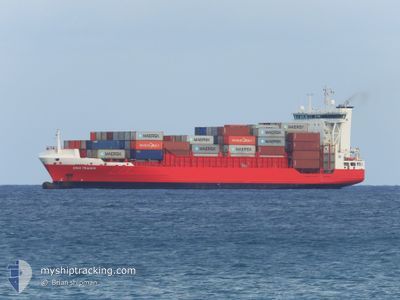
DINA TRADER
Container Ship
Current Trip
| Time Travelled | 4 h, 49 mins |
|---|---|
| Remaining Time | --- |
| Distance Travelled | 45.03 nm |
| Remaining Distance | --- |
| AVG Speed | 12.8 Knots |
| MAX Speed | 15.1 Knots |
| AVG Wind | 3.9 knots |
| MAX Wind | 5.3 knots |
| MIN Temp | 21.2°C / 70.16°F |
| MAX Temp | 22.8°C / 73.04°F |
| Draught | 8.3 m |
| Position Received | 1 d ago |
Current Position
| Longitude | 3.06685° |
|---|---|
| Latitude | 36.76489° |
| Status | Moored |
| Speed | |
| Course | 320° |
| Area | Mediterranean Sea - Western Basin |
| Station | T-AIS |
| Position Received | 1 d ago |
Info
Information
The current position of DINA TRADER is in Mediterranean Sea - Western Basin with coordinates 36.76489° / 3.06685° as reported on 2024-06-08 14:43 by AIS to our vessel tracker app. The vessel's current speed is 0 Knots and is heading at the port of VADO LIGURE. The estimated time of arrival as calculated by vessel tracking app is 2024-06-13 17:00 LT
The vessel DINA TRADER (IMO: 9354442, MMSI: 255801780) is a Container Ship that was built in 2007 ( 17 years old ). It's sailing under the flag of [PT] Portugal.
In this page you can find informations about the vessels current position, last detected port calls, and current voyage information. If the vessels is not in coverage by AIS you will find the latest position.
The current position of DINA TRADER is detected by our AIS receivers and we are not responsible for the reliability of the data. The last position was recorded while the vessel was in Coverage by the Ais receivers of our vessel tracking app.
The current draught of DINA TRADER as reported by AIS is 8.3 meters
Weather
| Temperature | 21.9°C / 71.42°F |
|---|---|
| Wind Speed | 2 knots |
| Direction | 307° NW |
| Pressure | 1011.8 hPa |
| Humidity | 66.1 % |
| Cloud Coverage | 30 % |
Featured Company
Last Port Calls
| Port | Arrival | Departure | Time In Port |
|---|---|---|---|
| 2024-06-04 20:39 | 2024-06-10 06:03 | 5 d | |
| 2024-05-31 04:18 | 2024-06-01 06:21 | 1 d | |
| 2024-05-14 16:01 | 2024-05-18 14:57 | 3 d | |
| 2024-05-10 08:47 | 2024-05-11 06:36 | 21 h | |
| 2024-04-28 21:31 | 2024-05-03 18:55 | 4 d | |
| 2024-04-20 12:51 | 2024-04-21 02:37 | 13 h | |
| 2024-04-16 12:35 | 2024-04-18 06:15 | 1 d | |
| 2024-04-09 21:13 | 2024-04-14 20:04 | 4 d | |
| 2024-04-07 00:41 | 2024-04-07 13:03 | 12 h | |
| 2024-04-03 03:09 | 2024-04-03 14:37 | 11 h |
Most Visited Ports (Last year)
| Port | Arrivals | |
|---|---|---|
| 18 | ||
| 14 | ||
| 14 | ||
| 12 | ||
| 7 | ||
| 4 |
Last Trips
| Origin | Departure | Destination | Arrival | Distance | |
|---|---|---|---|---|---|
| 2024-06-01 08:21 | 2024-06-04 21:39 | 281.92 nm | |||
| 2024-05-18 15:57 | 2024-05-31 06:18 | 294.36 nm | |||
| 2024-05-11 08:36 | 2024-05-14 17:01 | 284.48 nm | |||
| 2024-05-03 19:55 | 2024-05-10 10:47 | 294.99 nm | |||
| 2024-04-21 04:37 | 2024-04-28 22:31 | 394.13 nm | |||
| 2024-04-18 07:15 | 2024-04-20 14:51 | 671.62 nm | |||
| 2024-04-14 21:04 | 2024-04-16 13:35 | 639.67 nm | |||
| 2024-04-07 15:03 | 2024-04-09 22:13 | 283.19 nm | |||
| 2024-04-03 16:37 | 2024-04-07 02:41 | 191.94 nm | |||
| 2024-03-30 20:04 | 2024-04-03 05:09 | 195.68 nm |
Events
| Time | Event | Details | Position / Dest | Info |
|---|---|---|---|---|
| 2024-06-10 06:03 | PORT DEPARTURE |
|
36.80406 / 3.11923
ITVDL
|
Speed: 4.3 kn Course: 123° |
| 2024-06-10 05:54 | START Moving |
36.76437 / 3.06916
[DZ] ALGER
|
Speed: 4.3 kn Course: 123° |
|
| 2024-06-08 14:49 | Status Changed | Default Moored |
36.76497 / 3.06692
[DZ] ALGER
|
Speed: Course: 320° |
| 2024-06-08 14:43 | OUT of Coverage |
36.76489 / 3.06685
Mediterranean Sea - Western Basin
[DZ] ALGER
|
Speed: Course: 240.8° |
|
| 2024-06-08 14:40 | Status Changed | Moored Default |
36.76492 / 3.06686
[DZ] ALGER
|
Speed: Course: 320° |
| 2024-06-08 14:37 | IN Coverage |
36.76492 / 3.06686
Mediterranean Sea - Western Basin
[DZ] ALGER
|
Speed: Course: 240.8° |
|
| 2024-06-07 16:19 | Status Changed | Default Moored |
36.76487 / 3.06692
[DZ] ALGER
|
Speed: Course: 322° |
| 2024-06-07 16:16 | Status Changed | Moored Default |
36.76489 / 3.06693
[DZ] ALGER
|
Speed: Course: 322° |
| 2024-06-07 16:16 | OUT of Coverage |
36.76489 / 3.06693
Mediterranean Sea - Western Basin
[DZ] ALGER
|
Speed: Course: 240.8° |
|
| 2024-06-07 16:07 | Status Changed | Default Moored |
36.76483 / 3.06691
[DZ] ALGER
|
Speed: Course: 322° |