
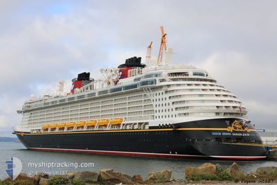
DISNEY FANTASY
Passengers Ship
Current Trip
| Trip Time | 2 days |
|---|---|
| Trip Distance | 1083.94 nm |
| AVG Speed | 16.7 Knots |
| MAX Speed | 20.9 Knots |
| Draught | 8.6 m |
| AVG Wind | 10.5 knots |
| MAX Wind | 15.1 knots |
| MIN Temp | 24.3°C / 75.74°F |
| MAX Temp | 28.5°C / 83.3°F |
| Position Received | 8 h, 42 m ago |
Current Position
| Longitude | -64.60044° |
|---|---|
| Latitude | 18.41130° |
| Status | Under way using engine |
| Speed | 6 Knots |
| Course | 293° |
| Area | Caribbean Sea |
| Station | T-AIS |
| Position Received | 8 h, 42 m ago |
Info
Information
The current position of DISNEY FANTASY is in Caribbean Sea with coordinates 18.41130° / -64.60044° as reported on 2024-05-28 10:52 by AIS to our vessel tracker app. The vessel's current speed is 6 Knots and is currently inside the port of ROAD TOWN.
The vessel DISNEY FANTASY (IMO: 9445590, MMSI: 311058700) is a Passengers Ship that was built in 2012 ( 12 years old ). It's sailing under the flag of [BS] Bahamas.
In this page you can find informations about the vessels current position, last detected port calls, and current voyage information. If the vessels is not in coverage by AIS you will find the latest position.
The current position of DISNEY FANTASY is detected by our AIS receivers and we are not responsible for the reliability of the data. The last position was recorded while the vessel was in Coverage by the Ais receivers of our vessel tracking app.
The current draught of DISNEY FANTASY as reported by AIS is 8.6 meters
Weather
| Temperature | 28.7°C / 83.66°F |
|---|---|
| Wind Speed | 10 knots |
| Direction | 107° ESE |
| Pressure | 1016.2 hPa |
| Humidity | 75.9 % |
| Cloud Coverage | 100 % |
Featured Company
Last Port Calls
| Port | Arrival | Departure | Time In Port |
|---|---|---|---|
| 2024-05-28 11:02 | |||
| 2024-05-25 09:14 | 2024-05-25 21:18 | 12 h | |
| 2024-05-22 11:23 | 2024-05-22 22:09 | 10 h | |
| 2024-05-20 12:32 | 2024-05-20 22:00 | 9 h | |
| 2024-05-18 09:06 | 2024-05-18 21:19 | 12 h | |
| 2024-05-15 10:54 | 2024-05-15 20:11 | 9 h | |
| 2024-05-14 11:15 | 2024-05-14 22:07 | 10 h | |
| 2024-05-11 09:08 | 2024-05-11 20:57 | 11 h | |
| 2024-05-08 11:58 | 2024-05-08 21:59 | 10 h | |
| 2024-05-06 12:33 | 2024-05-06 22:00 | 9 h |
Last Trips
| Origin | Departure | Destination | Arrival | Distance | |
|---|---|---|---|---|---|
| 2024-05-25 17:18 | 2024-05-28 07:02 | 1083.94 nm | |||
| 2024-05-22 17:09 | 2024-05-25 05:14 | 900.55 nm | |||
| 2024-05-20 17:00 | 2024-05-22 06:23 | 560.41 nm | |||
| 2024-05-18 17:19 | 2024-05-20 07:32 | 694.55 nm | |||
| 2024-05-15 16:11 | 2024-05-18 05:06 | 1076.02 nm | |||
| 2024-05-14 18:07 | 2024-05-15 06:54 | 133.11 nm | |||
| 2024-05-11 16:57 | 2024-05-14 07:15 | 1083.99 nm | |||
| 2024-05-08 16:59 | 2024-05-11 05:08 | 901.50 nm | |||
| 2024-05-06 17:00 | 2024-05-08 06:58 | 555.99 nm | |||
| 2024-05-04 16:52 | 2024-05-06 07:33 | 695.21 nm |
Events
| Time | Event | Details | Position / Dest | Info |
|---|---|---|---|---|
| 2024-05-28 11:02 | PORT ARRIVAL |
|
18.42245 / -64.61283
[VG] ROAD TOWN
|
Speed: 6 kn Course: 293° |
| 2024-05-28 10:52 | OUT of Coverage |
18.41130 / -64.60044
Caribbean Sea
VG TOV
|
Speed: 6 kn Course: 293° |
|
| 2024-05-28 10:11 | Status Changed | Under way using engine Default |
18.43060 / -64.48680
VG TOV
|
Speed: 14.5 kn Course: 165° |
| 2024-05-28 09:33 | Status Changed | Default Under way using engine |
18.56670 / -64.52745
VG TOV
|
Speed: 14.2 kn Course: 129.9° |
| 2024-05-28 07:14 | Detected in Sea | British Virgin Islands part of the Caribbean Sea |
18.85498 / -65.01843
Caribbean Sea
VG TOV
|
Speed: 14.2 kn Course: 120.2° |
| 2024-05-28 07:05 | Change Sea Area | Puerto Rican part of the Caribbean Sea Puerto Rican part of the North Atlantic Ocean |
18.87305 / -65.05063
Caribbean Sea
VG TOV
|
Speed: 14.3 kn Course: 120.5° |
| 2024-05-28 05:13 | Status Changed | Under way using engine Default |
19.13093 / -65.50725
VG TOV
|
Speed: 17.6 kn Course: 122° |
| 2024-05-28 05:11 | Status Changed | Default Under way using engine |
19.13820 / -65.51957
VG TOV
|
Speed: 17.7 kn Course: 121.3° |
| 2024-05-28 04:50 | Change Sea Area | Puerto Rican part of the North Atlantic Ocean Dominican Republic part of the North Atlantic Ocean |
19.19053 / -65.60997
North Atlantic Ocean
VG TOV
|
Speed: 17.7 kn Course: 120° |
| 2024-05-28 04:50 | Status Changed | Under way using engine Default |
19.19053 / -65.60997
VG TOV
|
Speed: 17.7 kn Course: 120° |