
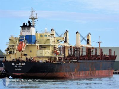
DL JASMINE
Bulk Carrier
Current Trip
NZ MAP
| Time Travelled | 15 days |
|---|---|
| Remaining Time | --- |
| Distance Travelled | 1263.36 nm |
| Remaining Distance | --- |
| AVG Speed | 10.9 Knots |
| MAX Speed | 15.3 Knots |
| AVG Wind | 13.4 knots |
| MAX Wind | 21 knots |
| MIN Temp | 11.7°C / 53.06°F |
| MAX Temp | 24.4°C / 75.92°F |
| Draught | 7.2 m |
| Position Received | 2 h, 0 m ago |
Current Position
| Longitude | 119.80810° |
|---|---|
| Latitude | 23.61959° |
| Status | Under way using engine |
| Speed | 12.4 Knots |
| Course | 182.9° |
| Area | South China Sea |
| Station | T-AIS |
| Position Received | 2 h, 0 m ago |
Info
Information
The current position of DL JASMINE is in South China Sea with coordinates 23.61959° / 119.80810° as reported on 2024-05-14 10:52 by AIS to our vessel tracker app. The vessel's current speed is 12.4 Knots
The vessel DL JASMINE (IMO: 9629665, MMSI: 373797000) is a Bulk Carrier that was built in 2012 ( 12 years old ). It's sailing under the flag of [PA] Panama.
In this page you can find informations about the vessels current position, last detected port calls, and current voyage information. If the vessels is not in coverage by AIS you will find the latest position.
The current position of DL JASMINE is detected by our AIS receivers and we are not responsible for the reliability of the data. The last position was recorded while the vessel was in Coverage by the Ais receivers of our vessel tracking app.
The current draught of DL JASMINE as reported by AIS is 7.2 meters
Weather
| Temperature | 24.4°C / 75.92°F |
|---|---|
| Wind Speed | 18 knots |
| Direction | 24° NNE |
| Pressure | 1013.8 hPa |
| Humidity | 77.1 % |
| Cloud Coverage | --- |
Featured Company
Last Port Calls
| Port | Arrival | Departure | Time In Port |
|---|---|---|---|
| 2024-04-23 23:12 | 2024-04-29 02:24 | 5 d | |
| 2024-04-02 03:32 | 2024-04-04 01:37 | 1 d | |
| 2024-03-29 09:37 | 2024-04-01 07:09 | 2 d | |
| 2024-03-24 21:24 | 2024-03-27 17:43 | 2 d | |
| 2024-03-12 19:20 | 2024-03-17 22:15 | 5 d |
Last Trips
| Origin | Departure | Destination | Arrival | Distance | |
|---|---|---|---|---|---|
| 2024-04-04 14:37 | 2024-04-24 07:12 | 5356.73 nm | |||
| 2024-04-01 20:09 | 2024-04-02 16:32 | 158.93 nm | |||
| 2024-03-28 06:43 | 2024-03-29 22:37 | 493.75 nm | |||
| 2024-03-18 09:15 | 2024-03-25 10:24 | 1665.70 nm | |||
| 2024-02-03 12:25 | 2024-03-13 06:20 | 5437.22 nm |
Events
| Time | Event | Details | Position / Dest | Info |
|---|---|---|---|---|
| 2024-05-14 10:57 | Status Changed | Default Under way using engine |
23.60154 / 119.80740
NZ MAP
|
Speed: 12.4 kn Course: 182.9° |
| 2024-05-14 10:52 | Change Sea Area | Taiwanese part of the South China Sea New Zealand part of the South Pacific Ocean |
23.61959 / 119.80810
South China Sea
|
Speed: 12.4 kn Course: 182.9° |
| 2024-05-14 10:52 | Status Changed | Under way using engine Default |
23.61959 / 119.80810
NZ MAP
|
Speed: 12 kn Course: 183° |
| 2024-05-14 10:52 | IN Coverage |
23.61959 / 119.80810
South China Sea
|
Speed: 12.4 kn Course: 182.9° |
|
| 2024-05-14 10:52 | OUT of Coverage |
23.61959 / 119.80810
South China Sea
|
Speed: 12.4 kn Course: 182.9° |
|
| 2024-05-12 02:12 | START Moving | 7.43 nm, East of ZHANGJIAGANG |
32.00033 / 120.55483
NZ MAP
|
Speed: 4.5 kn Course: 110° |
| 2024-05-05 04:44 | STOP Moving | 7.22 nm, East of ZHANGJIAGANG |
32.00008 / 120.55070
NZ MAP
|
Speed: Course: 106° |
| 2024-05-04 18:43 | STOP Moving | 1.92 nm, East of TAICANG |
31.65726 / 121.23242
NZ MAP
|
Speed: 0.3 kn Course: 282° |
| 2024-05-04 16:36 | START Moving | 8.04 nm, North West of SHANGHAI |
31.44222 / 121.47644
NZ MAP
|
Speed: 5.1 kn Course: 10° |