
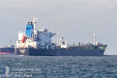
DOLUNAY
Oil/Chemical Tanker
Current Trip
| Time Travelled | 13 days |
|---|---|
| Remaining Time | --- |
| Distance Travelled | 4209.33 nm |
| Remaining Distance | --- |
| AVG Speed | 12.5 Knots |
| MAX Speed | 15.5 Knots |
| AVG Wind | 11.2 knots |
| MAX Wind | 36 knots |
| MIN Temp | 11°C / 51.8°F |
| MAX Temp | 25.3°C / 77.54°F |
| Draught | 12.1 m |
| Position Received | 48 m ago |
Current Position
| Longitude | 22.25981° |
|---|---|
| Latitude | 34.79706° |
| Status | Under way using engine |
| Speed | 13.3 Knots |
| Course | 106.4° |
| Area | Mediterranean Sea - Eastern Basin |
| Station | T-AIS |
| Position Received | 48 m ago |
Info
Information
The current position of DOLUNAY is in Mediterranean Sea - Eastern Basin with coordinates 34.79706° / 22.25981° as reported on 2024-06-10 20:00 by AIS to our vessel tracker app. The vessel's current speed is 13.3 Knots and is heading at the port of MERSIN. The estimated time of arrival as calculated by vessel tracking app is 2024-06-12 18:00 LT
The vessel DOLUNAY (IMO: 9327463, MMSI: 271051118) is a Oil/Chemical Tanker that was built in 2007 ( 17 years old ). It's sailing under the flag of [TR] Turkey.
In this page you can find informations about the vessels current position, last detected port calls, and current voyage information. If the vessels is not in coverage by AIS you will find the latest position.
The current position of DOLUNAY is detected by our AIS receivers and we are not responsible for the reliability of the data. The last position was recorded while the vessel was in Coverage by the Ais receivers of our vessel tracking app.
The current draught of DOLUNAY as reported by AIS is 12.1 meters
Weather
| Temperature | 24.2°C / 75.56°F |
|---|---|
| Wind Speed | 9 knots |
| Direction | 325° NW |
| Pressure | 1012.6 hPa |
| Humidity | 69.6 % |
| Cloud Coverage | --- |
Featured Company
Events
| Time | Event | Details | Position / Dest | Info |
|---|---|---|---|---|
| 2024-06-10 20:11 | Status Changed | Default Under way using engine |
34.78908 / 22.30869
TRMER
|
Speed: 13.3 kn Course: 106.4° |
| 2024-06-10 19:59 | Status Changed | Under way using engine Default |
34.79839 / 22.25407
TRMER
|
Speed: 13.2 kn Course: 106° |
| 2024-06-10 19:52 | Status Changed | Default Under way using engine |
34.80500 / 22.22333
TRMER
|
Speed: 13.3 kn Course: 106.2° |
| 2024-06-10 19:45 | Status Changed | Under way using engine Default |
34.81243 / 22.19525
TRMER
|
Speed: 13.1 kn Course: 106° |
| 2024-06-10 19:34 | IN Coverage |
34.81243 / 22.19525
Mediterranean Sea - Eastern Basin
TRMER
|
Speed: 13.3 kn Course: 106.2° |
|
| 2024-06-10 16:27 | Status Changed | Default Under way using engine |
35.01150 / 21.34146
TRMER
|
Speed: 13.2 kn Course: 103.8° |
| 2024-06-10 16:24 | OUT of Coverage |
35.01478 / 21.32478
Mediterranean Sea - Eastern Basin
TRMER
|
Speed: 13.2 kn Course: 103.8° |
|
| 2024-06-10 15:16 | Status Changed | Under way using engine Default |
35.07543 / 21.02558
TRMER
|
Speed: 13.5 kn Course: 104° |
| 2024-06-10 15:03 | IN Coverage |
35.07543 / 21.02558
Mediterranean Sea - Eastern Basin
TRMER
|
Speed: 13.5 kn Course: 103.6° |
|
| 2024-06-10 12:59 | OUT of Coverage |
35.20397 / 20.41734
Mediterranean Sea - Eastern Basin
TRMER
|
Speed: 13.5 kn Course: 106.4° |