
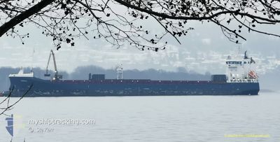
DONAU
General Cargo
Current Trip
| Time Travelled | 12 h, 4 mins |
|---|---|
| Remaining Time | 14 h, 20 mins |
| Distance Travelled | 146.79 nm |
| Remaining Distance | 201.78 nm |
| AVG Speed | 10.2 Knots |
| MAX Speed | 15.4 Knots |
| AVG Wind | 9.5 knots |
| MAX Wind | 12.5 knots |
| MIN Temp | 17.2°C / 62.96°F |
| MAX Temp | 25°C / 77°F |
| Draught | 4.5 m |
| Position Received | 1 m ago |
Current Position
| Longitude | -5.11363° |
|---|---|
| Latitude | 36.00772° |
| Status | Under way using engine |
| Speed | 15.2 Knots |
| Course | 81.6° |
| Area | Alboran Sea |
| Station | T-AIS |
| Position Received | 1 m ago |
Info
Information
The current position of DONAU is in Alboran Sea with coordinates 36.00772° / -5.11363° as reported on 2024-06-13 06:29 by AIS to our vessel tracker app. The vessel's current speed is 15.2 Knots and is heading at the port of GARRUCHA. The estimated time of arrival as calculated by vessel tracking app is 2024-06-13 20:51 LT
The vessel DONAU (IMO: 9385908, MMSI: 244642000) is a General Cargo that was built in 2011 ( 13 years old ). It's sailing under the flag of [NL] Netherlands.
In this page you can find informations about the vessels current position, last detected port calls, and current voyage information. If the vessels is not in coverage by AIS you will find the latest position.
The current position of DONAU is detected by our AIS receivers and we are not responsible for the reliability of the data. The last position was recorded while the vessel was in Coverage by the Ais receivers of our vessel tracking app.
The current draught of DONAU as reported by AIS is 4.5 meters
Weather
| Temperature | 19.2°C / 66.56°F |
|---|---|
| Wind Speed | 7 knots |
| Direction | 103° ESE |
| Pressure | 1018.6 hPa |
| Humidity | 89.7 % |
| Cloud Coverage | --- |
Featured Company
Last Port Calls
| Port | Arrival | Departure | Time In Port |
|---|---|---|---|
| 2024-06-10 18:39 | 2024-06-12 18:27 | 1 d | |
| 2024-05-31 17:26 | 2024-06-02 03:34 | 1 d | |
| 2024-05-13 00:02 | 2024-05-27 18:20 | 14 d | |
| 2024-05-09 19:52 | 2024-05-11 08:08 | 1 d | |
| 2024-05-01 14:12 | 2024-05-02 15:30 | 1 d | |
| 2024-04-30 11:49 | |||
| 2024-04-22 10:45 | 2024-04-22 16:18 | 5 h | |
| 2024-04-16 14:40 | 2024-04-18 08:08 | 1 d | |
| 2024-04-14 03:18 | 2024-04-15 16:37 | 1 d | |
| 2024-04-08 10:32 | 2024-04-11 10:15 | 2 d |
Last Trips
| Origin | Departure | Destination | Arrival | Distance | |
|---|---|---|---|---|---|
| 2024-06-02 06:34 | 2024-06-10 20:39 | 2437.33 nm | |||
| 2024-05-27 20:20 | 2024-05-31 20:26 | 1080.27 nm | |||
| 2024-05-11 10:08 | 2024-05-13 02:02 | 527.74 nm | |||
| 2024-05-02 17:30 | 2024-05-09 21:52 | 2078.84 nm | |||
| 2024-04-30 13:49 | 2024-05-01 16:12 | 343.78 nm | |||
| 2024-04-18 11:08 | 2024-04-22 12:45 | 1178.02 nm | |||
| 2024-04-15 19:37 | 2024-04-16 17:40 | 273.77 nm | |||
| 2024-04-11 12:15 | 2024-04-14 06:18 | 810.09 nm | |||
| 2024-04-03 20:45 | 2024-04-08 12:32 | 1181.35 nm |
Events
| Time | Event | Details | Position / Dest | Info |
|---|---|---|---|---|
| 2024-06-13 05:52 | Change Sea Area | Spanish part of the Alboran Sea Spanish part of the Strait of Gibraltar |
35.98278 / -5.30797
Alboran Sea
GARRUCHA
|
Speed: 14.8 kn Course: 80.4° |
| 2024-06-13 05:52 | Status Changed | Under way using engine Default |
35.98278 / -5.30797
GARRUCHA
|
Speed: 14.8 kn Course: 83° |
| 2024-06-13 05:51 | Status Changed | Default Under way using engine |
35.98229 / -5.31148
GARRUCHA
|
Speed: 14.9 kn Course: 82.2° |
| 2024-06-13 05:40 | Change Sea Area | Spanish part of the Strait of Gibraltar Moroccan part of the Strait of Gibraltar |
35.97539 / -5.36564
Strait of Gibraltar
GARRUCHA
|
Speed: 14.7 kn Course: 80.8° |
| 2024-06-13 04:34 | Status Changed | Under way using engine Default |
35.92492 / -5.66768
GARRUCHA
|
Speed: 12.3 kn Course: 94° |
| 2024-06-13 04:23 | Status Changed | Default Under way using engine |
35.92759 / -5.71279
GARRUCHA
|
Speed: 12.2 kn Course: 91.4° |
| 2024-06-13 04:23 | Change Sea Area | Moroccan part of the Strait of Gibraltar Spanish part of the North Atlantic Ocean |
35.92765 / -5.71625
Strait of Gibraltar
GARRUCHA
|
Speed: 12.2 kn Course: 91.4° |
| 2024-06-13 04:22 | Status Changed | Under way using engine Default |
35.92771 / -5.71967
GARRUCHA
|
Speed: 11.8 kn Course: 91° |
| 2024-06-13 04:11 | IN Coverage |
35.92765 / -5.71625
Strait of Gibraltar
GARRUCHA
|
Speed: 12.2 kn Course: 91.4° |
|
| 2024-06-13 01:35 | OUT of Coverage |
36.21305 / -6.31852
North Atlantic Ocean
GARRUCHA
|
Speed: 13.4 kn Course: 156.5° |