
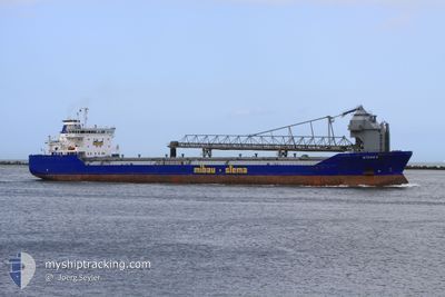
DONNACONA
Self Discharging Bulk Carrier
Current Trip
| Time Travelled | 27 days |
|---|---|
| Remaining Time | --- |
| Distance Travelled | 687.06 nm |
| Remaining Distance | --- |
| AVG Speed | 6.9 Knots |
| MAX Speed | 12.2 Knots |
| AVG Wind | 9.7 knots |
| MAX Wind | 25.9 knots |
| MIN Temp | 18.6°C / 65.48°F |
| MAX Temp | 28.6°C / 83.48°F |
| Draught | 7.9 m |
| Position Received | 4 d ago |
Current Position
| Longitude | 116.22631° |
|---|---|
| Latitude | -20.75102° |
| Status | Moored |
| Speed | |
| Course | 4° |
| Area | Indian Ocean |
| Station | T-AIS |
| Position Received | 4 d ago |
Info
Information
The current position of DONNACONA is in Indian Ocean with coordinates -20.75102° / 116.22631° as reported on 2024-05-28 04:50 by AIS to our vessel tracker app. The vessel's current speed is 0 Knots and is heading at the port of PRESTON.
The vessel DONNACONA (IMO: 9226396, MMSI: 503000114) is a Self Discharging Bulk Carrier that was built in 2001 ( 23 years old ). It's sailing under the flag of [AU] Australia.
In this page you can find informations about the vessels current position, last detected port calls, and current voyage information. If the vessels is not in coverage by AIS you will find the latest position.
The current position of DONNACONA is detected by our AIS receivers and we are not responsible for the reliability of the data. The last position was recorded while the vessel was in Coverage by the Ais receivers of our vessel tracking app.
The current draught of DONNACONA as reported by AIS is 7.9 meters
Weather
| Temperature | 24.1°C / 75.38°F |
|---|---|
| Wind Speed | 11 knots |
| Direction | 37° NE |
| Pressure | 1016 hPa |
| Humidity | 74.6 % |
| Cloud Coverage | 11 % |
Featured Company
Last Port Calls
| Port | Arrival | Departure | Time In Port |
|---|---|---|---|
| 2024-05-05 09:59 | 2024-05-05 10:11 | 11 m | |
| 2024-04-30 23:03 | 2024-05-01 12:25 | 13 h | |
| 2024-04-18 02:54 | 2024-04-18 03:12 | 18 m | |
| 2024-04-17 09:40 | 2024-04-17 09:53 | 12 m | |
| 2024-04-16 12:01 | 2024-04-16 12:14 | 13 m | |
| 2024-04-13 09:08 | 2024-04-13 09:28 | 20 m | |
| 2024-04-02 05:55 | 2024-04-02 06:15 | 20 m | |
| 2024-04-01 11:46 |
Most Visited Ports (Last year)
| Port | Arrivals | |
|---|---|---|
| 53 | ||
| 1 |
Last Trips
| Origin | Departure | Destination | Arrival | Distance | |
|---|---|---|---|---|---|
| 2024-05-01 20:25 | 2024-05-05 17:59 | 83.90 nm | |||
| 2024-04-18 11:12 | 2024-05-01 07:03 | 252.94 nm | |||
| 2024-04-17 17:53 | 2024-04-18 10:54 | 13.78 nm | |||
| 2024-04-16 20:14 | 2024-04-17 17:40 | 24.80 nm | |||
| 2024-04-13 17:28 | 2024-04-16 20:01 | 92.68 nm | |||
| 2024-04-02 14:15 | 2024-04-13 17:08 | 439.69 nm | |||
| 2024-04-01 19:46 | 2024-04-02 13:55 | 14.32 nm |
Events
| Time | Event | Details | Position / Dest | Info |
|---|---|---|---|---|
| 2024-06-01 09:05 | STOP Moving | 8.46 nm, North West of CAPE PRESTON |
-20.72115 / 116.09643
CAPE PRESTON,WA
|
Speed: 0.2 kn Course: 67° |
| 2024-06-01 07:17 | START Moving | 0.47 nm, West of CAPE PRESTON |
-20.82707 / 116.18580
CAPE PRESTON,WA
|
Speed: 3.7 kn Course: 331° |
| 2024-06-01 01:19 | STOP Moving | 0.41 nm, North West of CAPE PRESTON |
-20.82352 / 116.18964
CAPE PRESTON,WA
|
Speed: 0.2 kn Course: 61° |
| 2024-05-31 23:57 | START Moving | 8.33 nm, North West of CAPE PRESTON |
-20.71960 / 116.10221
CAPE PRESTON,WA
|
Speed: 7.3 kn Course: 98° |
| 2024-05-31 15:09 | STOP Moving | 8.43 nm, North West of CAPE PRESTON |
-20.72201 / 116.09618
CAPE PRESTON,WA
|
Speed: 0.1 kn Course: 45° |
| 2024-05-31 13:40 | START Moving | 0.64 nm, West of CAPE PRESTON |
-20.82569 / 116.18304
CAPE PRESTON,WA
|
Speed: 3.6 kn Course: 325° |
| 2024-05-31 08:03 | STOP Moving | 0.41 nm, North West of CAPE PRESTON |
-20.82356 / 116.18967
CAPE PRESTON,WA
|
Speed: Course: 61° |
| 2024-05-31 06:41 | START Moving | 8.56 nm, North West of CAPE PRESTON |
-20.71824 / 116.09738
CAPE PRESTON,WA
|
Speed: 5.4 kn Course: 36° |
| 2024-05-30 21:16 | STOP Moving | 8.45 nm, North West of CAPE PRESTON |
-20.71902 / 116.09943
CAPE PRESTON,WA
|
Speed: 0.1 kn Course: 106° |
| 2024-05-30 19:49 | START Moving | 0.78 nm, North West of CAPE PRESTON |
-20.82332 / 116.18148
CAPE PRESTON,WA
|
Speed: 4.9 kn Course: 345° |