
DROGDENBANK
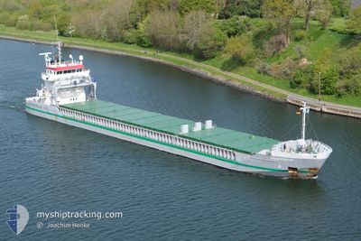
General Cargo
Current Trip
FITOR
| Time Travelled | 6 h, 12 mins |
|---|---|
| Remaining Time | --- |
| Distance Travelled | 72.96 nm |
| Remaining Distance | --- |
| AVG Speed | 12.4 Knots |
| MAX Speed | 13 Knots |
| AVG Wind | 3.2 knots |
| MAX Wind | 5 knots |
| MIN Temp | 7.7°C / 45.86°F |
| MAX Temp | 9.7°C / 49.46°F |
| Draught | 5.5 m |
| Position Received | 2 d ago |
Current Position
| Longitude | 20.96473° |
|---|---|
| Latitude | 63.56575° |
| Status | Under way using engine |
| Speed | 11.1 Knots |
| Course | 51.1° |
| Area | Gulf of Bothnia |
| Station | T-AIS |
| Position Received | 2 d ago |
Info
Information
The current position of DROGDENBANK is in Gulf of Bothnia with coordinates 63.56575° / 20.96473° as reported on 2024-05-30 01:02 by AIS to our vessel tracker app. The vessel's current speed is 11.1 Knots
The vessel DROGDENBANK (IMO: 9474163, MMSI: 244689000) is a General Cargo that was built in 2009 ( 15 years old ). It's sailing under the flag of [NL] Netherlands.
In this page you can find informations about the vessels current position, last detected port calls, and current voyage information. If the vessels is not in coverage by AIS you will find the latest position.
The current position of DROGDENBANK is detected by our AIS receivers and we are not responsible for the reliability of the data. The last position was recorded while the vessel was in Coverage by the Ais receivers of our vessel tracking app.
The current draught of DROGDENBANK as reported by AIS is 5.5 meters
Weather
| Temperature | 9.7°C / 49.46°F |
|---|---|
| Wind Speed | 3 knots |
| Direction | 334° NNW |
| Pressure | 1016.2 hPa |
| Humidity | 84.5 % |
| Cloud Coverage | 96 % |
Featured Company
Last Port Calls
| Port | Arrival | Departure | Time In Port |
|---|---|---|---|
| 2024-05-30 15:34 | 2024-06-01 07:10 | 1 d | |
| 2024-05-21 09:21 | 2024-05-25 15:34 | 4 d | |
| 2024-05-17 15:24 | 2024-05-21 06:27 | 3 d | |
| 2024-05-17 02:49 | 2024-05-17 03:36 | 46 m | |
| 2024-05-16 06:06 | 2024-05-17 01:53 | 19 h | |
| 2024-05-13 14:07 | 2024-05-14 13:33 | 23 h | |
| 2024-05-03 21:01 | 2024-05-10 13:39 | 6 d | |
| 2024-04-30 10:23 | 2024-04-30 10:26 | 2 m | |
| 2024-04-25 22:32 | 2024-04-28 18:27 | 2 d | |
| 2024-04-25 06:03 | 2024-04-25 06:58 | 55 m |
Last Trips
| Origin | Departure | Destination | Arrival | Distance | |
|---|---|---|---|---|---|
| 2024-05-25 17:34 | 2024-05-30 18:34 | 1279.13 nm | |||
| 2024-05-21 08:27 | 2024-05-21 11:21 | 30.19 nm | |||
| 2024-05-17 05:36 | 2024-05-17 17:24 | 99.75 nm | |||
| 2024-05-17 03:53 | 2024-05-17 04:49 | 4.90 nm | |||
| 2024-05-14 15:33 | 2024-05-16 08:06 | 398.20 nm | |||
| 2024-05-10 16:39 | 2024-05-13 16:07 | 769.98 nm | |||
| 2024-04-30 12:26 | 2024-05-04 00:01 | 837.41 nm | |||
| 2024-04-28 20:27 | 2024-04-30 12:23 | 360.85 nm | |||
| 2024-04-25 08:58 | 2024-04-26 00:32 | 109.67 nm | |||
| 2024-04-25 07:07 | 2024-04-25 08:03 | 4.22 nm |
Events
| Time | Event | Details | Position / Dest | Info |
|---|---|---|---|---|
| 2024-06-01 07:10 | START Moving | 0.27 nm, South of ROYTTA |
65.74651 / 24.15614
FITOR
|
Speed: 10.5 kn Course: 171° |
| 2024-06-01 07:10 | PORT DEPARTURE |
|
65.74651 / 24.15614
FITOR
|
Speed: 1 kn Course: 109° |
| 2024-05-30 15:42 | STOP Moving |
65.75249 / 24.15671
[FI] ROYTTA
|
Speed: 0.3 kn Course: 331° |
|
| 2024-05-30 15:34 | PORT ARRIVAL |
|
65.75022 / 24.15608
[FI] ROYTTA
|
Speed: 4.2 kn Course: 2° |
| 2024-05-30 01:06 | Status Changed | Default Under way using engine |
63.57630 / 20.98191
FITOR
|
Speed: 11.1 kn Course: 51.1° |
| 2024-05-30 01:02 | Status Changed | Under way using engine Default |
63.56575 / 20.96473
FITOR
|
Speed: 11.5 kn Course: 75° |
| 2024-05-30 01:02 | OUT of Coverage |
63.56575 / 20.96473
Gulf of Bothnia
FITOR
|
Speed: 11.1 kn Course: 51.1° |
|
| 2024-05-30 00:58 | Status Changed | Default Under way using engine |
63.56192 / 20.93959
FITOR
|
Speed: 11.5 kn Course: 74.6° |
| 2024-05-30 00:47 | Status Changed | Under way using engine Default |
63.55260 / 20.86407
FITOR
|
Speed: 11.5 kn Course: 75° |
| 2024-05-30 00:38 | Status Changed | Default Under way using engine |
63.54504 / 20.80244
FITOR
|
Speed: 11.5 kn Course: 55.1° |