
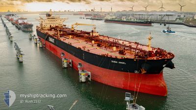
DUBAI ANGEL
Crude Oil Tanker
Current Trip
| Time Travelled | 10 days |
|---|---|
| Remaining Time | 14 days |
| Distance Travelled | 2327.36 nm |
| Remaining Distance | 4001.51 nm |
| AVG Speed | 10.5 Knots |
| MAX Speed | 14.6 Knots |
| AVG Wind | 10.1 knots |
| MAX Wind | 22.8 knots |
| MIN Temp | 7.9°C / 46.22°F |
| MAX Temp | 24.6°C / 76.28°F |
| Draught | 8 m |
| Position Received | 1 d ago |
Current Position
| Longitude | 142.15795° |
|---|---|
| Latitude | 41.54253° |
| Status | Under way using engine |
| Speed | 10.7 Knots |
| Course | 91° |
| Area | North Pacific Ocean |
| Station | T-AIS |
| Position Received | 1 d ago |
Info
Information
The current position of DUBAI ANGEL is in North Pacific Ocean with coordinates 41.54253° / 142.15795° as reported on 2024-06-24 08:04 by AIS to our vessel tracker app. The vessel's current speed is 10.7 Knots and is heading at the port of VANCOUVER. The estimated time of arrival as calculated by vessel tracking app is 2024-07-10 05:43 LT
The vessel DUBAI ANGEL (IMO: 9422524, MMSI: 538003882) is a Crude Oil Tanker that was built in 2010 ( 14 years old ). It's sailing under the flag of [MH] Marshall Is.
In this page you can find informations about the vessels current position, last detected port calls, and current voyage information. If the vessels is not in coverage by AIS you will find the latest position.
The current position of DUBAI ANGEL is detected by our AIS receivers and we are not responsible for the reliability of the data. The last position was recorded while the vessel was in Coverage by the Ais receivers of our vessel tracking app.
The current draught of DUBAI ANGEL as reported by AIS is 8 meters
Weather
| Temperature | 7.6°C / 45.68°F |
|---|---|
| Wind Speed | 10 knots |
| Direction | 214° SW |
| Pressure | 1000.8 hPa |
| Humidity | 92.7 % |
| Cloud Coverage | 98 % |
Featured Company
Last Port Calls
| Port | Arrival | Departure | Time In Port |
|---|---|---|---|
| 2024-06-14 00:29 | 2024-06-16 01:41 | 2 d | |
| 2024-05-20 17:03 | 2024-05-20 18:40 | 1 h | |
| 2024-04-12 23:34 | 2024-04-14 01:35 | 1 d |
Most Visited Ports (Last year)
| Port | Arrivals | |
|---|---|---|
| 2 | ||
| 2 | ||
| 1 | ||
| 1 | ||
| 1 | ||
| 1 |
Last Trips
| Origin | Departure | Destination | Arrival | Distance | |
|---|---|---|---|---|---|
| 2024-05-20 11:40 | 2024-06-14 08:29 | 5364.48 nm | |||
| 2024-04-13 18:35 | 2024-05-20 10:03 | 2345.43 nm | |||
| 2024-02-17 17:49 | 2024-04-12 16:34 | 6205.16 nm |
Events
| Time | Event | Details | Position / Dest | Info |
|---|---|---|---|---|
| 2024-06-24 08:09 | Status Changed | Default Under way using engine |
41.54205 / 142.17926
CA VAN
|
Speed: 10.7 kn Course: 91° |
| 2024-06-24 08:04 | Status Changed | Under way using engine Default |
41.54253 / 142.15795
CA VAN
|
Speed: 10.9 kn Course: 86° |
| 2024-06-24 08:04 | OUT of Coverage |
41.54253 / 142.15795
North Pacific Ocean
CA VAN
|
Speed: 10.7 kn Course: 91° |
|
| 2024-06-24 07:39 | Status Changed | Default Under way using engine |
41.53585 / 142.05214
CA VAN
|
Speed: 11.8 kn Course: 85° |
| 2024-06-24 07:26 | Status Changed | Under way using engine Default |
41.53375 / 141.99498
CA VAN
|
Speed: 12.4 kn Course: 88° |
| 2024-06-24 07:13 | Status Changed | Default Under way using engine |
41.53183 / 141.93751
CA VAN
|
Speed: 12.3 kn Course: 87° |
| 2024-06-24 06:51 | Status Changed | Under way using engine Default |
41.53153 / 141.83982
CA VAN
|
Speed: 11.4 kn Course: 92° |
| 2024-06-24 06:37 | Status Changed | Default Under way using engine |
41.53290 / 141.78136
CA VAN
|
Speed: 11.5 kn Course: 91° |
| 2024-06-24 05:02 | Change Sea Area | Japanese part of the North Pacific Ocean Japanese part of the Japan Sea |
41.53525 / 141.34883
North Pacific Ocean
CA VAN
|
Speed: 13.4 kn Course: 85° |
| 2024-06-24 04:19 | Status Changed | Under way using engine Default |
41.54537 / 141.14127
CA VAN
|
Speed: 13.5 kn Course: 109° |