
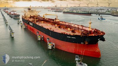
DUBAI ANGEL
Crude Oil Tanker
Current Trip
CNLKU
| Time Travelled | 16 h, 27 mins |
|---|---|
| Remaining Time | --- |
| Distance Travelled | 160.72 nm |
| Remaining Distance | --- |
| AVG Speed | 9.9 Knots |
| MAX Speed | 12.5 Knots |
| AVG Wind | 10.2 knots |
| MAX Wind | 15 knots |
| MIN Temp | 20°C / 68°F |
| MAX Temp | 21.6°C / 70.88°F |
| Draught | 11.8 m |
| Position Received | 7 m ago |
Current Position
| Longitude | 122.96423° |
|---|---|
| Latitude | 37.37055° |
| Status | Under way using engine |
| Speed | 8.3 Knots |
| Course | 179° |
| Area | Yellow Sea |
| Station | T-AIS |
| Position Received | 7 m ago |
Info
Information
The current position of DUBAI ANGEL is in Yellow Sea with coordinates 37.37055° / 122.96423° as reported on 2024-06-16 18:01 by AIS to our vessel tracker app. The vessel's current speed is 8.3 Knots
The vessel DUBAI ANGEL (IMO: 9422524, MMSI: 538003882) is a Crude Oil Tanker that was built in 2010 ( 14 years old ). It's sailing under the flag of [MH] Marshall Is.
In this page you can find informations about the vessels current position, last detected port calls, and current voyage information. If the vessels is not in coverage by AIS you will find the latest position.
The current position of DUBAI ANGEL is detected by our AIS receivers and we are not responsible for the reliability of the data. The last position was recorded while the vessel was in Coverage by the Ais receivers of our vessel tracking app.
The current draught of DUBAI ANGEL as reported by AIS is 11.8 meters
Weather
| Temperature | 20.2°C / 68.36°F |
|---|---|
| Wind Speed | 14 knots |
| Direction | 220° SW |
| Pressure | 1007.7 hPa |
| Humidity | 84.3 % |
| Cloud Coverage | 89 % |
Featured Company
Last Port Calls
| Port | Arrival | Departure | Time In Port |
|---|---|---|---|
| 2024-06-14 00:29 | 2024-06-16 01:41 | 2 d | |
| 2024-05-20 17:03 | 2024-05-20 18:40 | 1 h | |
| 2024-04-12 23:34 | 2024-04-14 01:35 | 1 d |
Most Visited Ports (Last year)
| Port | Arrivals | |
|---|---|---|
| 2 | ||
| 2 | ||
| 1 | ||
| 1 | ||
| 1 | ||
| 1 |
Last Trips
| Origin | Departure | Destination | Arrival | Distance | |
|---|---|---|---|---|---|
| 2024-05-20 11:40 | 2024-06-14 08:29 | 5364.48 nm | |||
| 2024-04-13 18:35 | 2024-05-20 10:03 | 2345.43 nm | |||
| 2024-02-17 17:49 | 2024-04-12 16:34 | 6205.16 nm |
Events
| Time | Event | Details | Position / Dest | Info |
|---|---|---|---|---|
| 2024-06-16 18:05 | Status Changed | Default Under way using engine |
37.35918 / 122.96445
CNLKU
|
Speed: 8.3 kn Course: 179° |
| 2024-06-16 17:57 | Status Changed | Under way using engine Default |
37.37982 / 122.96422
CNLKU
|
Speed: 8.3 kn Course: 179° |
| 2024-06-16 17:41 | Status Changed | Default Under way using engine |
37.41538 / 122.96391
CNLKU
|
Speed: 8.4 kn Course: 179° |
| 2024-06-16 17:35 | Status Changed | Under way using engine Default |
37.43135 / 122.96368
CNLKU
|
Speed: 8.4 kn Course: 179° |
| 2024-06-16 17:29 | IN Coverage |
37.43135 / 122.96368
Yellow Sea
|
Speed: 8.4 kn Course: 179° |
|
| 2024-06-16 16:09 | Status Changed | Default Under way using engine |
37.61487 / 122.87677
CNLKU
|
Speed: 9.4 kn Course: 120° |
| 2024-06-16 16:04 | OUT of Coverage |
37.62295 / 122.86140
Yellow Sea
|
Speed: 9.4 kn Course: 120° |
|
| 2024-06-16 15:53 | Status Changed | Under way using engine Default |
37.63783 / 122.83025
CNLKU
|
Speed: 9.4 kn Course: 118° |
| 2024-06-16 15:49 | Status Changed | Default Under way using engine |
37.64250 / 122.81895
CNLKU
|
Speed: 9.5 kn Course: 118° |
| 2024-06-16 15:39 | Status Changed | Under way using engine Default |
37.65535 / 122.78860
CNLKU
|
Speed: 9.5 kn Course: 118° |