
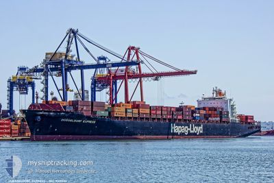
DUSSELDORF EXPRESS
Container Ship
Current Trip
| Time Travelled | 3 days |
|---|---|
| Remaining Time | --- |
| Distance Travelled | 940.93 nm |
| Remaining Distance | --- |
| AVG Speed | 17 Knots |
| MAX Speed | 19.9 Knots |
| AVG Wind | 12.4 knots |
| MAX Wind | 28 knots |
| MIN Temp | 6.6°C / 43.88°F |
| MAX Temp | 17.5°C / 63.5°F |
| Draught | 9.3 m |
| Position Received | 1 d ago |
Current Position
| Longitude | -71.82153° |
|---|---|
| Latitude | -33.03001° |
| Status | Under way using engine |
| Speed | 19.5 Knots |
| Course | 179.1° |
| Area | South Pacific Ocean |
| Station | T-AIS |
| Position Received | 1 d ago |
Info
Information
The current position of DUSSELDORF EXPRESS is in South Pacific Ocean with coordinates -33.03001° / -71.82153° as reported on 2024-06-25 17:53 by AIS to our vessel tracker app. The vessel's current speed is 19.5 Knots
The vessel DUSSELDORF EXPRESS (IMO: 9143556, MMSI: 310768000) is a Container Ship that was built in 1998 ( 26 years old ). It's sailing under the flag of [BM] Bermuda.
In this page you can find informations about the vessels current position, last detected port calls, and current voyage information. If the vessels is not in coverage by AIS you will find the latest position.
The current position of DUSSELDORF EXPRESS is detected by our AIS receivers and we are not responsible for the reliability of the data. The last position was recorded while the vessel was in Coverage by the Ais receivers of our vessel tracking app.
The current draught of DUSSELDORF EXPRESS as reported by AIS is 9.3 meters
Weather
| Temperature | 10.7°C / 51.26°F |
|---|---|
| Wind Speed | 8 knots |
| Direction | 172° S |
| Pressure | 1020.6 hPa |
| Humidity | 67.2 % |
| Cloud Coverage | 4 % |
Featured Company
Last Port Calls
| Port | Arrival | Departure | Time In Port |
|---|---|---|---|
| 2024-06-22 17:57 | 2024-06-23 14:06 | 20 h | |
| 2024-06-17 19:04 | 2024-06-19 19:28 | 2 d | |
| 2024-06-14 16:06 | 2024-06-15 19:42 | 1 d | |
| 2024-06-09 10:52 | 2024-06-10 17:31 | 1 d | |
| 2024-05-28 04:47 | 2024-05-29 08:05 | 1 d | |
| 2024-05-25 15:57 | 2024-05-25 16:03 | 6 m | |
| 2024-05-23 16:20 | 2024-05-24 11:37 | 19 h | |
| 2024-05-13 10:23 | 2024-05-14 16:48 | 1 d | |
| 2024-05-10 12:17 | 2024-05-11 16:16 | 1 d | |
| 2024-05-06 11:14 | 2024-05-07 10:53 | 23 h |
Most Visited Ports (Last year)
| Port | Arrivals | |
|---|---|---|
| 6 | ||
| 5 | ||
| 5 | ||
| 4 | ||
| 4 | ||
| 4 |
Last Trips
| Origin | Departure | Destination | Arrival | Distance | |
|---|---|---|---|---|---|
| 2024-06-19 14:28 | 2024-06-22 13:57 | 1296.60 nm | |||
| 2024-06-15 14:42 | 2024-06-17 14:04 | 811.89 nm | |||
| 2024-06-10 13:31 | 2024-06-14 11:06 | 1507.96 nm | |||
| 2024-05-29 05:05 | 2024-06-09 06:52 | 3733.71 nm | |||
| 2024-05-25 13:03 | 2024-05-28 01:47 | 343.28 nm | |||
| 2024-05-24 08:37 | 2024-05-25 12:57 | 421.08 nm | |||
| 2024-05-14 12:48 | 2024-05-23 13:20 | 3375.68 nm | |||
| 2024-05-11 12:16 | 2024-05-13 06:23 | 233.65 nm | |||
| 2024-05-07 06:53 | 2024-05-10 08:17 | 616.37 nm | |||
| 2024-05-05 02:12 | 2024-05-06 07:14 | 335.09 nm |
Events
| Time | Event | Details | Position / Dest | Info |
|---|---|---|---|---|
| 2024-06-25 21:19 | STOP Moving | 5.26 nm, South West of SAN ANTONIO |
-33.64156 / -71.70125
CLSAI
|
Speed: 0.1 kn Course: 230° |
| 2024-06-25 17:58 | Status Changed | Default Under way using engine |
-33.05767 / -71.82112
CLSAI
|
Speed: 19.5 kn Course: 179.1° |
| 2024-06-25 17:53 | OUT of Coverage |
-33.03001 / -71.82153
South Pacific Ocean
CLSAI
|
Speed: 19.5 kn Course: 179.1° |
|
| 2024-06-25 17:51 | Status Changed | Under way using engine Default |
-33.01861 / -71.82176
CLSAI
|
Speed: 19.5 kn Course: 171° |
| 2024-06-25 17:41 | Status Changed | Default Under way using engine |
-32.96588 / -71.82420
CLSAI
|
Speed: 19.7 kn Course: 173.5° |
| 2024-06-25 17:31 | Status Changed | Under way using engine Default |
-32.91179 / -71.83248
CLSAI
|
Speed: 19.8 kn Course: 173° |
| 2024-06-25 17:30 | Status Changed | Default Under way using engine |
-32.90407 / -71.83355
CLSAI
|
Speed: 19.8 kn Course: 173.5° |
| 2024-06-25 17:00 | Draught Changed | 9.3 11.6 |
-32.74276 / -71.85313
CLSAI
|
Speed: 19.9 kn Course: 174° |
| 2024-06-25 17:00 | Destination Changed | CLSAI BRSSZ-BRRIG |
-32.74276 / -71.85313
CLSAI
|
Speed: 19.9 kn Course: 174° |
| 2024-06-25 17:00 | ETA Changed | 2024/06/25 20:00 2024/05/30 11:00 |
-32.74276 / -71.85313
CLSAI
|
Speed: 19.9 kn Course: 174° |