
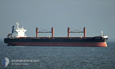
DULCE DIVA
Cargo
Current Trip
| Time Travelled | 11 days |
|---|---|
| Remaining Time | --- |
| Distance Travelled | 2126.07 nm |
| Remaining Distance | --- |
| AVG Speed | 12.1 Knots |
| MAX Speed | 16.6 Knots |
| AVG Wind | 13 knots |
| MAX Wind | 30 knots |
| MIN Temp | 12.9°C / 55.22°F |
| MAX Temp | 27.4°C / 81.32°F |
| Draught | 6.6 m |
| Position Received | 4 d ago |
Current Position
| Longitude | 26.33203° |
|---|---|
| Latitude | -33.91221° |
| Status | Under way using engine |
| Speed | 9.8 Knots |
| Course | 257.8° |
| Area | Indian Ocean |
| Station | T-AIS |
| Position Received | 4 d ago |
Info
Information
The current position of DULCE DIVA is in Indian Ocean with coordinates -33.91221° / 26.33203° as reported on 2024-06-12 21:09 by AIS to our vessel tracker app. The vessel's current speed is 9.8 Knots
The vessel DULCE DIVA (IMO: 9852755, MMSI: 538008429) is a Cargo It's sailing under the flag of [MH] Marshall Is.
In this page you can find informations about the vessels current position, last detected port calls, and current voyage information. If the vessels is not in coverage by AIS you will find the latest position.
The current position of DULCE DIVA is detected by our AIS receivers and we are not responsible for the reliability of the data. The last position was recorded while the vessel was in Coverage by the Ais receivers of our vessel tracking app.
The current draught of DULCE DIVA as reported by AIS is 6.6 meters
Weather
| Temperature | 15.5°C / 59.9°F |
|---|---|
| Wind Speed | 6 knots |
| Direction | 351° N |
| Pressure | 1015.6 hPa |
| Humidity | 58.1 % |
| Cloud Coverage | 100 % |
Featured Company
Last Port Calls
| Port | Arrival | Departure | Time In Port |
|---|---|---|---|
| 2024-05-30 12:45 | 2024-06-05 14:03 | 6 d | |
| 2024-05-23 08:51 | 2024-05-24 07:23 | 22 h | |
| 2024-05-05 17:48 | 2024-05-09 05:20 | 3 d |
Last Trips
| Origin | Departure | Destination | Arrival | Distance | |
|---|---|---|---|---|---|
| 2024-05-24 09:23 | 2024-05-30 15:45 | 1695.90 nm | |||
| 2024-05-09 10:50 | 2024-05-23 10:51 | 3898.76 nm | |||
| 2024-02-18 22:49 | 2024-05-05 23:18 | 1380.79 nm |
Events
| Time | Event | Details | Position / Dest | Info |
|---|---|---|---|---|
| 2024-06-13 00:20 | STOP Moving | 5.94 nm, South East of COEGA |
-33.86846 / 25.78351
ZA PLZ
|
Speed: 0.3 kn Course: 185° |
| 2024-06-12 21:16 | Status Changed | Default Under way using engine |
-33.91505 / 26.31057
ZA PLZ
|
Speed: 9.8 kn Course: 257.8° |
| 2024-06-12 21:09 | OUT of Coverage |
-33.91221 / 26.33203
Indian Ocean
ZA PLZ
|
Speed: 9.8 kn Course: 257.8° |
|
| 2024-06-12 18:21 | Status Changed | Under way using engine Default |
-33.76422 / 26.79648
ZA PLZ
|
Speed: 8 kn Course: 248° |
| 2024-06-12 18:20 | Status Changed | Default Under way using engine |
-33.76308 / 26.79990
ZA PLZ
|
Speed: 8.3 kn Course: 248.9° |
| 2024-06-12 18:18 | Status Changed | Under way using engine Default |
-33.76140 / 26.80500
ZA PLZ
|
Speed: 8.2 kn Course: 244° |
| 2024-06-12 18:14 | IN Coverage |
-33.76422 / 26.79648
Indian Ocean
ZA PLZ
|
Speed: 8.2 kn Course: 248.3° |
|
| 2024-06-11 20:27 | Status Changed | Default Under way using engine |
-30.38786 / 31.11072
ZA PLZ
|
Speed: 15.4 kn Course: 215.2° |
| 2024-06-11 20:22 | OUT of Coverage |
-30.36897 / 31.12620
Indian Ocean
ZA PLZ
|
Speed: 15.4 kn Course: 215.2° |
|
| 2024-06-11 16:03 | Status Changed | Under way using engine Default |
-29.51154 / 31.88289
ZA PLZ
|
Speed: 14.2 kn Course: 218° |