
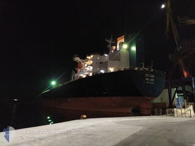
DYLAN
Oil Products Tanker
Current Trip
BRAZIL FOR ORDERS
| Time Travelled | 20 days |
|---|---|
| Remaining Time | --- |
| Distance Travelled | 4925.70 nm |
| Remaining Distance | --- |
| AVG Speed | 11.8 Knots |
| MAX Speed | 16.3 Knots |
| AVG Wind | 11.9 knots |
| MAX Wind | 21 knots |
| MIN Temp | 3.8°C / 38.84°F |
| MAX Temp | 27.8°C / 82.04°F |
| Draught | 11.4 m |
| Position Received | 5 d ago |
Current Position
| Longitude | -15.38780° |
|---|---|
| Latitude | 27.51736° |
| Status | Under way using engine |
| Speed | 12.6 Knots |
| Course | 212.6° |
| Area | North Atlantic Ocean |
| Station | T-AIS |
| Position Received | 5 d ago |
Info
Information
The current position of DYLAN is in North Atlantic Ocean with coordinates 27.51736° / -15.38780° as reported on 2024-05-18 15:16 by AIS to our vessel tracker app. The vessel's current speed is 12.6 Knots
The vessel DYLAN (IMO: 9282510, MMSI: 538005182) is a Oil Products Tanker that was built in 2004 ( 20 years old ). It's sailing under the flag of [MH] Marshall Is.
In this page you can find informations about the vessels current position, last detected port calls, and current voyage information. If the vessels is not in coverage by AIS you will find the latest position.
The current position of DYLAN is detected by our AIS receivers and we are not responsible for the reliability of the data. The last position was recorded while the vessel was in Coverage by the Ais receivers of our vessel tracking app.
The current draught of DYLAN as reported by AIS is 11.4 meters
Weather
| Temperature | 27.9°C / 82.22°F |
|---|---|
| Wind Speed | 14 knots |
| Direction | 69° ENE |
| Pressure | 1011.2 hPa |
| Humidity | 70.9 % |
| Cloud Coverage | 100 % |
Featured Company
Last Port Calls
| Port | Arrival | Departure | Time In Port |
|---|---|---|---|
| 2024-05-02 09:43 | 2024-05-03 08:17 | 22 h | |
| 2024-05-01 22:59 | 2024-05-02 09:41 | 10 h | |
| 2024-04-18 00:34 | 2024-04-18 00:41 | 7 m | |
| 2024-03-01 21:57 |
Most Visited Ports (Last year)
| Port | Arrivals | |
|---|---|---|
| 3 | ||
| 3 | ||
| 2 | ||
| 2 | ||
| 2 | ||
| 1 |
Last Trips
| Origin | Departure | Destination | Arrival | Distance | |
|---|---|---|---|---|---|
| 2024-05-02 12:41 | 2024-05-02 12:43 | 1.03 nm | |||
| 2024-04-18 01:41 | 2024-05-02 01:59 | 3162.11 nm | |||
| 2024-03-02 00:57 | 2024-04-18 01:34 | 7874.38 nm |
Events
| Time | Event | Details | Position / Dest | Info |
|---|---|---|---|---|
| 2024-05-18 15:22 | Status Changed | Default Under way using engine |
27.50103 / -15.39932
BRAZIL FOR ORDERS
|
Speed: 12.6 kn Course: 212.6° |
| 2024-05-18 15:16 | OUT of Coverage |
27.51736 / -15.38780
North Atlantic Ocean
BRAZIL FOR ORDERS
|
Speed: 12.6 kn Course: 212.6° |
|
| 2024-05-18 15:14 | Status Changed | Under way using engine Default |
27.52479 / -15.38244
BRAZIL FOR ORDERS
|
Speed: 12.5 kn Course: 213° |
| 2024-05-18 15:07 | Status Changed | Default Under way using engine |
27.54547 / -15.36764
BRAZIL FOR ORDERS
|
Speed: 12.5 kn Course: 212.2° |
| 2024-05-18 15:04 | Status Changed | Under way using engine Default |
27.55282 / -15.36241
BRAZIL FOR ORDERS
|
Speed: 12.4 kn Course: 213° |
| 2024-05-18 14:47 | Status Changed | Default Under way using engine |
27.60459 / -15.32644
BRAZIL FOR ORDERS
|
Speed: 12.5 kn Course: 201.1° |
| 2024-05-18 12:00 | START Moving | 4.73 nm, East of LAS PALMAS |
28.12049 / -15.32671
BRAZIL FOR ORDERS
|
Speed: 3.3 kn Course: 150° |
| 2024-05-18 11:51 | STOP Moving | 4.5 nm, East of LAS PALMAS |
28.12141 / -15.33101
BRAZIL FOR ORDERS
|
Speed: 0.3 kn Course: 48° |
| 2024-05-18 07:25 | Destination Changed | BRAZIL FOR ORDERS GB FOR ORDERS |
28.78614 / -14.91026
BRAZIL FOR ORDERS
|
Speed: 12.4 kn Course: 192.5° |
| 2024-05-18 07:25 | ETA Changed | 2024/05/26 12:00 2024/05/13 18:00 |
28.78614 / -14.91026
BRAZIL FOR ORDERS
|
Speed: 12.4 kn Course: 192.5° |