
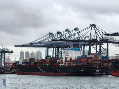
EA CETUS
Cargo
Current Trip
| Trip Time | 10 h, 13 mins |
|---|---|
| Trip Distance | 160.00 nm |
| AVG Speed | 15.2 Knots |
| MAX Speed | 19 Knots |
| Draught | 12.6 m |
| AVG Wind | 6.5 knots |
| MAX Wind | 12.1 knots |
| MIN Temp | 11.2°C / 52.16°F |
| MAX Temp | 20.5°C / 68.9°F |
| Position Received | 3 m ago |
Current Position
| Longitude | -123.09468° |
|---|---|
| Latitude | 49.28908° |
| Status | Moored |
| Speed | |
| Course | 113° |
| Area | The Coastal Waters of Southeast Alaska and British Columbia |
| Station | T-AIS |
| Position Received | 3 m ago |
Info
Information
The current position of EA CETUS is in The Coastal Waters of Southeast Alaska and British Columbia with coordinates 49.28908° / -123.09468° as reported on 2024-06-27 23:50 by AIS to our vessel tracker app. The vessel's current speed is 0 Knots and is currently inside the port of VANCOUVER.
The vessel EA CETUS (IMO: 9967495, MMSI: 563211800) is a Cargo It's sailing under the flag of [SG] Singapore.
In this page you can find informations about the vessels current position, last detected port calls, and current voyage information. If the vessels is not in coverage by AIS you will find the latest position.
The current position of EA CETUS is detected by our AIS receivers and we are not responsible for the reliability of the data. The last position was recorded while the vessel was in Coverage by the Ais receivers of our vessel tracking app.
The current draught of EA CETUS as reported by AIS is 12.6 meters
Weather
| Temperature | 13.2°C / 55.76°F |
|---|---|
| Wind Speed | 1 knots |
| Direction | 353° N |
| Pressure | 1016.2 hPa |
| Humidity | 88.6 % |
| Cloud Coverage | 100 % |
Featured Company
Last Port Calls
| Port | Arrival | Departure | Time In Port |
|---|---|---|---|
| 2024-06-25 11:08 | |||
| 2024-06-23 21:24 | 2024-06-25 00:55 | 1 d | |
| 2024-06-19 05:28 | 2024-06-21 08:42 | 2 d | |
| 2024-06-19 04:45 | 2024-06-19 04:57 | 11 m | |
| 2024-06-08 06:34 | 2024-06-08 22:01 | 15 h | |
| 2024-05-30 23:37 | 2024-05-31 15:39 | 16 h | |
| 2024-05-29 19:18 | 2024-05-30 18:50 | 23 h | |
| 2024-05-15 03:03 | 2024-05-16 03:11 | 1 d | |
| 2024-05-12 10:44 | 2024-05-14 17:49 | 2 d | |
| 2024-05-06 14:06 | 2024-05-09 22:48 | 3 d |
Last Trips
| Origin | Departure | Destination | Arrival | Distance | |
|---|---|---|---|---|---|
| 2024-06-24 17:55 | 2024-06-25 04:08 | 160.00 nm | |||
| 2024-06-21 01:42 | 2024-06-23 14:24 | 611.82 nm | |||
| 2024-06-18 21:57 | 2024-06-18 22:28 | 1.05 nm | |||
| 2024-06-09 06:01 | 2024-06-18 21:45 | 4663.09 nm | |||
| 2024-05-31 23:39 | 2024-06-08 14:34 | 921.47 nm | |||
| 2024-05-31 02:50 | 2024-05-31 07:37 | 51.03 nm | |||
| 2024-05-15 20:11 | 2024-05-30 03:18 | 5806.70 nm | |||
| 2024-05-14 10:49 | 2024-05-14 20:03 | 159.68 nm | |||
| 2024-05-09 15:48 | 2024-05-12 03:44 | 629.77 nm | |||
| 2024-05-06 06:08 | 2024-05-06 07:06 | 1.37 nm |
Events
| Time | Event | Details | Position / Dest | Info |
|---|---|---|---|---|
| 2024-06-25 12:02 | Status Changed | Moored Under way using engine |
49.28897 / -123.09473
[CA] VANCOUVER
|
Speed: 0.1 kn Course: 113° |
| 2024-06-25 11:43 | STOP Moving |
49.29004 / -123.09543
[CA] VANCOUVER
|
Speed: 0.3 kn Course: 123° |
|
| 2024-06-25 11:08 | PORT ARRIVAL |
|
49.31728 / -123.14633
[CA] VANCOUVER
|
Speed: 9.8 kn Course: 110.2° |
| 2024-06-25 09:40 | Change Sea Area | Canadian part of the The Coastal Waters of Southeast Alaska and British Columbia United States part of the The Coastal Waters of Southeast Alaska and British Columbia |
49.00838 / -123.25082
The Coastal Waters of Southeast Alaska and British Columbia
CAVAN
|
Speed: 18.3 kn Course: 313.3° |
| 2024-06-25 08:40 | Change Sea Area | United States part of the The Coastal Waters of Southeast Alaska and British Columbia Canadian part of the The Coastal Waters of Southeast Alaska and British Columbia |
48.78981 / -122.99766
The Coastal Waters of Southeast Alaska and British Columbia
CAVAN
|
Speed: 15 kn Course: 31.2° |
| 2024-06-25 08:13 | Change Sea Area | Canadian part of the The Coastal Waters of Southeast Alaska and British Columbia United States part of the The Coastal Waters of Southeast Alaska and British Columbia |
48.73329 / -123.12607
The Coastal Waters of Southeast Alaska and British Columbia
CAVAN
|
Speed: 13.9 kn Course: 64.4° |
| 2024-06-25 07:16 | Draught Changed | 12.6 12.4 |
48.57086 / -123.20807
CAVAN
|
Speed: 14.2 kn Course: 347.4° |
| 2024-06-25 06:47 | Change Sea Area | United States part of the The Coastal Waters of Southeast Alaska and British Columbia Canadian part of the The Coastal Waters of Southeast Alaska and British Columbia |
48.46051 / -123.16470
The Coastal Waters of Southeast Alaska and British Columbia
CAVAN
|
Speed: 13.2 kn Course: 352.7° |
| 2024-06-25 05:16 | Change Sea Area | Canadian part of the The Coastal Waters of Southeast Alaska and British Columbia United States part of the The Coastal Waters of Southeast Alaska and British Columbia |
48.24377 / -123.43360
The Coastal Waters of Southeast Alaska and British Columbia
CAVAN
|
Speed: 12.9 kn Course: 19.2° |
| 2024-06-25 02:57 | Draught Changed | 12.4 12 |
48.11185 / -122.65483
CAVAN
|
Speed: 15.4 kn Course: 329° |