
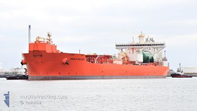
EAGLE BALDER
Tanker
Current Trip
| Time Travelled | 8 days |
|---|---|
| Remaining Time | --- |
| Distance Travelled | 559.34 nm |
| Remaining Distance | --- |
| AVG Speed | 7 Knots |
| MAX Speed | 12.1 Knots |
| AVG Wind | 12.2 knots |
| MAX Wind | 27 knots |
| MIN Temp | 11.9°C / 53.42°F |
| MAX Temp | 16.8°C / 62.24°F |
| Draught | 9.5 m |
| Position Received | 2 m ago |
Current Position
| Longitude | 10.67183° |
|---|---|
| Latitude | 57.68929° |
| Status | At anchor |
| Speed | |
| Course | 148° |
| Area | Kattegat |
| Station | T-AIS |
| Position Received | 2 m ago |
Info
Information
The current position of EAGLE BALDER is in Kattegat with coordinates 57.68929° / 10.67183° as reported on 2024-05-23 15:02 by AIS to our vessel tracker app. The vessel's current speed is 0 Knots
The vessel EAGLE BALDER (IMO: 9833113, MMSI: 257089150) is a Tanker It's sailing under the flag of [NO] Norway.
In this page you can find informations about the vessels current position, last detected port calls, and current voyage information. If the vessels is not in coverage by AIS you will find the latest position.
The current position of EAGLE BALDER is detected by our AIS receivers and we are not responsible for the reliability of the data. The last position was recorded while the vessel was in Coverage by the Ais receivers of our vessel tracking app.
The current draught of EAGLE BALDER as reported by AIS is 9.5 meters
Weather
| Temperature | 15.4°C / 59.72°F |
|---|---|
| Wind Speed | 5 knots |
| Direction | 110° ESE |
| Pressure | 1012.4 hPa |
| Humidity | 83.2 % |
| Cloud Coverage | 7 % |
Featured Company
Events
| Time | Event | Details | Position / Dest | Info |
|---|---|---|---|---|
| 2024-05-19 16:07 | Status Changed | At anchor Under way using engine |
57.68962 / 10.67452
SKAGEN ROADS
|
Speed: 0.3 kn Course: 229° |
| 2024-05-19 15:43 | STOP Moving | 2.96 nm, South East of SKAGEN |
57.68818 / 10.67493
SKAGEN ROADS
|
Speed: 0.3 kn Course: 224° |
| 2024-05-19 12:59 | Change Sea Area | Danish part of the Kattegat Swedish part of the Kattegat |
57.61891 / 11.23514
Kattegat
SKAGEN ROADS
|
Speed: 7.6 kn Course: 290° |
| 2024-05-19 11:18 | ETA Changed | 2024/05/19 15:00 2024/05/18 06:00 |
57.56899 / 11.58590
SKAGEN ROADS
|
Speed: 3.3 kn Course: 10° |
| 2024-05-19 11:17 | START Moving | 6.22 nm, West of VRANGO |
57.56862 / 11.58552
SKAGEN ROADS
|
Speed: 3.1 kn Course: 16° |
| 2024-05-19 11:11 | Destination Changed | SKAGEN ROADS SEGOT ANCH |
57.56753 / 11.58160
SKAGEN ROADS
|
Speed: 0.3 kn Course: 72° |
| 2024-05-19 11:11 | Status Changed | Under way using engine At anchor |
57.56755 / 11.58156
SEGOT ANCH
|
Speed: 0.2 kn Course: 77° |
| 2024-05-18 06:51 | Status Changed | At anchor Under way using engine |
57.56935 / 11.57911
SEGOT ANCH
|
Speed: 0.2 kn Course: 130° |
| 2024-05-18 06:35 | STOP Moving | 6.41 nm, South of FOTO |
57.56844 / 11.57939
SEGOT ANCH
|
Speed: 0.3 kn Course: 111° |
| 2024-05-18 04:23 | Detected in Sea | Swedish part of the Kattegat |
57.67133 / 11.19340
Kattegat
SEGOT ANCH
|
Speed: 6.9 kn Course: 118° |