
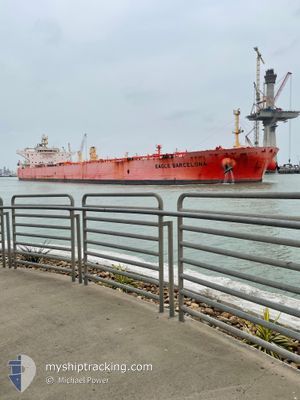
EAGLE BARCELONA
Tanker
Current Trip
EGSKT
| Time Travelled | 1 day |
|---|---|
| Remaining Time | --- |
| Distance Travelled | 17.13 nm |
| Remaining Distance | --- |
| AVG Speed | 11.2 Knots |
| MAX Speed | 12.5 Knots |
| AVG Wind | 4.9 knots |
| MAX Wind | 6.5 knots |
| MIN Temp | 18.3°C / 64.94°F |
| MAX Temp | 21.5°C / 70.7°F |
| Draught | 8.8 m |
| Position Received | 1 d ago |
Current Position
| Longitude | 5.03958° |
|---|---|
| Latitude | 43.11963° |
| Status | Under way using engine |
| Speed | 11.1 Knots |
| Course | 171.1° |
| Area | Mediterranean Sea - Western Basin |
| Station | T-AIS |
| Position Received | 1 d ago |
Info
Information
The current position of EAGLE BARCELONA is in Mediterranean Sea - Western Basin with coordinates 43.11963° / 5.03958° as reported on 2024-05-27 13:14 by AIS to our vessel tracker app. The vessel's current speed is 11.1 Knots
The vessel EAGLE BARCELONA (IMO: 9795048, MMSI: 563045300) is a Tanker It's sailing under the flag of [SG] Singapore.
In this page you can find informations about the vessels current position, last detected port calls, and current voyage information. If the vessels is not in coverage by AIS you will find the latest position.
The current position of EAGLE BARCELONA is detected by our AIS receivers and we are not responsible for the reliability of the data. The last position was recorded while the vessel was in Coverage by the Ais receivers of our vessel tracking app.
The current draught of EAGLE BARCELONA as reported by AIS is 8.8 meters
Weather
| Temperature | 20.3°C / 68.54°F |
|---|---|
| Wind Speed | 18 knots |
| Direction | 342° NNW |
| Pressure | 1016.1 hPa |
| Humidity | 75.9 % |
| Cloud Coverage | 8 % |
Featured Company
Last Port Calls
| Port | Arrival | Departure | Time In Port |
|---|---|---|---|
| 2024-05-26 05:37 | 2024-05-27 11:41 | 1 d | |
| 2024-05-23 06:11 | 2024-05-24 06:25 | 1 d | |
| 2024-05-12 22:54 | 2024-05-15 01:15 | 2 d | |
| 2024-04-13 14:24 | 2024-04-14 21:02 | 1 d | |
| 2024-03-14 21:16 | 2024-03-18 00:49 | 3 d |
Last Trips
| Origin | Departure | Destination | Arrival | Distance | |
|---|---|---|---|---|---|
| 2024-05-24 07:25 | 2024-05-26 07:37 | 582.73 nm | |||
| 2024-05-15 03:15 | 2024-05-23 07:11 | 1594.08 nm | |||
| 2024-04-14 23:02 | 2024-05-13 00:54 | 5445.91 nm | |||
| 2024-03-17 19:49 | 2024-04-13 16:24 | 5603.17 nm | |||
| 2024-02-25 18:38 | 2024-03-14 16:16 | 5135.65 nm |
Events
| Time | Event | Details | Position / Dest | Info |
|---|---|---|---|---|
| 2024-05-27 13:17 | Status Changed | Default Under way using engine |
43.10991 / 5.04157
EGSKT
|
Speed: 11.1 kn Course: 171.1° |
| 2024-05-27 13:14 | OUT of Coverage |
43.11963 / 5.03958
Mediterranean Sea - Western Basin
EGSKT
|
Speed: 11.1 kn Course: 171.1° |
|
| 2024-05-27 13:09 | Status Changed | Under way using engine Default |
43.13481 / 5.03629
EGSKT
|
Speed: 11.1 kn Course: 170° |
| 2024-05-27 13:04 | Status Changed | Default Under way using engine |
43.15046 / 5.03250
EGSKT
|
Speed: 11.2 kn Course: 167° |
| 2024-05-27 13:01 | Status Changed | Under way using engine Default |
43.15947 / 5.02973
EGSKT
|
Speed: 11.2 kn Course: 166° |
| 2024-05-27 12:49 | Status Changed | Default Under way using engine |
43.19534 / 5.01820
EGSKT
|
Speed: 12.5 kn Course: 166.3° |
| 2024-05-27 12:37 | Status Changed | Under way using engine Default |
43.23632 / 5.00481
EGSKT
|
Speed: 12.4 kn Course: 166° |
| 2024-05-27 12:33 | Status Changed | Default Under way using engine |
43.24972 / 5.00009
EGSKT
|
Speed: 12.4 kn Course: 166.3° |
| 2024-05-27 12:29 | Status Changed | Under way using engine Default |
43.26151 / 4.99612
EGSKT
|
Speed: 12.4 kn Course: 167° |
| 2024-05-27 12:25 | Status Changed | Default Under way using engine |
43.27597 / 4.99145
EGSKT
|
Speed: 12.3 kn Course: 166.4° |