
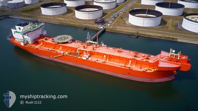
EAGLE BARENTS
Tanker
Current Trip
| Time Travelled | 46 days |
|---|---|
| Remaining Time | --- |
| Distance Travelled | 1550.50 nm |
| Remaining Distance | 3.88 nm |
| AVG Speed | 8.6 Knots |
| MAX Speed | 12.9 Knots |
| AVG Wind | 13.9 knots |
| MAX Wind | 29 knots |
| MIN Temp | 9.4°C / 48.92°F |
| MAX Temp | 18.5°C / 65.3°F |
| Draught | 14.1 m |
| Position Received | 1 m ago |
Current Position
| Longitude | -3.06006° |
|---|---|
| Latitude | 58.91167° |
| Status | At anchor |
| Speed | |
| Course | 134° |
| Area | North Sea |
| Station | T-AIS |
| Position Received | 1 m ago |
Info
Information
The current position of EAGLE BARENTS is in North Sea with coordinates 58.91167° / -3.06006° as reported on 2024-06-26 10:15 by AIS to our vessel tracker app. The vessel's current speed is 0 Knots and is heading at the port of SCAPA. The estimated time of arrival as calculated by vessel tracking app is 2024-06-25 07:00 LT
The vessel EAGLE BARENTS (IMO: 9676125, MMSI: 257980000) is a Tanker It's sailing under the flag of [NO] Norway.
In this page you can find informations about the vessels current position, last detected port calls, and current voyage information. If the vessels is not in coverage by AIS you will find the latest position.
The current position of EAGLE BARENTS is detected by our AIS receivers and we are not responsible for the reliability of the data. The last position was recorded while the vessel was in Coverage by the Ais receivers of our vessel tracking app.
The current draught of EAGLE BARENTS as reported by AIS is 14.1 meters
Weather
| Temperature | 11.3°C / 52.34°F |
|---|---|
| Wind Speed | 11 knots |
| Direction | 128° SE |
| Pressure | 1015.1 hPa |
| Humidity | 94.8 % |
| Cloud Coverage | 96 % |
Featured Company
Events
| Time | Event | Details | Position / Dest | Info |
|---|---|---|---|---|
| 2024-06-25 09:54 | Draught Changed | 14.1 14.3 |
58.90902 / -3.05539
SCAPA FLOW
|
Speed: Course: 345° |
| 2024-06-25 09:48 | Status Changed | At anchor Under way using engine |
58.90882 / -3.05518
SCAPA FLOW
|
Speed: 0.2 kn Course: 346° |
| 2024-06-25 09:08 | STOP Moving | 3.81 nm, South West of SCAPA |
58.91041 / -3.05666
SCAPA FLOW
|
Speed: 0.3 kn Course: 346° |
| 2024-06-25 05:27 | Status Changed | Under way using engine Default |
58.80677 / -2.46880
SCAPA FLOW
|
Speed: 10.9 kn Course: 245° |
| 2024-06-25 05:03 | Status Changed | Default Under way using engine |
58.83482 / -2.33799
SCAPA FLOW
|
Speed: 10.9 kn Course: 250.2° |
| 2024-06-25 04:54 | Status Changed | Under way using engine Default |
58.84407 / -2.28832
SCAPA FLOW
|
Speed: 10.9 kn Course: 250° |
| 2024-06-25 04:52 | Status Changed | Default Under way using engine |
58.84699 / -2.27259
SCAPA FLOW
|
Speed: 10.7 kn Course: 250.1° |
| 2024-06-25 04:47 | Status Changed | Under way using engine Default |
58.85205 / -2.24643
SCAPA FLOW
|
Speed: 10.8 kn Course: 251° |
| 2024-06-25 04:44 | Status Changed | Default Under way using engine |
58.85537 / -2.22926
SCAPA FLOW
|
Speed: 10.8 kn Course: 250.7° |
| 2024-06-25 04:30 | Status Changed | Under way using engine Default |
58.86822 / -2.15661
SCAPA FLOW
|
Speed: 10.9 kn Course: 251° |