
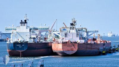
EAGLE SAN PEDRO
Crude Oil Tanker
Current Trip
| Time Travelled | 3 days |
|---|---|
| Remaining Time | --- |
| Distance Travelled | 415.54 nm |
| Remaining Distance | --- |
| AVG Speed | 10 Knots |
| MAX Speed | 13.6 Knots |
| AVG Wind | 14.8 knots |
| MAX Wind | 35.6 knots |
| MIN Temp | 22.9°C / 73.22°F |
| MAX Temp | 30.1°C / 86.18°F |
| Draught | 9.5 m |
| Position Received | 7 h, 2 m ago |
Current Position
| Longitude | -95.11732° |
|---|---|
| Latitude | 28.73259° |
| Status | Under way using engine |
| Speed | 11 Knots |
| Course | 57.2° |
| Area | Gulf of Mexico |
| Station | T-AIS |
| Position Received | 7 h, 2 m ago |
Info
Information
The current position of EAGLE SAN PEDRO is in Gulf of Mexico with coordinates 28.73259° / -95.11732° as reported on 2024-05-31 19:15 by AIS to our vessel tracker app. The vessel's current speed is 11 Knots
The vessel EAGLE SAN PEDRO (IMO: 9594858, MMSI: 566690000) is a Crude Oil Tanker that was built in 2012 ( 12 years old ). It's sailing under the flag of [SG] Singapore.
In this page you can find informations about the vessels current position, last detected port calls, and current voyage information. If the vessels is not in coverage by AIS you will find the latest position.
The current position of EAGLE SAN PEDRO is detected by our AIS receivers and we are not responsible for the reliability of the data. The last position was recorded while the vessel was in Coverage by the Ais receivers of our vessel tracking app.
The current draught of EAGLE SAN PEDRO as reported by AIS is 9.5 meters
Weather
| Temperature | 26.6°C / 79.88°F |
|---|---|
| Wind Speed | 5 knots |
| Direction | 151° SSE |
| Pressure | 1013 hPa |
| Humidity | 77.8 % |
| Cloud Coverage | --- |
Featured Company
Last Port Calls
| Port | Arrival | Departure | Time In Port |
|---|---|---|---|
| 2024-05-26 15:49 | 2024-05-28 14:47 | 1 d | |
| 2024-05-13 14:01 | 2024-05-15 19:57 | 2 d | |
| 2024-05-07 21:42 | 2024-05-09 20:02 | 1 d | |
| 2024-04-28 21:52 | 2024-04-30 13:42 | 1 d | |
| 2024-04-22 11:34 | 2024-04-24 14:01 | 2 d | |
| 2024-04-15 19:37 | 2024-04-15 20:13 | 35 m | |
| 2024-04-10 21:00 | 2024-04-10 21:40 | 39 m |
Most Visited Ports (Last year)
| Port | Arrivals | |
|---|---|---|
| 28 | ||
| 8 | ||
| 4 | ||
| 2 | ||
| 1 |
Last Trips
| Origin | Departure | Destination | Arrival | Distance | |
|---|---|---|---|---|---|
| 2024-05-15 14:57 | 2024-05-26 10:49 | 671.14 nm | |||
| 2024-05-09 15:02 | 2024-05-13 09:01 | 273.55 nm | |||
| 2024-04-30 08:42 | 2024-05-07 16:42 | 376.55 nm | |||
| 2024-04-24 09:01 | 2024-04-28 16:52 | 185.73 nm | |||
| 2024-04-15 15:13 | 2024-04-22 06:34 | 378.65 nm | |||
| 2024-04-10 16:40 | 2024-04-15 14:37 | 163.64 nm | |||
| 2024-03-30 09:10 | 2024-04-10 16:00 | 390.43 nm |
Events
| Time | Event | Details | Position / Dest | Info |
|---|---|---|---|---|
| 2024-05-31 23:22 | STOP Moving | 14.95 nm, South East of GALVESTON |
29.18574 / -94.54847
GALVESTON ANCHORAGE
|
Speed: 0.3 kn Course: 48° |
| 2024-05-31 19:20 | Status Changed | Default Under way using engine |
28.74083 / -95.10251
GALVESTON ANCHORAGE
|
Speed: 11 kn Course: 57.2° |
| 2024-05-31 19:15 | OUT of Coverage |
28.73259 / -95.11732
Gulf of Mexico
GALVESTON ANCHORAGE
|
Speed: 11 kn Course: 57.2° |
|
| 2024-05-31 19:08 | Status Changed | Under way using engine Default |
28.72208 / -95.13642
GALVESTON ANCHORAGE
|
Speed: 10.8 kn Course: 58° |
| 2024-05-31 19:04 | Status Changed | Default Under way using engine |
28.71521 / -95.14906
GALVESTON ANCHORAGE
|
Speed: 10.7 kn Course: 57.6° |
| 2024-05-31 18:58 | Status Changed | Under way using engine Default |
28.70536 / -95.16693
GALVESTON ANCHORAGE
|
Speed: 10.7 kn Course: 58° |
| 2024-05-31 18:16 | Status Changed | Default Under way using engine |
28.63408 / -95.28676
GALVESTON ANCHORAGE
|
Speed: 11.5 kn Course: 57.4° |
| 2024-05-31 17:43 | Draught Changed | 9.5 13.7 |
28.57648 / -95.38864
GALVESTON ANCHORAGE
|
Speed: 11.3 kn Course: 58° |
| 2024-05-31 17:43 | Destination Changed | GALVESTON ANCHORAGE CCLZ |
28.57648 / -95.38864
GALVESTON ANCHORAGE
|
Speed: 11.3 kn Course: 58° |
| 2024-05-31 17:43 | ETA Changed | 2024/05/31 21:00 2024/05/29 03:00 |
28.57648 / -95.38864
GALVESTON ANCHORAGE
|
Speed: 11.3 kn Course: 58° |