
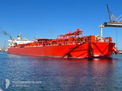
EAGLE TEXAS
Tanker
Current Trip
GOLA USA
| Time Travelled | 6 days |
|---|---|
| Remaining Time | --- |
| Distance Travelled | 1479.60 nm |
| Remaining Distance | --- |
| AVG Speed | 11.4 Knots |
| MAX Speed | 15.7 Knots |
| AVG Wind | 7.6 knots |
| MAX Wind | 14.8 knots |
| MIN Temp | 15.2°C / 59.36°F |
| MAX Temp | 29.7°C / 85.46°F |
| Draught | 9.2 m |
| Position Received | 1 d ago |
Current Position
| Longitude | -80.51272° |
|---|---|
| Latitude | 24.59374° |
| Status | Under way using engine |
| Speed | 9.7 Knots |
| Course | 235.1° |
| Area | North Atlantic Ocean |
| Station | T-AIS |
| Position Received | 1 d ago |
Info
Information
The current position of EAGLE TEXAS is in North Atlantic Ocean with coordinates 24.59374° / -80.51272° as reported on 2024-06-06 22:47 by AIS to our vessel tracker app. The vessel's current speed is 9.7 Knots
The vessel EAGLE TEXAS (IMO: 9518907, MMSI: 538004199) is a Tanker It's sailing under the flag of [MH] Marshall Is.
In this page you can find informations about the vessels current position, last detected port calls, and current voyage information. If the vessels is not in coverage by AIS you will find the latest position.
The current position of EAGLE TEXAS is detected by our AIS receivers and we are not responsible for the reliability of the data. The last position was recorded while the vessel was in Coverage by the Ais receivers of our vessel tracking app.
The current draught of EAGLE TEXAS as reported by AIS is 9.2 meters
Weather
| Temperature | 28.6°C / 83.48°F |
|---|---|
| Wind Speed | 9 knots |
| Direction | 114° ESE |
| Pressure | 1011.2 hPa |
| Humidity | 74.7 % |
| Cloud Coverage | --- |
Featured Company
Last Port Calls
| Port | Arrival | Departure | Time In Port |
|---|---|---|---|
| 2024-06-01 02:39 | 2024-06-01 23:53 | 21 h | |
| 2024-05-24 14:57 | 2024-05-24 15:54 | 57 m | |
| 2024-05-22 23:47 | 2024-05-24 12:27 | 1 d | |
| 2024-05-19 21:27 | 2024-05-19 22:13 | 46 m | |
| 2024-05-17 22:42 | 2024-05-19 19:14 | 1 d | |
| 2024-05-14 14:08 | 2024-05-14 14:59 | 50 m | |
| 2024-05-12 22:21 | 2024-05-14 12:07 | 1 d | |
| 2024-05-07 22:45 | 2024-05-07 23:35 | 50 m | |
| 2024-05-06 17:32 | 2024-05-07 20:40 | 1 d | |
| 2024-05-01 22:37 | 2024-05-01 23:38 | 1 h |
Most Visited Ports (Last year)
| Port | Arrivals | |
|---|---|---|
| 21 | ||
| 16 | ||
| 11 | ||
| 4 | ||
| 4 | ||
| 2 |
Last Trips
| Origin | Departure | Destination | Arrival | Distance | |
|---|---|---|---|---|---|
| 2024-05-24 10:54 | 2024-05-31 22:39 | 1967.89 nm | |||
| 2024-05-24 07:27 | 2024-05-24 09:57 | 17.08 nm | |||
| 2024-05-19 17:13 | 2024-05-22 18:47 | 218.93 nm | |||
| 2024-05-19 14:14 | 2024-05-19 16:27 | 17.54 nm | |||
| 2024-05-14 09:59 | 2024-05-17 17:42 | 262.41 nm | |||
| 2024-05-14 07:07 | 2024-05-14 09:08 | 16.71 nm | |||
| 2024-05-07 18:35 | 2024-05-12 17:21 | 248.64 nm | |||
| 2024-05-07 15:40 | 2024-05-07 17:45 | 14.90 nm | |||
| 2024-05-01 18:38 | 2024-05-06 12:32 | 390.45 nm | |||
| 2024-05-01 14:46 | 2024-05-01 17:37 | 19.26 nm |
Events
| Time | Event | Details | Position / Dest | Info |
|---|---|---|---|---|
| 2024-06-06 22:47 | OUT of Coverage |
24.59374 / -80.51272
North Atlantic Ocean
GOLA USA
|
Speed: 9.7 kn Course: 235.1° |
|
| 2024-06-06 18:17 | IN Coverage |
25.09304 / -79.95280
North Atlantic Ocean
GOLA USA
|
Speed: 9.7 kn Course: 212° |
|
| 2024-06-06 16:57 | OUT of Coverage |
25.28918 / -79.85242
North Atlantic Ocean
GOLA USA
|
Speed: 9.8 kn Course: 203.4° |
|
| 2024-06-06 10:56 | Detected in Sea | United States part of the North Atlantic Ocean |
26.17632 / -79.58416
North Atlantic Ocean
GOLA USA
|
Speed: 11.1 kn Course: 239.2° |
| 2024-06-06 10:38 | Destination Changed | GOLA USA FREE PORT(BAHAMAS) |
26.20594 / -79.53075
GOLA USA
|
Speed: 11.4 kn Course: 238.2° |
| 2024-06-06 10:38 | ETA Changed | 2024/06/10 02:00 2024/06/06 07:00 |
26.20594 / -79.53075
GOLA USA
|
Speed: 11.4 kn Course: 238.2° |
| 2024-06-06 09:45 | Status Changed | Under way using engine Default |
26.28794 / -79.36230
FREE PORT(BAHAMAS)
|
Speed: 12 kn Course: 248° |
| 2024-06-06 09:45 | IN Coverage |
26.28548 / -79.36929
North Atlantic Ocean
FREE PORT(BAHAMAS)
|
Speed: 12 kn Course: 248.6° |
|
| 2024-06-05 21:46 | OUT of Coverage |
27.35050 / -79.47957
North Atlantic Ocean
FREE PORT(BAHAMAS)
|
Speed: 10.5 kn Course: 181° |
|
| 2024-06-05 20:22 | Draught Changed | 9.2 9.5 |
27.60947 / -79.48022
FREE PORT(BAHAMAS)
|
Speed: 10.7 kn Course: 179.2° |