
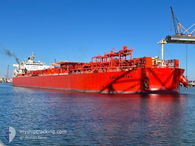
EAGLE TEXAS
Tanker
Current Trip
| Time Travelled | 7 days |
|---|---|
| Remaining Time | 2 h, 21 mins |
| Distance Travelled | 1939.05 nm |
| Remaining Distance | 30.27 nm |
| AVG Speed | 11.7 Knots |
| MAX Speed | 15.3 Knots |
| AVG Wind | 12.1 knots |
| MAX Wind | 17.9 knots |
| MIN Temp | 15.9°C / 60.62°F |
| MAX Temp | 29.5°C / 85.1°F |
| Draught | 11.7 m |
| Position Received | 2 h, 33 m ago |
Current Position
| Longitude | -75.22515° |
|---|---|
| Latitude | 39.12857° |
| Status | Under way using engine |
| Speed | 11.8 Knots |
| Course | 324.8° |
| Area | North Atlantic Ocean |
| Station | T-AIS |
| Position Received | 2 h, 33 m ago |
Info
Information
The current position of EAGLE TEXAS is in North Atlantic Ocean with coordinates 39.12857° / -75.22515° as reported on 2024-05-31 20:55 by AIS to our vessel tracker app. The vessel's current speed is 11.8 Knots and is heading at the port of PAULSBORO. The estimated time of arrival as calculated by vessel tracking app is 2024-06-01 01:50 LT
The vessel EAGLE TEXAS (IMO: 9518907, MMSI: 538004199) is a Tanker It's sailing under the flag of [MH] Marshall Is.
In this page you can find informations about the vessels current position, last detected port calls, and current voyage information. If the vessels is not in coverage by AIS you will find the latest position.
The current position of EAGLE TEXAS is detected by our AIS receivers and we are not responsible for the reliability of the data. The last position was recorded while the vessel was in Coverage by the Ais receivers of our vessel tracking app.
The current draught of EAGLE TEXAS as reported by AIS is 11.7 meters
Weather
| Temperature | 20.3°C / 68.54°F |
|---|---|
| Wind Speed | 7 knots |
| Direction | 291° WNW |
| Pressure | 1021.7 hPa |
| Humidity | 51.5 % |
| Cloud Coverage | 8 % |
Featured Company
Last Port Calls
| Port | Arrival | Departure | Time In Port |
|---|---|---|---|
| 2024-05-24 14:57 | 2024-05-24 15:54 | 57 m | |
| 2024-05-22 23:47 | 2024-05-24 12:27 | 1 d | |
| 2024-05-19 21:27 | 2024-05-19 22:13 | 46 m | |
| 2024-05-17 22:42 | 2024-05-19 19:14 | 1 d | |
| 2024-05-14 14:08 | 2024-05-14 14:59 | 50 m | |
| 2024-05-12 22:21 | 2024-05-14 12:07 | 1 d | |
| 2024-05-07 22:45 | 2024-05-07 23:35 | 50 m | |
| 2024-05-06 17:32 | 2024-05-07 20:40 | 1 d | |
| 2024-05-01 22:37 | 2024-05-01 23:38 | 1 h | |
| 2024-04-29 22:36 | 2024-05-01 19:46 | 1 d |
Most Visited Ports (Last year)
| Port | Arrivals | |
|---|---|---|
| 22 | ||
| 17 | ||
| 11 | ||
| 4 | ||
| 3 | ||
| 2 |
Last Trips
| Origin | Departure | Destination | Arrival | Distance | |
|---|---|---|---|---|---|
| 2024-05-24 07:27 | 2024-05-24 09:57 | 17.08 nm | |||
| 2024-05-19 17:13 | 2024-05-22 18:47 | 218.93 nm | |||
| 2024-05-19 14:14 | 2024-05-19 16:27 | 17.54 nm | |||
| 2024-05-14 09:59 | 2024-05-17 17:42 | 262.41 nm | |||
| 2024-05-14 07:07 | 2024-05-14 09:08 | 16.71 nm | |||
| 2024-05-07 18:35 | 2024-05-12 17:21 | 248.64 nm | |||
| 2024-05-07 15:40 | 2024-05-07 17:45 | 14.90 nm | |||
| 2024-05-01 18:38 | 2024-05-06 12:32 | 390.45 nm | |||
| 2024-05-01 14:46 | 2024-05-01 17:37 | 19.26 nm | |||
| 2024-04-26 07:03 | 2024-04-29 17:36 | 173.44 nm |
Events
| Time | Event | Details | Position / Dest | Info |
|---|---|---|---|---|
| 2024-05-31 21:00 | Status Changed | Default Under way using engine |
39.14158 / -75.23701
PAULSBORO
|
Speed: 11.8 kn Course: 324.8° |
| 2024-05-31 20:55 | OUT of Coverage |
39.12857 / -75.22515
North Atlantic Ocean
PAULSBORO
|
Speed: 11.8 kn Course: 324.8° |
|
| 2024-05-31 18:19 | Status Changed | Under way using engine Default |
38.74660 / -74.95409
PAULSBORO
|
Speed: 6.3 kn Course: 307° |
| 2024-05-31 18:16 | Status Changed | Default Under way using engine |
38.74322 / -74.94821
PAULSBORO
|
Speed: 6.2 kn Course: 327.8° |
| 2024-05-31 17:09 | Status Changed | Under way using engine Default |
38.65449 / -74.85558
PAULSBORO
|
Speed: 9.3 kn Course: 321° |
| 2024-05-31 16:56 | Status Changed | Default Under way using engine |
38.63045 / -74.82982
PAULSBORO
|
Speed: 10.8 kn Course: 318.6° |
| 2024-05-31 16:39 | ETA Changed | 2024/06/01 02:00 2024/05/31 20:00 |
38.59325 / -74.78955
PAULSBORO
|
Speed: 10.9 kn Course: 320.1° |
| 2024-05-31 16:26 | Draught Changed | 11.7 11.4 |
38.56633 / -74.75395
PAULSBORO
|
Speed: 10.8 kn Course: 312.5° |
| 2024-05-31 16:17 | Status Changed | Under way using engine Default |
38.54812 / -74.72924
PAULSBORO
|
Speed: 10.5 kn Course: 310° |
| 2024-05-31 16:12 | Status Changed | Default Under way using engine |
38.53853 / -74.71433
PAULSBORO
|
Speed: 11 kn Course: 308.8° |