
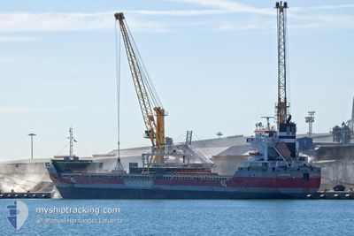
EBROBORG
General Cargo
Current Trip
| Time Travelled | 5 days |
|---|---|
| Remaining Time | --- |
| Distance Travelled | 1289.24 nm |
| Remaining Distance | --- |
| AVG Speed | 10.4 Knots |
| MAX Speed | 16 Knots |
| AVG Wind | 8.8 knots |
| MAX Wind | 22.1 knots |
| MIN Temp | 0.9°C / 33.62°F |
| MAX Temp | 20.2°C / 68.36°F |
| Draught | 8.3 m |
| Position Received | 2 d ago |
Current Position
| Longitude | -57.55076° |
|---|---|
| Latitude | 51.01505° |
| Status | Under way using engine |
| Speed | 10.3 Knots |
| Course | 46.3° |
| Area | Gulf of St-Lawrence |
| Station | T-AIS |
| Position Received | 2 d ago |
Info
Information
The current position of EBROBORG is in Gulf of St-Lawrence with coordinates 51.01505° / -57.55076° as reported on 2024-05-17 21:55 by AIS to our vessel tracker app. The vessel's current speed is 10.3 Knots and is heading at the port of WATERFORD. The estimated time of arrival as calculated by vessel tracking app is 2024-05-26 08:00 LT
The vessel EBROBORG (IMO: 9463451, MMSI: 245952000) is a General Cargo that was built in 2010 ( 14 years old ). It's sailing under the flag of [NL] Netherlands.
In this page you can find informations about the vessels current position, last detected port calls, and current voyage information. If the vessels is not in coverage by AIS you will find the latest position.
The current position of EBROBORG is detected by our AIS receivers and we are not responsible for the reliability of the data. The last position was recorded while the vessel was in Coverage by the Ais receivers of our vessel tracking app.
The current draught of EBROBORG as reported by AIS is 8.3 meters
Weather
| Temperature | 4.1°C / 39.38°F |
|---|---|
| Wind Speed | 11 knots |
| Direction | 297° WNW |
| Pressure | 1026.4 hPa |
| Humidity | 65.3 % |
| Cloud Coverage | 100 % |
Featured Company
Last Port Calls
| Port | Arrival | Departure | Time In Port |
|---|---|---|---|
| 2024-05-14 09:14 | 2024-05-14 19:38 | 10 h | |
| 2024-05-13 00:53 | 2024-05-13 01:29 | 35 m | |
| 2024-05-09 20:58 | 2024-05-11 18:59 | 1 d | |
| 2024-05-03 04:42 | 2024-05-07 21:02 | 4 d | |
| 2024-04-27 22:37 | 2024-04-30 22:48 | 3 d | |
| 2024-04-26 19:02 | 2024-04-26 20:08 | 1 h | |
| 2024-04-25 07:57 | 2024-04-25 08:49 | 51 m | |
| 2024-04-22 12:13 | 2024-04-23 21:45 | 1 d | |
| 2024-03-23 02:11 | 2024-03-27 22:19 | 4 d | |
| 2024-03-20 16:16 | 2024-03-22 11:26 | 1 d |
Most Visited Ports (Last year)
| Port | Arrivals | |
|---|---|---|
| 4 | ||
| 4 | ||
| 4 | ||
| 3 | ||
| 3 | ||
| 2 |
Last Trips
| Origin | Departure | Destination | Arrival | Distance | |
|---|---|---|---|---|---|
| 2024-05-12 21:29 | 2024-05-14 05:14 | 296.85 nm | |||
| 2024-05-11 14:59 | 2024-05-12 20:53 | 231.07 nm | |||
| 2024-05-07 16:02 | 2024-05-09 16:58 | 574.05 nm | |||
| 2024-04-30 18:48 | 2024-05-02 23:42 | 575.68 nm | |||
| 2024-04-26 16:08 | 2024-04-27 18:37 | 229.63 nm | |||
| 2024-04-25 04:49 | 2024-04-26 15:02 | 296.52 nm | |||
| 2024-04-23 17:45 | 2024-04-25 03:57 | 339.25 nm | |||
| 2024-03-27 23:19 | 2024-04-22 08:13 | 4430.10 nm | |||
| 2024-03-22 12:26 | 2024-03-23 03:11 | 162.35 nm | |||
| 2024-03-01 16:19 | 2024-03-20 17:16 | 2221.74 nm |
Events
| Time | Event | Details | Position / Dest | Info |
|---|---|---|---|---|
| 2024-05-18 02:22 | START Moving | 10.95 nm, North of ST BARBE |
51.38704 / -56.75428
IE WAT
|
Speed: 8 kn Course: 55° |
| 2024-05-18 01:58 | STOP Moving | 10.63 nm, North of ST BARBE |
51.38167 / -56.75667
IE WAT
|
Speed: Course: -1° |
| 2024-05-17 22:01 | Status Changed | Default Under way using engine |
51.02500 / -57.53333
IE WAT
|
Speed: 10.3 kn Course: 46.3° |
| 2024-05-17 21:55 | OUT of Coverage |
51.01505 / -57.55076
Gulf of St-Lawrence
IE WAT
|
Speed: 10.3 kn Course: 46.3° |
|
| 2024-05-17 21:34 | Status Changed | Under way using engine Default |
50.97337 / -57.61858
IE WAT
|
Speed: 10 kn Course: 43° |
| 2024-05-17 21:17 | Status Changed | Default Under way using engine |
50.93618 / -57.67380
IE WAT
|
Speed: 10.5 kn Course: 45° |
| 2024-05-17 21:00 | Status Changed | Under way using engine Default |
50.90270 / -57.72651
IE WAT
|
Speed: 10 kn Course: 45° |
| 2024-05-17 20:18 | Status Changed | Default Under way using engine |
50.81005 / -57.86686
IE WAT
|
Speed: 10.7 kn Course: 42.8° |
| 2024-05-17 20:10 | Status Changed | Under way using engine Default |
50.79460 / -57.88942
IE WAT
|
Speed: 10.8 kn Course: 43° |
| 2024-05-17 19:52 | IN Coverage |
50.79460 / -57.88942
Gulf of St-Lawrence
IE WAT
|
Speed: 10.7 kn Course: 42.8° |