
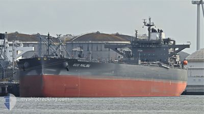
ECO MALIBU
Tanker
Current Trip
| Time Travelled | 24 days |
|---|---|
| Remaining Time | --- |
| Distance Travelled | 4754.80 nm |
| Remaining Distance | --- |
| AVG Speed | 11.2 Knots |
| MAX Speed | 14 Knots |
| AVG Wind | 8.8 knots |
| MAX Wind | 22.8 knots |
| MIN Temp | 25.6°C / 78.08°F |
| MAX Temp | 37.2°C / 98.96°F |
| Draught | 15.8 m |
| Position Received | 2 h, 41 m ago |
Current Position
| Longitude | 57.06645° |
|---|---|
| Latitude | 24.68352° |
| Status | Under way using engine |
| Speed | 12.5 Knots |
| Course | 137.6° |
| Area | Gulf of Oman |
| Station | T-AIS |
| Position Received | 2 h, 41 m ago |
Info
Information
The current position of ECO MALIBU is in Gulf of Oman with coordinates 24.68352° / 57.06645° as reported on 2024-06-09 23:29 by AIS to our vessel tracker app. The vessel's current speed is 12.5 Knots and is heading at the port of THESSALONIKI. The estimated time of arrival as calculated by vessel tracking app is 2024-07-19 04:00 LT
The vessel ECO MALIBU (IMO: 9902823, MMSI: 538009214) is a Tanker It's sailing under the flag of [MH] Marshall Is.
In this page you can find informations about the vessels current position, last detected port calls, and current voyage information. If the vessels is not in coverage by AIS you will find the latest position.
The current position of ECO MALIBU is detected by our AIS receivers and we are not responsible for the reliability of the data. The last position was recorded while the vessel was in Coverage by the Ais receivers of our vessel tracking app.
The current draught of ECO MALIBU as reported by AIS is 15.8 meters
Weather
| Temperature | 31.3°C / 88.34°F |
|---|---|
| Wind Speed | 6 knots |
| Direction | 100° E |
| Pressure | 1004.3 hPa |
| Humidity | 72.1 % |
| Cloud Coverage | --- |
Featured Company
Last Port Calls
| Port | Arrival | Departure | Time In Port |
|---|---|---|---|
| 2024-05-15 02:21 | 2024-05-16 13:59 | 1 d |
Last Trips
| Origin | Departure | Destination | Arrival | Distance | |
|---|---|---|---|---|---|
| 2024-03-26 09:43 | 2024-05-15 05:21 | 12236.02 nm |
Events
| Time | Event | Details | Position / Dest | Info |
|---|---|---|---|---|
| 2024-06-09 23:37 | Status Changed | Default Under way using engine |
24.66229 / 57.08752
IQ BSR>GR SKG
|
Speed: 12.5 kn Course: 137.6° |
| 2024-06-09 23:29 | OUT of Coverage |
24.68352 / 57.06645
Gulf of Oman
|
Speed: 12.5 kn Course: 137.6° |
|
| 2024-06-09 21:23 | Change Sea Area | Omani part of the Gulf of Oman United Arab Emirates part of the Gulf of Oman |
25.05041 / 56.83000
Gulf of Oman
|
Speed: 12.6 kn Course: 174.7° |
| 2024-06-09 18:26 | Change Sea Area | United Arab Emirates part of the Gulf of Oman Omani part of the Gulf of Oman |
25.65095 / 56.82435
Gulf of Oman
|
Speed: 11.1 kn Course: 178.8° |
| 2024-06-09 17:08 | Detected in Sea | Omani part of the Gulf of Oman |
25.90134 / 56.80620
Gulf of Oman
|
Speed: 10.8 kn Course: 176.2° |
| 2024-06-09 17:07 | Status Changed | Under way using engine Default |
25.90341 / 56.80608
IQ BSR>GR SKG
|
Speed: 10.8 kn Course: 177° |
| 2024-06-09 17:07 | IN Coverage |
25.90134 / 56.80620
Gulf of Oman
|
Speed: 10.8 kn Course: 176.2° |
|
| 2024-06-09 10:09 | Status Changed | Default Under way using engine |
26.22656 / 55.92700
IQ BSR>GR SKG
|
Speed: 11 kn Course: 47.2° |
| 2024-06-09 10:06 | Status Changed | Under way using engine Default |
26.22001 / 55.91926
IQ BSR>GR SKG
|
Speed: 11 kn Course: 47° |
| 2024-06-09 10:06 | OUT of Coverage |
26.22001 / 55.91926
Persian Gulf
|
Speed: 11 kn Course: 47.2° |