
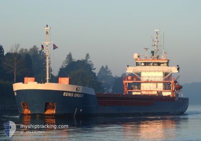
EEMS DRAIT
General Cargo
Current Trip
| Trip Time | 4 days |
|---|---|
| Trip Distance | 918.06 nm |
| AVG Speed | 7.9 Knots |
| MAX Speed | 11.6 Knots |
| Draught | 5.5 m |
| AVG Wind | 13.2 knots |
| MAX Wind | 20 knots |
| MIN Temp | 9.7°C / 49.46°F |
| MAX Temp | 17.4°C / 63.32°F |
| Position Received | 2 d ago |
Current Position
| Longitude | -8.95080° |
|---|---|
| Latitude | 42.52188° |
| Status | Under way using engine |
| Speed | 8.6 Knots |
| Course | 23.6° |
| Area | North Atlantic Ocean |
| Station | T-AIS |
| Position Received | 2 d ago |
Info
Information
The current position of EEMS DRAIT is in North Atlantic Ocean with coordinates 42.52188° / -8.95080° as reported on 2024-05-26 21:16 by AIS to our vessel tracker app. The vessel's current speed is 8.6 Knots and is currently inside the port of VILLAGARCIA.
The vessel EEMS DRAIT (IMO: 9195688, MMSI: 244096000) is a General Cargo that was built in 2000 ( 24 years old ). It's sailing under the flag of [NL] Netherlands.
In this page you can find informations about the vessels current position, last detected port calls, and current voyage information. If the vessels is not in coverage by AIS you will find the latest position.
The current position of EEMS DRAIT is detected by our AIS receivers and we are not responsible for the reliability of the data. The last position was recorded while the vessel was in Coverage by the Ais receivers of our vessel tracking app.
The current draught of EEMS DRAIT as reported by AIS is 5.5 meters
Weather
| Temperature | 21.5°C / 70.7°F |
|---|---|
| Wind Speed | 4 knots |
| Direction | 279° W |
| Pressure | 1019.6 hPa |
| Humidity | 47.7 % |
| Cloud Coverage | 36 % |
Featured Company
Last Port Calls
| Port | Arrival | Departure | Time In Port |
|---|---|---|---|
| 2024-05-26 22:34 | |||
| 2024-05-21 11:53 | 2024-05-22 12:32 | 1 d | |
| 2024-05-18 18:03 | |||
| 2024-05-17 04:25 | 2024-05-18 00:10 | 19 h | |
| 2024-05-11 12:55 | 2024-05-13 18:26 | 2 d | |
| 2024-05-08 10:38 | 2024-05-10 23:24 | 2 d | |
| 2024-04-29 04:14 | 2024-05-04 18:36 | 5 d | |
| 2024-04-23 09:56 | 2024-04-24 16:20 | 1 d | |
| 2024-04-20 12:15 | 2024-04-22 22:17 | 2 d | |
| 2024-04-14 01:57 | 2024-04-17 05:37 | 3 d |
Most Visited Ports (Last year)
| Port | Arrivals | |
|---|---|---|
| 13 | ||
| 10 | ||
| 9 | ||
| 7 | ||
| 6 | ||
| 6 |
Last Trips
| Origin | Departure | Destination | Arrival | Distance | |
|---|---|---|---|---|---|
| 2024-05-22 14:32 | 2024-05-27 00:34 | 918.06 nm | |||
| 2024-05-18 01:10 | 2024-05-21 13:53 | 171.75 nm | |||
| 2024-05-18 01:10 | 2024-05-18 20:03 | 170.89 nm | |||
| 2024-05-13 19:26 | 2024-05-17 05:25 | 695.75 nm | |||
| 2024-05-11 00:24 | 2024-05-11 13:55 | 142.54 nm | |||
| 2024-05-04 20:36 | 2024-05-08 11:38 | 788.98 nm | |||
| 2024-04-24 18:20 | 2024-04-29 06:14 | 924.99 nm | |||
| 2024-04-23 00:17 | 2024-04-23 11:56 | 97.87 nm | |||
| 2024-04-17 06:37 | 2024-04-20 14:15 | 654.82 nm | |||
| 2024-04-13 01:58 | 2024-04-14 02:57 | 11.31 nm |
Events
| Time | Event | Details | Position / Dest | Info |
|---|---|---|---|---|
| 2024-05-26 22:34 | PORT ARRIVAL |
|
42.59573 / -8.78066
[ES] VILLAGARCIA
|
Speed: 8.7 kn Course: 73° |
| 2024-05-26 21:23 | Status Changed | Default Under way using engine |
42.53577 / -8.93900
ESVIL
|
Speed: 8.6 kn Course: 23.6° |
| 2024-05-26 21:16 | Status Changed | Under way using engine Default |
42.52188 / -8.95080
ESVIL
|
Speed: 8.6 kn Course: 23° |
| 2024-05-26 21:16 | OUT of Coverage |
42.52188 / -8.95080
North Atlantic Ocean
ESVIL
|
Speed: 8.6 kn Course: 23.6° |
|
| 2024-05-26 21:11 | Status Changed | Default Under way using engine |
42.51039 / -8.95743
ESVIL
|
Speed: 8.7 kn Course: 20.2° |
| 2024-05-26 20:53 | Status Changed | Under way using engine Default |
42.47049 / -8.97843
ESVIL
|
Speed: 8.3 kn Course: 24° |
| 2024-05-26 20:51 | Status Changed | Default Under way using engine |
42.46535 / -8.98135
ESVIL
|
Speed: 8.2 kn Course: 23° |
| 2024-05-26 20:46 | ETA Changed | 2024/05/26 23:30 2024/05/26 18:00 |
42.45468 / -8.98744
ESVIL
|
Speed: 8.2 kn Course: 21.6° |
| 2024-05-26 20:40 | Change Sea Area | Spanish part of the North Atlantic Ocean French part of the English Channel |
42.44230 / -8.99638
North Atlantic Ocean
ESVIL
|
Speed: 7.9 kn Course: 40° |
| 2024-05-26 20:39 | Status Changed | Under way using engine Default |
42.44118 / -8.99768
ESVIL
|
Speed: 8.4 kn Course: 92° |