
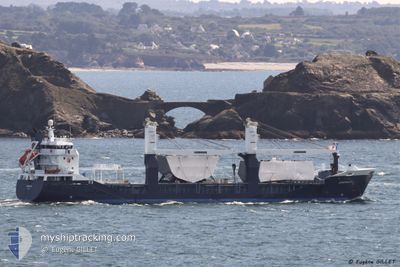
EENDRACHT
General Cargo
Current Trip
| Time Travelled | 10 days |
|---|---|
| Remaining Time | 7 days |
| Distance Travelled | 3878.39 nm |
| Remaining Distance | 3031.35 nm |
| AVG Speed | 14.9 Knots |
| MAX Speed | 19.2 Knots |
| AVG Wind | 12.9 knots |
| MAX Wind | 28.1 knots |
| MIN Temp | 7°C / 44.6°F |
| MAX Temp | 28.8°C / 83.84°F |
| Draught | 5.2 m |
| Position Received | 4 d ago |
Current Position
| Longitude | -16.76138° |
|---|---|
| Latitude | 27.06123° |
| Status | Under way using engine |
| Speed | 15.8 Knots |
| Course | 202.9° |
| Area | North Atlantic Ocean |
| Station | T-AIS |
| Position Received | 4 d ago |
Info
Information
The current position of EENDRACHT is in North Atlantic Ocean with coordinates 27.06123° / -16.76138° as reported on 2024-05-12 20:39 by AIS to our vessel tracker app. The vessel's current speed is 15.8 Knots and is heading at the port of CAPE TOWN. The estimated time of arrival as calculated by vessel tracking app is 2024-05-25 00:26 LT
The vessel EENDRACHT (IMO: 9512783, MMSI: 244620052) is a General Cargo that was built in 2009 ( 15 years old ). It's sailing under the flag of [NL] Netherlands.
In this page you can find informations about the vessels current position, last detected port calls, and current voyage information. If the vessels is not in coverage by AIS you will find the latest position.
The current position of EENDRACHT is detected by our AIS receivers and we are not responsible for the reliability of the data. The last position was recorded while the vessel was in Coverage by the Ais receivers of our vessel tracking app.
The current draught of EENDRACHT as reported by AIS is 5.2 meters
Weather
| Temperature | 28°C / 82.4°F |
|---|---|
| Wind Speed | 8 knots |
| Direction | 169° S |
| Pressure | 1012.5 hPa |
| Humidity | 74.3 % |
| Cloud Coverage | 100 % |
Featured Company
Last Port Calls
| Port | Arrival | Departure | Time In Port |
|---|---|---|---|
| 2024-05-04 20:17 | 2024-05-06 12:40 | 1 d | |
| 2024-05-03 22:01 | 2024-05-04 03:39 | 5 h | |
| 2024-05-03 17:47 | 2024-05-03 17:51 | 3 m | |
| 2024-05-02 03:33 | 2024-05-02 10:29 | 6 h | |
| 2024-04-27 05:40 | 2024-04-30 09:18 | 3 d | |
| 2024-04-14 17:35 | 2024-04-18 11:14 | 3 d | |
| 2024-04-11 14:39 | 2024-04-12 11:30 | 20 h | |
| 2024-04-08 14:17 | 2024-04-08 18:29 | 4 h | |
| 2024-04-04 07:35 | 2024-04-04 18:10 | 10 h | |
| 2024-04-01 09:49 | 2024-04-01 20:55 | 11 h |
Most Visited Ports (Last year)
| Port | Arrivals | |
|---|---|---|
| 6 | ||
| 4 | ||
| 2 | ||
| 2 | ||
| 2 | ||
| 2 |
Last Trips
| Origin | Departure | Destination | Arrival | Distance | |
|---|---|---|---|---|---|
| 2024-05-04 05:39 | 2024-05-04 22:17 | 243.24 nm | |||
| 2024-05-03 19:51 | 2024-05-04 00:01 | 50.41 nm | |||
| 2024-05-02 12:29 | 2024-05-03 19:47 | 331.59 nm | |||
| 2024-04-30 11:18 | 2024-05-02 05:33 | 625.35 nm | |||
| 2024-04-18 13:14 | 2024-04-27 07:40 | 2236.36 nm | |||
| 2024-04-12 14:30 | 2024-04-14 19:35 | 820.22 nm | |||
| 2024-04-08 21:29 | 2024-04-11 17:39 | 868.69 nm | |||
| 2024-04-04 20:10 | 2024-04-08 17:17 | 1085.20 nm | |||
| 2024-04-01 22:55 | 2024-04-04 09:35 | 895.26 nm | |||
| 2024-03-12 22:51 | 2024-04-01 11:49 | 3816.79 nm |
Events
| Time | Event | Details | Position / Dest | Info |
|---|---|---|---|---|
| 2024-05-12 20:54 | Status Changed | Default Under way using engine |
27.00312 / -16.78836
ZACPT
|
Speed: 15.8 kn Course: 202.9° |
| 2024-05-12 20:39 | OUT of Coverage |
27.06123 / -16.76138
North Atlantic Ocean
ZACPT
|
Speed: 15.8 kn Course: 202.9° |
|
| 2024-05-12 20:15 | Status Changed | Under way using engine Default |
27.15766 / -16.71475
ZACPT
|
Speed: 15.8 kn Course: 205° |
| 2024-05-12 20:12 | Status Changed | Default Under way using engine |
27.17120 / -16.70797
ZACPT
|
Speed: 15.8 kn Course: 204° |
| 2024-05-12 11:11 | Change Sea Area | Spanish (Canary Islands) part of the North Atlantic Ocean Portuguese (Madeira) part of the North Atlantic Ocean |
29.25179 / -15.53526
North Atlantic Ocean
ZACPT
|
Speed: 15.5 kn Course: 198.4° |
| 2024-05-12 07:33 | Status Changed | Under way using engine Default |
30.15161 / -15.19731
ZACPT
|
Speed: 15.4 kn Course: 196° |
| 2024-05-12 07:30 | Status Changed | Default Under way using engine |
30.16158 / -15.19400
ZACPT
|
Speed: 15.5 kn Course: 197° |
| 2024-05-12 07:23 | Status Changed | Under way using engine Default |
30.19153 / -15.18388
ZACPT
|
Speed: 15.4 kn Course: 198° |
| 2024-05-12 06:56 | Status Changed | Default Under way using engine |
30.30115 / -15.14633
ZACPT
|
Speed: 15.3 kn Course: 196.8° |
| 2024-05-12 06:41 | Status Changed | Under way using engine Default |
30.36460 / -15.12404
ZACPT
|
Speed: 15.4 kn Course: 198° |