
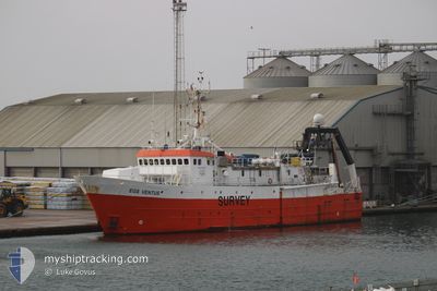
EGS VENTUS
Research/Survey Vessel
Current Trip
SURVEY AREA
| Time Travelled | 1 day |
|---|---|
| Remaining Time | --- |
| Distance Travelled | 122.66 nm |
| Remaining Distance | --- |
| AVG Speed | 5.6 Knots |
| MAX Speed | 10.5 Knots |
| AVG Wind | 9.9 knots |
| MAX Wind | 13.6 knots |
| MIN Temp | 17.1°C / 62.78°F |
| MAX Temp | 18.8°C / 65.84°F |
| Draught | 6.1 m |
| Position Received | 1 m ago |
Current Position
| Longitude | 7.82152° |
|---|---|
| Latitude | 56.08285° |
| Status | Restricted manoeuverability |
| Speed | 4 Knots |
| Course | 308° |
| Area | North Sea |
| Station | T-AIS |
| Position Received | 1 m ago |
Info
Information
The current position of EGS VENTUS is in North Sea with coordinates 56.08285° / 7.82152° as reported on 2024-06-27 06:29 by AIS to our vessel tracker app. The vessel's current speed is 4 Knots
The vessel EGS VENTUS (IMO: 7504237, MMSI: 538007957) is a Research/Survey Vessel that was built in 1977 ( 47 years old ). It's sailing under the flag of [MH] Marshall Is.
In this page you can find informations about the vessels current position, last detected port calls, and current voyage information. If the vessels is not in coverage by AIS you will find the latest position.
The current position of EGS VENTUS is detected by our AIS receivers and we are not responsible for the reliability of the data. The last position was recorded while the vessel was in Coverage by the Ais receivers of our vessel tracking app.
The current draught of EGS VENTUS as reported by AIS is 6.1 meters
Weather
| Temperature | 17.5°C / 63.5°F |
|---|---|
| Wind Speed | 14 knots |
| Direction | 108° ESE |
| Pressure | 1008.3 hPa |
| Humidity | 86.4 % |
| Cloud Coverage | 20 % |
Featured Company
Last Trips
Events
| Time | Event | Details | Position / Dest | Info |
|---|---|---|---|---|
| 2024-06-27 01:34 | START Moving | 14.43 nm, North West of HVIDE SANDE |
56.10415 / 7.73590
SURVEY AREA
|
Speed: 3.1 kn Course: 131° |
| 2024-06-27 01:24 | STOP Moving | 14.37 nm, North West of HVIDE SANDE |
56.10225 / 7.73635
SURVEY AREA
|
Speed: 0.3 kn Course: 120° |
| 2024-06-27 00:01 | START Moving |
56.09643 / 7.40412
SURVEY AREA
|
Speed: 3.9 kn Course: 86° |
|
| 2024-06-26 22:59 | STOP Moving |
56.09679 / 7.40092
SURVEY AREA
|
Speed: Course: 329° |
|
| 2024-06-26 21:23 | START Moving | 20.36 nm, West of HVIDE SANDE |
56.09837 / 7.54427
SURVEY AREA
|
Speed: 3.2 kn Course: 258° |
| 2024-06-26 20:12 | STOP Moving | 20.29 nm, West of HVIDE SANDE |
56.09974 / 7.54693
SURVEY AREA
|
Speed: 0.2 kn Course: 243° |
| 2024-06-26 19:18 | START Moving | 15.53 nm, North West of HVIDE SANDE |
56.10288 / 7.69911
SURVEY AREA
|
Speed: 5.5 kn Course: 273.2° |
| 2024-06-26 17:31 | STOP Moving | 15.48 nm, North West of HVIDE SANDE |
56.10429 / 7.70189
SURVEY AREA
|
Speed: 0.3 kn Course: 190° |
| 2024-06-26 13:47 | Status Changed | Restricted manoeuverability Under way using engine |
56.00640 / 7.94833
SURVEY AREA
|
Speed: 0.9 kn Course: 60° |
| 2024-06-26 07:08 | Destination Changed | SURVEY AREA DK EBJ |
55.42068 / 8.12639
SURVEY AREA
|
Speed: 9.8 kn Course: 270.4° |