
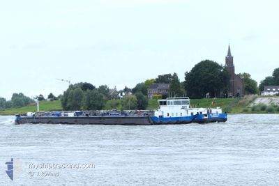
EILTANK 68
Tanker
Aktuelle Reise
| Bisherige Reisezeit | 6 Tage |
|---|---|
| Verbleibende Reisezeit | --- |
| Zurückgelegte Distanz | 77.68 nm |
| Verbleibende Distanz | --- |
| Durchschnittliche Geschwindigkeit | 5.2 Knoten |
| Maximale Geschwindigkeit | 6.8 Knoten |
| Durchschnittliche Windgeschwindigkeit | 8.9 Knoten |
| Maximale Windgeschwindigkeit | 10.4 Knoten |
| Minimale Temperatur | 12°C / 53.6°F |
| Maximale Temperatur | 16.4°C / 61.52°F |
| Tiefgang | 2.5 m |
| Position erhalten | 1 d alt |
Aktuelle Position
| Länge | --- |
|---|---|
| Breite | --- |
| Zustand | Under way using engine |
| Geschwindigkeit | 1.2 Knoten |
| Kurs | --- |
| Gebiet | North Sea |
| Station | T-AIS |
| Position erhalten | 1 d alt |
Schiffsdetails
Information
Die EILTANK 68 befindet sich derzeit in North Sea mit den Koordinaten 52.40782° / 9.73943°, Diese Position wurde am 2024-10-30 07:40 von unserer Schiffsverfolgungs-App über AIS erfasst. Das Schiff fährt momentan mit einer Geschwindigkeit von 1.2 Knoten
Das Schiff EILTANK 68 (MMSI: 211512080) ist Tanker und fährt unter der Flagge von [DE] Germany.
Auf dieser Seite erhalten Sie Informationen zur aktuellen Position des Schiffes, zu den letzten bekannten Hafenanläufen und zu den aktuellen Reiseinformationen. Sollte das Schiff nicht durch AIS abgedeckt sein, wird die zuletzt erfasste Position angezeigt.
Die EILTANK 68 wird durch unsere AIS-Empfänger ermittelt. Wir übernehmen keine Gewähr für die Richtigkeit der Daten. Die letzte Position wurde von unseren AIS-Empfängern aufgezeichnet, während das Schiff in Reichweite war.
Der aktuelle Entwurf von EILTANK 68, wie von AIS gemeldet, betragt 2.5 meter
Wetter
| Temperatur | 12.5°C / 54.5°F |
|---|---|
| Windgeschwindigkeit | 6 Knoten |
| Windrichtung | 264° W |
| Luftdruck | 1025.8 hPa |
| Luftfeuchtigkeit | 95.4 % |
| Wolken | 100 % |
Featured Company
Letzte Hafenanläufe
| Hafen | Ankunft | Abfahrt | Time In Port |
|---|---|---|---|
| 2024-10-24 10:31 | 2024-10-25 05:14 | 18 h | |
| 2024-10-23 07:57 | 2024-10-23 08:33 | 35 m | |
| 2024-10-18 12:32 | 2024-10-18 12:44 | 11 m | |
| 2024-10-07 12:07 | 2024-10-07 12:25 | 18 m | |
| 2024-10-06 13:01 | 2024-10-06 13:13 | 11 m | |
| 2024-09-28 11:14 | 2024-10-06 03:50 | 7 d | |
| 2024-09-27 11:47 | 2024-09-28 00:21 | 12 h | |
| 2024-09-26 16:29 | 2024-09-27 03:26 | 10 h | |
| 2024-09-24 16:52 | 2024-09-26 05:14 | 1 d | |
| 2024-09-22 16:13 | 2024-09-24 05:08 | 1 d |
Letzte Reisen
| Herkunft | Abfahrt | Ziel | Ankunft | Distanz | |
|---|---|---|---|---|---|
| 2024-10-23 10:33 | 2024-10-24 12:31 | 64.27 nm | |||
| 2024-10-18 14:44 | 2024-10-23 09:57 | 21.98 nm | |||
| 2024-10-07 14:25 | 2024-10-18 14:32 | 13.72 nm | |||
| 2024-10-06 15:13 | 2024-10-07 14:07 | 1.35 nm | |||
| 2024-10-06 05:50 | 2024-10-06 15:01 | 1.23 nm | |||
| 2024-09-28 02:21 | 2024-09-28 13:14 | 48.18 nm | |||
| 2024-09-27 05:26 | 2024-09-27 13:47 | 42.87 nm | |||
| 2024-09-26 07:14 | 2024-09-26 18:29 | 1.27 nm | |||
| 2024-09-24 07:08 | 2024-09-24 18:52 | 62.58 nm | |||
| 2024-09-19 13:53 | 2024-09-22 18:13 | 35.58 nm |
Events
| Zeit | Ereignis | Details | Position / Ziel | Information |
|---|---|---|---|---|
| 2024-10-30 07:40 | außerhalb Abdeckung |
52.40782 / 9.73943
North Sea
SALZGITTER TAN QUID
|
Geschwindigkeit: 1.2 kn Kurs: 102.8° |
|
| 2024-10-30 07:28 | in Abdeckung |
52.41197 / 9.72664
North Sea
SALZGITTER TAN QUID
|
Geschwindigkeit: 4 kn Kurs: 120.2° |
|
| 2024-10-30 05:45 | geänderter Status | Default Under way using engine |
52.40728 / 9.49194
SALZGITTER TAN QUID
|
Geschwindigkeit: 4.6 kn Kurs: 69.1° |
| 2024-10-30 05:35 | außerhalb Abdeckung |
52.40184 / 9.46917
North Sea
SALZGITTER TAN QUID
|
Geschwindigkeit: 4.6 kn Kurs: 69.1° |
|
| 2024-10-30 05:03 | in Abdeckung |
52.39155 / 9.39920
North Sea
SALZGITTER TAN QUID
|
Geschwindigkeit: 3.6 kn Kurs: 83.4° |
|
| 2024-10-29 17:30 | außerhalb Abdeckung |
52.39126 / 9.39713
North Sea
SALZGITTER TAN QUID
|
Geschwindigkeit: Kurs: 511° |
|
| 2024-10-29 17:28 | STOP Bewegung | 2.58 nm, West of KOLENFELD |
52.39126 / 9.39705
SALZGITTER TAN QUID
|
Geschwindigkeit: 0.2 kn Kurs: 511° |
| 2024-10-29 16:40 | geänderter Status | Under way using engine Default |
52.38710 / 9.30788
SALZGITTER TAN QUID
|
Geschwindigkeit: 5.3 kn Kurs: 80° |
| 2024-10-29 16:40 | in Abdeckung |
52.38713 / 9.30822
North Sea
SALZGITTER TAN QUID
|
Geschwindigkeit: 5 kn Kurs: 81° |
|
| 2024-10-29 14:28 | außerhalb Abdeckung |
52.31378 / 9.05953
North Sea
SALZGITTER TAN QUID
|
Geschwindigkeit: 3.6 kn Kurs: 40.4° |