
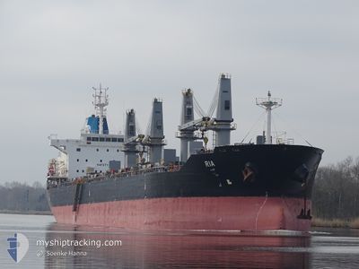
EIRINI S
Bulk Carrier
Current Trip
| Time Travelled | 13 days |
|---|---|
| Remaining Time | 4 days |
| Distance Travelled | 1210.42 nm |
| Remaining Distance | 1616.64 nm |
| AVG Speed | 10 Knots |
| MAX Speed | 14.9 Knots |
| AVG Wind | 12.3 knots |
| MAX Wind | 35 knots |
| MIN Temp | 14.1°C / 57.38°F |
| MAX Temp | 22°C / 71.6°F |
| Draught | 5.9 m |
| Position Received | 1 m ago |
Current Position
| Longitude | -0.55736° |
|---|---|
| Latitude | 50.23098° |
| Status | Under way using engine |
| Speed | 14.9 Knots |
| Course | 73° |
| Area | English Channel |
| Station | T-AIS |
| Position Received | 1 m ago |
Info
Information
The current position of EIRINI S is in English Channel with coordinates 50.23098° / -0.55736° as reported on 2024-06-04 05:36 by AIS to our vessel tracker app. The vessel's current speed is 14.9 Knots and is heading at the port of UST-LUGA. The estimated time of arrival as calculated by vessel tracking app is 2024-06-09 01:52 LT
The vessel EIRINI S (IMO: 9595369, MMSI: 636021798) is a Bulk Carrier that was built in 2012 ( 12 years old ). It's sailing under the flag of [LR] Liberia.
In this page you can find informations about the vessels current position, last detected port calls, and current voyage information. If the vessels is not in coverage by AIS you will find the latest position.
The current position of EIRINI S is detected by our AIS receivers and we are not responsible for the reliability of the data. The last position was recorded while the vessel was in Coverage by the Ais receivers of our vessel tracking app.
The current draught of EIRINI S as reported by AIS is 5.9 meters
Weather
| Temperature | 14.2°C / 57.56°F |
|---|---|
| Wind Speed | 8 knots |
| Direction | 232° SW |
| Pressure | 1015 hPa |
| Humidity | 90.3 % |
| Cloud Coverage | 83 % |
Featured Company
Last Port Calls
| Port | Arrival | Departure | Time In Port |
|---|---|---|---|
| 2024-05-11 02:23 | 2024-05-21 14:09 | 10 d | |
| 2024-04-01 12:43 | 2024-04-13 12:37 | 11 d |
Most Visited Ports (Last year)
| Port | Arrivals | |
|---|---|---|
| 3 | ||
| 2 | ||
| 2 | ||
| 2 | ||
| 2 | ||
| 1 |
Last Trips
| Origin | Departure | Destination | Arrival | Distance | |
|---|---|---|---|---|---|
| 2024-04-13 07:37 | 2024-05-11 03:23 | 4632.20 nm | |||
| 2024-03-23 12:55 | 2024-04-01 07:43 | 715.13 nm |
Events
| Time | Event | Details | Position / Dest | Info |
|---|---|---|---|---|
| 2024-06-04 04:14 | Change Sea Area | United Kingdom part of the English Channel French part of the English Channel |
50.13762 / -1.05596
English Channel
RU ULU
|
Speed: 14.1 kn Course: 76.9° |
| 2024-06-04 02:48 | Status Changed | Under way using engine Default |
50.05880 / -1.53115
RU ULU
|
Speed: 12.2 kn Course: 74° |
| 2024-06-04 02:45 | Status Changed | Default Under way using engine |
50.05606 / -1.54633
RU ULU
|
Speed: 12 kn Course: 74.4° |
| 2024-06-04 00:58 | Detected in Sea | French part of the English Channel |
49.96880 / -2.03060
English Channel
RU ULU
|
Speed: 9.8 kn Course: 74° |
| 2024-06-03 21:04 | Status Changed | Under way using engine Default |
49.77964 / -2.96451
RU ULU
|
Speed: 11.3 kn Course: 62° |
| 2024-06-03 20:49 | Status Changed | Default Under way using engine |
49.75765 / -3.02557
RU ULU
|
Speed: 11.3 kn Course: 61.1° |
| 2024-06-03 20:23 | Status Changed | Under way using engine Default |
49.71750 / -3.13628
RU ULU
|
Speed: 11.5 kn Course: 62° |
| 2024-06-03 20:17 | Status Changed | Default Under way using engine |
49.70821 / -3.16235
RU ULU
|
Speed: 11.6 kn Course: 61.8° |
| 2024-06-03 19:57 | Status Changed | Under way using engine Default |
49.67585 / -3.25182
RU ULU
|
Speed: 11.7 kn Course: 59° |
| 2024-06-03 19:45 | Status Changed | Default Under way using engine |
49.65719 / -3.30097
RU ULU
|
Speed: 12 kn Course: 59.7° |