
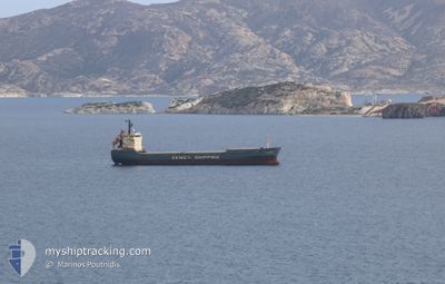
EKMEN STAR
Bulk Carrier
Current Trip
| Time Travelled | 23 days |
|---|---|
| Remaining Time | --- |
| Distance Travelled | 3586.25 nm |
| Remaining Distance | --- |
| AVG Speed | 8.2 Knots |
| MAX Speed | 11.2 Knots |
| AVG Wind | 9.3 knots |
| MAX Wind | 32 knots |
| MIN Temp | 12.5°C / 54.5°F |
| MAX Temp | 35.3°C / 95.54°F |
| Draught | 6 m |
| Position Received | 5 d ago |
Current Position
| Longitude | 29.35311° |
|---|---|
| Latitude | 41.28468° |
| Status | Under way using engine |
| Speed | 9.8 Knots |
| Course | 112° |
| Area | Black Sea |
| Station | T-AIS |
| Position Received | 5 d ago |
Info
Information
The current position of EKMEN STAR is in Black Sea with coordinates 41.28468° / 29.35311° as reported on 2024-06-16 08:36 by AIS to our vessel tracker app. The vessel's current speed is 9.8 Knots
The vessel EKMEN STAR (IMO: 9218193, MMSI: 314525000) is a Bulk Carrier that was built in 2001 ( 23 years old ). It's sailing under the flag of [BB] Barbados.
In this page you can find informations about the vessels current position, last detected port calls, and current voyage information. If the vessels is not in coverage by AIS you will find the latest position.
The current position of EKMEN STAR is detected by our AIS receivers and we are not responsible for the reliability of the data. The last position was recorded while the vessel was in Coverage by the Ais receivers of our vessel tracking app.
The current draught of EKMEN STAR as reported by AIS is 6 meters
Weather
| Temperature | 24.3°C / 75.74°F |
|---|---|
| Wind Speed | 5 knots |
| Direction | 335° NNW |
| Pressure | 1014.1 hPa |
| Humidity | 65.3 % |
| Cloud Coverage | --- |
Featured Company
Last Port Calls
| Port | Arrival | Departure | Time In Port |
|---|---|---|---|
| 2024-05-26 18:17 | 2024-05-29 13:23 | 2 d | |
| 2024-05-15 02:27 | 2024-05-21 16:02 | 6 d | |
| 2024-05-07 15:16 | 2024-05-09 22:08 | 2 d | |
| 2024-04-23 14:24 | 2024-05-03 18:14 | 10 d |
Last Trips
| Origin | Departure | Destination | Arrival | Distance | |
|---|---|---|---|---|---|
| 2024-05-21 18:02 | 2024-05-26 20:17 | 706.98 nm | |||
| 2024-05-10 01:08 | 2024-05-15 04:27 | 717.16 nm | |||
| 2024-05-03 20:14 | 2024-05-07 18:16 | 841.65 nm | |||
| 2024-03-29 09:25 | 2024-04-23 16:24 | 3987.74 nm |
Events
| Time | Event | Details | Position / Dest | Info |
|---|---|---|---|---|
| 2024-06-20 13:09 | START Moving | 2.95 nm, North of SAMSUN |
41.34188 / 36.35746
TRSSX
|
Speed: 4.3 kn Course: 84° |
| 2024-06-17 18:37 | STOP Moving | 2.94 nm, North of SAMSUN |
41.34168 / 36.35320
TRSSX
|
Speed: 0.1 kn Course: 155° |
| 2024-06-16 08:51 | Status Changed | Default Under way using engine |
41.27285 / 29.40639
TRSSX
|
Speed: 9.8 kn Course: 112° |
| 2024-06-16 08:36 | OUT of Coverage |
41.28468 / 29.35311
Black Sea
TRSSX
|
Speed: 9.8 kn Course: 112° |
|
| 2024-06-16 07:31 | Change Sea Area | Turkish part of the Black Sea Turkish part of the Sea of Marmara |
41.23220 / 29.14777
Black Sea
TRSSX
|
Speed: 9.4 kn Course: 50.5° |
| 2024-06-16 03:20 | START Moving | 10.85 nm, South West of MALTEPE |
40.78987 / 28.95650
TRSSX
|
Speed: 3.2 kn Course: 340° |
| 2024-06-16 03:10 | Status Changed | Under way using engine Not under command |
40.78907 / 28.96210
TRSSX
|
Speed: 0.4 kn Course: 215° |
| 2024-06-16 02:46 | ETA Changed | 2024/06/18 05:00 2024/06/16 05:00 |
40.78810 / 28.96706
TRSSX
|
Speed: 0.5 kn Course: 173° |
| 2024-06-15 20:36 | Status Changed | Not under command Default |
40.76092 / 29.04333
TRSSX
|
Speed: 0.4 kn Course: 161° |
| 2024-06-15 20:33 | Status Changed | Default Not under command |
40.76080 / 29.04377
TRSSX
|
Speed: 0.1 kn Course: 165° |