
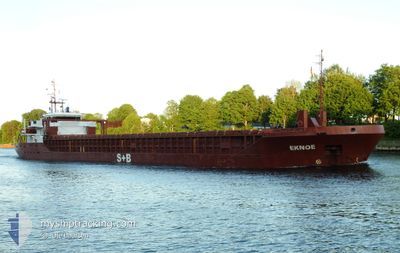
EKNOE
General Cargo
Current Trip
| Time Travelled | 1 day |
|---|---|
| Remaining Time | 2 days |
| Distance Travelled | 437.22 nm |
| Remaining Distance | 307.78 nm |
| AVG Speed | 7.9 Knots |
| MAX Speed | 11.7 Knots |
| AVG Wind | 11.9 knots |
| MAX Wind | 18.2 knots |
| MIN Temp | 11.2°C / 52.16°F |
| MAX Temp | 16.3°C / 61.34°F |
| Draught | 5.7 m |
| Position Received | Now |
Current Position
| Longitude | 9.50108° |
|---|---|
| Latitude | 54.18624° |
| Status | Under way using engine |
| Speed | 6.7 Knots |
| Course | 250.1° |
| Area | Baltic Sea |
| Station | T-AIS |
| Position Received | Now |
Info
Information
The current position of EKNOE is in Baltic Sea with coordinates 54.18624° / 9.50108° as reported on 2024-06-15 09:03 by AIS to our vessel tracker app. The vessel's current speed is 6.7 Knots and is heading at the port of SCHIEDAM. The estimated time of arrival as calculated by vessel tracking app is 2024-06-17 22:15 LT
The vessel EKNOE (IMO: 9353395, MMSI: 304936000) is a General Cargo that was built in 2006 ( 18 years old ). It's sailing under the flag of [AG] Antigua Barbuda.
In this page you can find informations about the vessels current position, last detected port calls, and current voyage information. If the vessels is not in coverage by AIS you will find the latest position.
The current position of EKNOE is detected by our AIS receivers and we are not responsible for the reliability of the data. The last position was recorded while the vessel was in Coverage by the Ais receivers of our vessel tracking app.
The current draught of EKNOE as reported by AIS is 5.7 meters
Weather
| Temperature | 13.7°C / 56.66°F |
|---|---|
| Wind Speed | 15 knots |
| Direction | 204° SSW |
| Pressure | 999 hPa |
| Humidity | 93.9 % |
| Cloud Coverage | 100 % |
Featured Company
Last Port Calls
| Port | Arrival | Departure | Time In Port |
|---|---|---|---|
| 2024-06-12 04:54 | 2024-06-13 10:53 | 1 d | |
| 2024-06-07 12:34 | 2024-06-09 02:04 | 1 d | |
| 2024-06-06 01:16 | 2024-06-06 02:07 | 51 m | |
| 2024-06-02 05:10 | 2024-06-04 08:58 | 2 d | |
| 2024-05-25 12:07 | 2024-05-26 12:05 | 23 h | |
| 2024-05-24 09:14 | 2024-05-24 10:54 | 1 h | |
| 2024-05-18 19:36 | 2024-05-18 19:39 | 3 m | |
| 2024-05-16 16:45 | 2024-05-17 16:41 | 23 h | |
| 2024-05-12 11:43 | 2024-05-13 16:20 | 1 d | |
| 2024-05-09 11:40 | 2024-05-10 12:01 | 1 d |
Last Trips
| Origin | Departure | Destination | Arrival | Distance | |
|---|---|---|---|---|---|
| 2024-06-09 04:04 | 2024-06-12 07:54 | 627.32 nm | |||
| 2024-06-06 04:07 | 2024-06-07 14:34 | 228.31 nm | |||
| 2024-06-04 11:58 | 2024-06-06 03:16 | 406.23 nm | |||
| 2024-05-26 14:05 | 2024-06-02 08:10 | 1471.56 nm | |||
| 2024-05-24 12:54 | 2024-05-25 14:07 | 181.83 nm | |||
| 2024-05-18 21:39 | 2024-05-24 11:14 | 1137.37 nm | |||
| 2024-05-17 18:41 | 2024-05-18 21:36 | 213.89 nm | |||
| 2024-05-13 18:20 | 2024-05-16 18:45 | 470.05 nm | |||
| 2024-05-10 14:01 | 2024-05-12 13:43 | 457.73 nm | |||
| 2024-05-08 08:03 | 2024-05-09 13:40 | 230.20 nm |
Events
| Time | Event | Details | Position / Dest | Info |
|---|---|---|---|---|
| 2024-06-15 08:41 | START Moving | 7.03 nm, North East of FISCHERHUTTE |
54.20116 / 9.55587
NLSCI
|
Speed: 3.2 kn Course: 229° |
| 2024-06-15 08:23 | STOP Moving | 7.14 nm, North East of FISCHERHUTTE |
54.20221 / 9.55843
NLSCI
|
Speed: 0.3 kn Course: 232° |
| 2024-06-15 03:50 | START Moving | 1.43 nm, South West of STICKENHΟRN SPORT |
54.36598 / 10.13905
NLSCI
|
Speed: 3.6 kn Course: 280° |
| 2024-06-15 03:22 | STOP Moving | 1.37 nm, South West of STICKENHΟRN SPORT |
54.36561 / 10.14236
NLSCI
|
Speed: 0.3 kn Course: 284° |
| 2024-06-15 02:58 | START Moving | 0.74 nm, South of STICKENHΟRN SPORT |
54.37059 / 10.16688
NLSCI
|
Speed: 3.1 kn Course: 229° |
| 2024-06-15 02:51 | Status Changed | Under way using engine At anchor |
54.37257 / 10.16757
NLSCI
|
Speed: 1.1 kn Course: 159° |
| 2024-06-15 02:06 | Status Changed | At anchor Under way using engine |
54.37353 / 10.16696
NLSCI
|
Speed: 0.3 kn Course: 161° |
| 2024-06-15 02:05 | STOP Moving | 0.56 nm, South of STICKENHΟRN SPORT |
54.37354 / 10.16684
NLSCI
|
Speed: 0.3 kn Course: 156° |
| 2024-06-14 23:35 | Change Sea Area | German part of the Baltic Sea Danish part of the Baltic Sea |
54.56934 / 10.55531
Baltic Sea
NLSCI
|
Speed: 4.3 kn Course: 246.8° |
| 2024-06-14 22:29 | Change Sea Area | Danish part of the Baltic Sea German part of the Baltic Sea |
54.59280 / 10.81903
Baltic Sea
NLSCI
|
Speed: 10.3 kn Course: 262.8° |