
EL GAIA
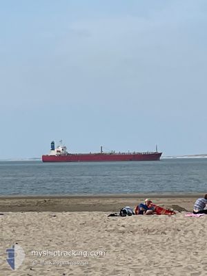
Oil Products Tanker
Current Trip
| Trip Time | 8 days |
|---|---|
| Trip Distance | 355.83 nm |
| AVG Speed | 7.7 Knots |
| MAX Speed | 13.5 Knots |
| Draught | 8 m |
| AVG Wind | 8.9 knots |
| MAX Wind | 25 knots |
| MIN Temp | 27.9°C / 82.22°F |
| MAX Temp | 31.4°C / 88.52°F |
| Position Received | 2 d ago |
Current Position
| Longitude | 50.67382° |
|---|---|
| Latitude | 26.16288° |
| Status | Under way using engine |
| Speed | |
| Course | --- |
| Area | Persian Gulf |
| Station | T-AIS |
| Position Received | 2 d ago |
Info
Information
The current position of EL GAIA is in Persian Gulf with coordinates 26.16288° / 50.67382° as reported on 2024-05-29 17:06 by AIS to our vessel tracker app. The vessel's current speed is 0 Knots and is currently inside the port of SITRAH.
The vessel EL GAIA (IMO: 9325336, MMSI: 371394000) is a Oil Products Tanker that was built in 2005 ( 19 years old ). It's sailing under the flag of [PA] Panama.
In this page you can find informations about the vessels current position, last detected port calls, and current voyage information. If the vessels is not in coverage by AIS you will find the latest position.
The current position of EL GAIA is detected by our AIS receivers and we are not responsible for the reliability of the data. The last position was recorded while the vessel was in Coverage by the Ais receivers of our vessel tracking app.
The current draught of EL GAIA as reported by AIS is 8 meters
Weather
| Temperature | 31.1°C / 87.98°F |
|---|---|
| Wind Speed | 6 knots |
| Direction | 311° NW |
| Pressure | 1003.5 hPa |
| Humidity | 61.6 % |
| Cloud Coverage | --- |
Featured Company
Last Port Calls
| Port | Arrival | Departure | Time In Port |
|---|---|---|---|
| 2024-05-29 17:01 | |||
| 2024-05-18 22:25 | 2024-05-20 23:41 | 2 d | |
| 2024-05-08 14:30 | 2024-05-10 22:34 | 2 d | |
| 2024-04-03 11:18 | 2024-04-05 14:48 | 2 d |
Most Visited Ports (Last year)
| Port | Arrivals | |
|---|---|---|
| 4 | ||
| 4 | ||
| 2 | ||
| 1 | ||
| 1 | ||
| 1 |
Last Trips
| Origin | Departure | Destination | Arrival | Distance | |
|---|---|---|---|---|---|
| 2024-05-21 03:41 | 2024-05-29 20:01 | 355.83 nm | |||
| 2024-05-11 01:34 | 2024-05-19 02:25 | 341.44 nm | |||
| 2024-04-05 22:48 | 2024-05-08 17:30 | 5859.23 nm | |||
| 2024-03-22 10:42 | 2024-04-03 19:18 | 860.84 nm |
Events
| Time | Event | Details | Position / Dest | Info |
|---|---|---|---|---|
| 2024-05-29 17:24 | Status Changed | Default Under way using engine |
26.16287 / 50.67382
[BH] SITRAH
|
Speed: Course: 511° |
| 2024-05-29 17:06 | OUT of Coverage |
26.16288 / 50.67382
Persian Gulf
[BH] SITRAH
|
Speed: Course: 217° |
|
| 2024-05-29 17:02 | STOP Moving |
26.16285 / 50.67386
[BH] SITRAH
|
Speed: 0.2 kn Course: 511° |
|
| 2024-05-29 17:01 | PORT ARRIVAL |
|
26.16285 / 50.67386
[BH] SITRAH
|
Speed: 0.9 kn Course: 511° |
| 2024-05-29 16:04 | START Moving | 3.05 nm, South East of KHALIFA BIN SALMAN |
26.16895 / 50.75075
BAHRAIN
|
Speed: 4.2 kn Course: 258° |
| 2024-05-29 15:19 | Status Changed | Under way using engine Default |
26.16173 / 50.75130
BAHRAIN
|
Speed: 1.1 kn Course: -1° |
| 2024-05-29 15:08 | Status Changed | Default At anchor |
26.15878 / 50.75453
BAHRAIN
|
Speed: 0.2 kn Course: 511° |
| 2024-05-29 15:02 | Status Changed | At anchor Default |
26.15722 / 50.75523
BAHRAIN
|
Speed: Course: -1° |
| 2024-05-29 14:31 | Status Changed | Default At anchor |
26.15705 / 50.75500
BAHRAIN
|
Speed: 0.1 kn Course: 511° |
| 2024-05-29 14:26 | Status Changed | At anchor Default |
26.15717 / 50.75522
BAHRAIN
|
Speed: Course: -1° |