
ELBSPIRIT
Container Ship
Current Trip
FRFOS
| Time Travelled | 1 day |
|---|---|
| Remaining Time | --- |
| Distance Travelled | 378.23 nm |
| Remaining Distance | --- |
| AVG Speed | 11.9 Knots |
| MAX Speed | 19.2 Knots |
| AVG Wind | 5.4 knots |
| MAX Wind | 13.9 knots |
| MIN Temp | 15.1°C / 59.18°F |
| MAX Temp | 19.3°C / 66.74°F |
| Draught | 9 m |
| Position Received | 16 h, 7 m ago |
Current Position
| Longitude | 7.61312° |
|---|---|
| Latitude | 39.57381° |
| Status | Under way using engine |
| Speed | 10.8 Knots |
| Course | 152.1° |
| Area | Mediterranean Sea - Western Basin |
| Station | T-AIS |
| Position Received | 16 h, 7 m ago |
Info
Information
The current position of ELBSPIRIT is in Mediterranean Sea - Western Basin with coordinates 39.57381° / 7.61312° as reported on 2024-05-17 22:31 by AIS to our vessel tracker app. The vessel's current speed is 10.8 Knots
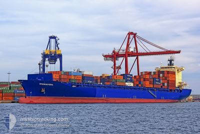
The vessel ELBSPIRIT (IMO: 9372860, MMSI: 636091619) is a Container Ship that was built in 2008 ( 16 years old ). It's sailing under the flag of [LR] Liberia.
In this page you can find informations about the vessels current position, last detected port calls, and current voyage information. If the vessels is not in coverage by AIS you will find the latest position.
The current position of ELBSPIRIT is detected by our AIS receivers and we are not responsible for the reliability of the data. The last position was recorded while the vessel was in Coverage by the Ais receivers of our vessel tracking app.
The current draught of ELBSPIRIT as reported by AIS is 9 meters
Weather
| Temperature | 19.6°C / 67.28°F |
|---|---|
| Wind Speed | 5 knots |
| Direction | 70° ENE |
| Pressure | 1010.3 hPa |
| Humidity | 81.3 % |
| Cloud Coverage | 9 % |
Featured Company
Last Port Calls
| Port | Arrival | Departure | Time In Port |
|---|---|---|---|
| 2024-05-15 02:36 | 2024-05-17 02:16 | 1 d | |
| 2024-05-12 08:44 | 2024-05-13 05:09 | 20 h | |
| 2024-05-04 08:20 | 2024-05-05 06:02 | 21 h | |
| 2024-04-21 17:36 | 2024-04-22 18:10 | 1 d | |
| 2024-04-17 14:31 | 2024-04-18 15:02 | 1 d | |
| 2024-04-15 07:39 | 2024-04-16 08:57 | 1 d | |
| 2024-04-12 18:16 | 2024-04-14 07:05 | 1 d | |
| 2024-04-08 20:17 | 2024-04-09 21:14 | 1 d | |
| 2024-04-04 15:39 | 2024-04-05 08:51 | 17 h | |
| 2024-03-26 17:28 | 2024-03-29 01:29 | 2 d |
Most Visited Ports (Last year)
| Port | Arrivals | |
|---|---|---|
| 11 | ||
| 10 | ||
| 9 | ||
| 8 | ||
| 7 | ||
| 7 |
Last Trips
| Origin | Departure | Destination | Arrival | Distance | |
|---|---|---|---|---|---|
| 2024-05-13 07:09 | 2024-05-15 04:36 | 705.31 nm | |||
| 2024-05-05 07:02 | 2024-05-12 10:44 | 378.16 nm | |||
| 2024-04-22 18:10 | 2024-05-04 09:20 | 2200.71 nm | |||
| 2024-04-18 15:02 | 2024-04-21 17:36 | 755.24 nm | |||
| 2024-04-16 08:57 | 2024-04-17 14:31 | 181.78 nm | |||
| 2024-04-14 07:05 | 2024-04-15 07:39 | 343.67 nm | |||
| 2024-04-09 21:14 | 2024-04-12 18:16 | 321.74 nm | |||
| 2024-04-05 08:51 | 2024-04-08 20:17 | 549.26 nm | |||
| 2024-03-29 01:29 | 2024-04-04 15:39 | 1556.06 nm | |||
| 2024-03-08 09:28 | 2024-03-26 17:28 | 2679.37 nm |
Events
| Time | Event | Details | Position / Dest | Info |
|---|---|---|---|---|
| 2024-05-17 22:32 | Status Changed | Default Under way using engine |
39.57065 / 7.61527
FRFOS
|
Speed: 10.8 kn Course: 152.1° |
| 2024-05-17 22:31 | Status Changed | Under way using engine Default |
39.57381 / 7.61312
FRFOS
|
Speed: 10.8 kn Course: 151° |
| 2024-05-17 22:31 | OUT of Coverage |
39.57381 / 7.61312
Mediterranean Sea - Western Basin
|
Speed: 10.8 kn Course: 152.1° |
|
| 2024-05-17 22:24 | Status Changed | Default Under way using engine |
39.59146 / 7.60053
FRFOS
|
Speed: 10.8 kn Course: 151.5° |
| 2024-05-17 22:04 | Status Changed | Under way using engine Default |
39.64506 / 7.56234
FRFOS
|
Speed: 10.9 kn Course: 149° |
| 2024-05-17 21:50 | IN Coverage |
39.64506 / 7.56234
Mediterranean Sea - Western Basin
|
Speed: 11 kn Course: 151.3° |
|
| 2024-05-17 12:00 | Status Changed | Default Under way using engine |
41.41621 / 6.30845
FRFOS
|
Speed: 17.1 kn Course: 151.9° |
| 2024-05-17 11:54 | Change Sea Area | Italian part of the Mediterranean Sea - Western Basin French part of the Mediterranean Sea - Western Basin |
41.44541 / 6.28793
Mediterranean Sea - Western Basin
|
Speed: 17.1 kn Course: 151.9° |
| 2024-05-17 11:54 | OUT of Coverage |
41.44541 / 6.28793
Mediterranean Sea - Western Basin
|
Speed: 17.1 kn Course: 151.9° |
|
| 2024-05-17 11:34 | Status Changed | Under way using engine Default |
41.52610 / 6.23107
FRFOS
|
Speed: 15.5 kn Course: 152° |