
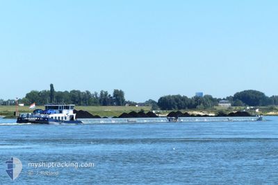
ELEGANCE II
Cargo
Current Trip
| Time Travelled | 2 days |
|---|---|
| Remaining Time | 14 h, 41 mins |
| Distance Travelled | 85.64 nm |
| Remaining Distance | 165.58 nm |
| AVG Speed | 5 Knots |
| MAX Speed | 7.1 Knots |
| AVG Wind | 4.9 knots |
| MAX Wind | 8.8 knots |
| MIN Temp | 11.1°C / 51.98°F |
| MAX Temp | 19.2°C / 66.56°F |
| Draught | 3 m |
| Position Received | 20 h, 8 m ago |
Current Position
| Longitude | 7.37717° |
|---|---|
| Latitude | 50.45267° |
| Status | Under way using engine |
| Speed | 5 Knots |
| Course | 132.1° |
| Area | North Sea |
| Station | T-AIS |
| Position Received | 20 h, 8 m ago |
Info
Information
The current position of ELEGANCE II is in North Sea with coordinates 50.45267° / 7.37717° as reported on 2024-05-17 08:33 by AIS to our vessel tracker app. The vessel's current speed is 5 Knots and is heading at the port of KEHL. The estimated time of arrival as calculated by vessel tracking app is 2024-05-18 19:23 LT
The vessel ELEGANCE II (MMSI: 244006118) is a Cargo It's sailing under the flag of [NL] Netherlands.
In this page you can find informations about the vessels current position, last detected port calls, and current voyage information. If the vessels is not in coverage by AIS you will find the latest position.
The current position of ELEGANCE II is detected by our AIS receivers and we are not responsible for the reliability of the data. The last position was recorded while the vessel was in Coverage by the Ais receivers of our vessel tracking app.
The current draught of ELEGANCE II as reported by AIS is 3 meters
Weather
| Temperature | 12.9°C / 55.22°F |
|---|---|
| Wind Speed | 5 knots |
| Direction | 322° NW |
| Pressure | 1005.1 hPa |
| Humidity | 97.1 % |
| Cloud Coverage | 100 % |
Featured Company
Last Port Calls
| Port | Arrival | Departure | Time In Port |
|---|---|---|---|
| 2024-05-14 22:59 | 2024-05-16 04:05 | 1 d | |
| 2024-05-14 11:30 | 2024-05-14 13:05 | 1 h | |
| 2024-05-13 17:02 | 2024-05-13 17:21 | 18 m | |
| 2024-05-12 16:05 | 2024-05-13 12:55 | 20 h | |
| 2024-05-09 14:57 | 2024-05-12 15:03 | 3 d | |
| 2024-05-09 07:25 | 2024-05-09 10:33 | 3 h | |
| 2024-05-08 08:03 | 2024-05-08 08:43 | 39 m | |
| 2024-05-04 14:27 | 2024-05-04 16:45 | 2 h | |
| 2024-05-03 16:36 | 2024-05-04 04:14 | 11 h | |
| 2024-05-02 11:15 | 2024-05-02 12:27 | 1 h |
Last Trips
| Origin | Departure | Destination | Arrival | Distance | |
|---|---|---|---|---|---|
| 2024-05-14 15:05 | 2024-05-15 00:59 | 37.32 nm | |||
| 2024-05-13 19:21 | 2024-05-14 13:30 | 101.56 nm | |||
| 2024-05-13 14:55 | 2024-05-13 19:02 | 21.63 nm | |||
| 2024-05-12 17:03 | 2024-05-12 18:05 | 7.67 nm | |||
| 2024-05-09 12:33 | 2024-05-09 16:57 | 22.58 nm | |||
| 2024-05-08 10:43 | 2024-05-09 09:25 | 21.12 nm | |||
| 2024-05-04 18:45 | 2024-05-08 10:03 | 92.81 nm | |||
| 2024-05-04 06:14 | 2024-05-04 16:27 | 73.79 nm | |||
| 2024-05-02 14:27 | 2024-05-03 18:36 | 83.32 nm | |||
| 2024-04-24 11:15 | 2024-05-02 13:15 | 343.82 nm |
Events
| Time | Event | Details | Position / Dest | Info |
|---|---|---|---|---|
| 2024-05-17 08:33 | OUT of Coverage |
50.45267 / 7.37717
North Sea
KEHL HARBOUR BASIN
|
Speed: 5 kn Course: 132.1° |
|
| 2024-05-17 04:02 | START Moving | 1.02 nm, South East of MONDORF |
50.76006 / 7.08882
KEHL HARBOUR BASIN
|
Speed: 4.9 kn Course: 119° |
| 2024-05-17 04:00 | Status Changed | Under way using engine Moored |
50.76087 / 7.08618
KEHL HARBOUR BASIN
|
Speed: 0.5 kn Course: 128° |
| 2024-05-16 16:54 | Status Changed | Moored Under way using engine |
50.76109 / 7.08547
KEHL HARBOUR BASIN
|
Speed: Course: 130° |
| 2024-05-16 16:32 | STOP Moving | 0.91 nm, South East of MONDORF |
50.76089 / 7.08594
KEHL HARBOUR BASIN
|
Speed: 0.3 kn Course: 128° |
| 2024-05-16 04:05 | PORT DEPARTURE |
|
51.40378 / 6.74447
KEHL HARBOUR BASIN
|
Speed: 5.3 kn Course: 180° |
| 2024-05-16 03:50 | START Moving |
51.42246 / 6.73213
[DE] DUISBURG
|
Speed: 3.1 kn Course: 147° |
|
| 2024-05-16 03:48 | Status Changed | Under way using engine Moored |
51.42346 / 6.73066
[DE] DUISBURG
|
Speed: 0.1 kn Course: 137° |
| 2024-05-15 19:06 | Destination Changed | KEHL HARBOUR BASIN HAFENKANAL DUISBURG |
51.42364 / 6.73051
[DE] DUISBURG
|
Speed: Course: 137° |
| 2024-05-15 19:06 | ETA Changed | 2024/05/17 19:30 2024/05/14 21:25 |
51.42364 / 6.73051
[DE] DUISBURG
|
Speed: Course: 137° |