
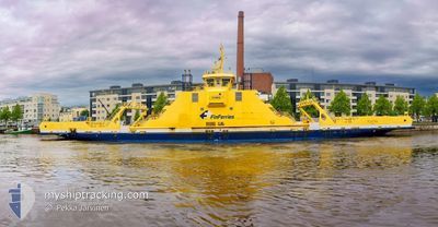
ELEKTRA
Passenger
Current Trip
| Time Travelled | 10 days |
|---|---|
| Remaining Time | --- |
| Distance Travelled | 390.54 nm |
| Remaining Distance | --- |
| AVG Speed | 6.5 Knots |
| MAX Speed | 11.9 Knots |
| AVG Wind | 10.7 knots |
| MAX Wind | 25 knots |
| MIN Temp | 1.5°C / 34.7°F |
| MAX Temp | 8.8°C / 47.84°F |
| Draught | 3.7 m |
| Position Received | 7 m ago |
Current Position
| Longitude | 22.10130° |
|---|---|
| Latitude | 60.22288° |
| Status | Under way using engine |
| Speed | 7.3 Knots |
| Course | 50.8° |
| Area | Gulf of Bothnia |
| Station | T-AIS |
| Position Received | 7 m ago |
Info
Information
The current position of ELEKTRA is in Gulf of Bothnia with coordinates 60.22288° / 22.10130° as reported on 2024-05-14 09:54 by AIS to our vessel tracker app. The vessel's current speed is 7.3 Knots
The vessel ELEKTRA (IMO: 9806328, MMSI: 230668000) is a Passenger It's sailing under the flag of [FI] Finland.
In this page you can find informations about the vessels current position, last detected port calls, and current voyage information. If the vessels is not in coverage by AIS you will find the latest position.
The current position of ELEKTRA is detected by our AIS receivers and we are not responsible for the reliability of the data. The last position was recorded while the vessel was in Coverage by the Ais receivers of our vessel tracking app.
The current draught of ELEKTRA as reported by AIS is 3.7 meters
Weather
| Temperature | 8.1°C / 46.58°F |
|---|---|
| Wind Speed | 5 knots |
| Direction | 266° W |
| Pressure | 1021.1 hPa |
| Humidity | 83.3 % |
| Cloud Coverage | 74 % |
Featured Company
Most Visited Ports (Last year)
| Port | Arrivals | |
|---|---|---|
| 5 |
Events
| Time | Event | Details | Position / Dest | Info |
|---|---|---|---|---|
| 2024-05-14 09:54 | START Moving | 7.41 nm, South West of PARGAS |
60.22288 / 22.10130
PROSTVIKLILLMALO
|
Speed: 7.3 kn Course: 50.8° |
| 2024-05-14 09:47 | Status Changed | Under way using engine Moored |
60.22186 / 22.09812
PROSTVIKLILLMALO
|
Speed: Course: 243° |
| 2024-05-14 08:41 | Status Changed | Moored Under way using engine |
60.22186 / 22.09813
PROSTVIKLILLMALO
|
Speed: Course: 243° |
| 2024-05-14 08:34 | STOP Moving | 7.53 nm, South West of PARGAS |
60.22184 / 22.09814
PROSTVIKLILLMALO
|
Speed: 0.2 kn Course: 243° |
| 2024-05-14 08:27 | START Moving | 6.84 nm, South West of PARGAS |
60.23300 / 22.11043
PROSTVIKLILLMALO
|
Speed: 5.9 kn Course: 200° |
| 2024-05-14 08:22 | STOP Moving | 6.73 nm, South West of PARGAS |
60.23483 / 22.11203
PROSTVIKLILLMALO
|
Speed: 0.3 kn Course: 202° |
| 2024-05-14 08:17 | START Moving | 7.34 nm, South West of PARGAS |
60.22473 / 22.10147
PROSTVIKLILLMALO
|
Speed: 7.8 kn Course: 35.4° |
| 2024-05-14 08:09 | STOP Moving | 7.47 nm, South West of PARGAS |
60.22303 / 22.09874
PROSTVIKLILLMALO
|
Speed: 0.3 kn Course: 216° |
| 2024-05-14 08:02 | START Moving | 6.85 nm, South West of PARGAS |
60.23306 / 22.10984
PROSTVIKLILLMALO
|
Speed: 5.8 kn Course: 211.3° |
| 2024-05-14 07:54 | STOP Moving | 6.73 nm, South West of PARGAS |
60.23483 / 22.11206
PROSTVIKLILLMALO
|
Speed: 0.2 kn Course: 22° |