
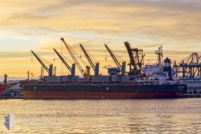
ELEOUSSA
Bulk Carrier
Aktuelle Reise
| Bisherige Reisezeit | 15 Tage |
|---|---|
| Verbleibende Reisezeit | 22 h, 41 Minuten |
| Zurückgelegte Distanz | 3308.76 nm |
| Verbleibende Distanz | 268.27 nm |
| Durchschnittliche Geschwindigkeit | 10.9 Knoten |
| Maximale Geschwindigkeit | 17.3 Knoten |
| Durchschnittliche Windgeschwindigkeit | 16.9 Knoten |
| Maximale Windgeschwindigkeit | 32 Knoten |
| Minimale Temperatur | 6.9°C / 44.42°F |
| Maximale Temperatur | 24.6°C / 76.28°F |
| Tiefgang | 10.9 m |
| Position erhalten | 6 h, 51 m alt |
Aktuelle Position
| Länge | --- |
|---|---|
| Breite | --- |
| Zustand | Under way using engine |
| Geschwindigkeit | 10.4 Knoten |
| Kurs | 70.1° |
| Gebiet | English Channel |
| Station | T-AIS |
| Position erhalten | 6 h, 51 m alt |
Schiffsdetails
Information
Die ELEOUSSA befindet sich derzeit in English Channel mit den Koordinaten 49.73491° / -3.33333°, Diese Position wurde am 2024-11-12 17:40 von unserer Schiffsverfolgungs-App über AIS erfasst. Das Schiff fährt momentan mit einer Geschwindigkeit von 10.4 Knoten und fahrt in den Hafen von VLISSINGEN. Die geschatzte Ankunftszeit, berechnet von der -App zur Schiffsverfolgung, ist 2024-11-13 23:12 LT
Das Schiff ELEOUSSA (IMO: 9323900, MMSI: 229462000) ist Bulk Carrier das wurde im Jahr 2008 ( 16 Jahre alt ) gebaut. und fährt unter der Flagge von [MT] Malta.
Auf dieser Seite erhalten Sie Informationen zur aktuellen Position des Schiffes, zu den letzten bekannten Hafenanläufen und zu den aktuellen Reiseinformationen. Sollte das Schiff nicht durch AIS abgedeckt sein, wird die zuletzt erfasste Position angezeigt.
Die ELEOUSSA wird durch unsere AIS-Empfänger ermittelt. Wir übernehmen keine Gewähr für die Richtigkeit der Daten. Die letzte Position wurde von unseren AIS-Empfängern aufgezeichnet, während das Schiff in Reichweite war.
Der aktuelle Entwurf von ELEOUSSA, wie von AIS gemeldet, betragt 10.9 meter
Wetter
| Temperatur | 12.8°C / 55.04°F |
|---|---|
| Windgeschwindigkeit | 23 Knoten |
| Windrichtung | 54° NE |
| Luftdruck | 1033.3 hPa |
| Luftfeuchtigkeit | 73.2 % |
| Wolken | 100 % |
Featured Company
Events
| Zeit | Ereignis | Details | Position / Ziel | Information |
|---|---|---|---|---|
| 2024-11-12 17:46 | geänderter Status | Default Under way using engine |
49.74097 / -3.30588
FLUSHING,NETHERLAND
|
Geschwindigkeit: 10.4 kn Kurs: 70.1° |
| 2024-11-12 17:40 | außerhalb Abdeckung |
49.73491 / -3.33333
English Channel
FLUSHING,NETHERLAND
|
Geschwindigkeit: 10.4 kn Kurs: 70.1° |
|
| 2024-11-12 17:34 | Ändere Seegebiet | Guernsey part of the English Channel United Kingdom part of the English Channel |
49.72997 / -3.35663
English Channel
FLUSHING,NETHERLAND
|
Geschwindigkeit: 10.4 kn Kurs: 69.4° |
| 2024-11-12 17:34 | geänderter Status | Under way using engine Default |
49.72944 / -3.35885
FLUSHING,NETHERLAND
|
Geschwindigkeit: 10.5 kn Kurs: 71° |
| 2024-11-12 17:26 | geänderter Status | Default Under way using engine |
49.72297 / -3.39086
FLUSHING,NETHERLAND
|
Geschwindigkeit: 10.5 kn Kurs: 71.4° |
| 2024-11-12 17:07 | geänderter Status | Under way using engine Default |
49.70738 / -3.47539
FLUSHING,NETHERLAND
|
Geschwindigkeit: 10.7 kn Kurs: 72° |
| 2024-11-12 17:02 | geänderter Status | Default Under way using engine |
49.70366 / -3.49595
FLUSHING,NETHERLAND
|
Geschwindigkeit: 10.8 kn Kurs: 72.6° |
| 2024-11-12 16:56 | geänderter Status | Under way using engine Default |
49.69800 / -3.52317
FLUSHING,NETHERLAND
|
Geschwindigkeit: 10.8 kn Kurs: 71° |
| 2024-11-12 16:06 | geänderter Status | Default Under way using engine |
49.65948 / -3.74729
FLUSHING,NETHERLAND
|
Geschwindigkeit: 11.1 kn Kurs: 77.1° |
| 2024-11-12 15:49 | geänderter Status | Under way using engine Default |
49.64950 / -3.82884
FLUSHING,NETHERLAND
|
Geschwindigkeit: 11 kn Kurs: 77° |