
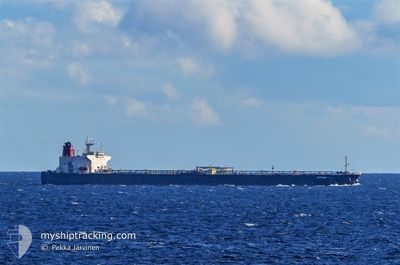
ELEPHANT
Crude Oil Tanker
Current Trip
| Time Travelled | 22 days |
|---|---|
| Remaining Time | 5 days |
| Distance Travelled | 6253.86 nm |
| Remaining Distance | 1573.04 nm |
| AVG Speed | 11.4 Knots |
| MAX Speed | 11.4 Knots |
| AVG Wind | 13.4 knots |
| MAX Wind | 26 knots |
| MIN Temp | 8.1°C / 46.58°F |
| MAX Temp | 40.1°C / 104.18°F |
| Draught | 15 m |
| Position Received | 2 d ago |
Current Position
| Longitude | 39.01050° |
|---|---|
| Latitude | 19.13154° |
| Status | Under way using engine |
| Speed | 12.4 Knots |
| Course | 156.3° |
| Area | Red Sea |
| Station | T-AIS |
| Position Received | 2 d ago |
Info
Information
The current position of ELEPHANT is in Red Sea with coordinates 19.13154° / 39.01050° as reported on 2024-06-08 02:35 by AIS to our vessel tracker app. The vessel's current speed is 12.4 Knots and is heading at the port of SIKKA. The estimated time of arrival as calculated by vessel tracking app is 2024-06-15 21:16 LT
The vessel ELEPHANT (IMO: 9374868, MMSI: 574005510) is a Crude Oil Tanker that was built in 2007 ( 17 years old ). It's sailing under the flag of [VN] Vietnam.
In this page you can find informations about the vessels current position, last detected port calls, and current voyage information. If the vessels is not in coverage by AIS you will find the latest position.
The current position of ELEPHANT is detected by our AIS receivers and we are not responsible for the reliability of the data. The last position was recorded while the vessel was in Coverage by the Ais receivers of our vessel tracking app.
The current draught of ELEPHANT as reported by AIS is 15 meters
Weather
| Temperature | 31.8°C / 89.24°F |
|---|---|
| Wind Speed | 12 knots |
| Direction | 204° SSW |
| Pressure | 1006.4 hPa |
| Humidity | 66.7 % |
| Cloud Coverage | 5 % |
Featured Company
Last Port Calls
| Port | Arrival | Departure | Time In Port |
|---|---|---|---|
| 2024-06-05 04:36 | 2024-06-05 13:57 | 9 h | |
| 2024-05-17 02:47 | 2024-05-18 16:30 | 1 d | |
| 2024-04-15 06:12 | 2024-04-15 16:09 | 9 h |
Most Visited Ports (Last year)
| Port | Arrivals | |
|---|---|---|
| 8 | ||
| 4 | ||
| 1 | ||
| 1 | ||
| 1 |
Last Trips
| Origin | Departure | Destination | Arrival | Distance | |
|---|---|---|---|---|---|
| 2024-05-18 19:30 | 2024-06-05 06:36 | 4788.27 nm | |||
| 2024-02-06 10:22 | 2024-04-15 08:12 | 11316.32 nm |
Events
| Time | Event | Details | Position / Dest | Info |
|---|---|---|---|---|
| 2024-06-08 02:43 | Status Changed | Default Under way using engine |
19.10554 / 39.02233
SIKKA INDIA
|
Speed: 12.4 kn Course: 156.3° |
| 2024-06-08 02:35 | Change Sea Area | Sudanese part of the Red Sea Saudi Arabian part of the Red Sea |
19.13154 / 39.01050
Red Sea
SIKKA INDIA
|
Speed: 12.4 kn Course: 156.3° |
| 2024-06-08 02:35 | Status Changed | Under way using engine Default |
19.13154 / 39.01050
SIKKA INDIA
|
Speed: 12.4 kn Course: 159° |
| 2024-06-08 02:35 | IN Coverage |
19.13154 / 39.01050
Red Sea
SIKKA INDIA
|
Speed: 12.4 kn Course: 156.3° |
|
| 2024-06-08 02:35 | OUT of Coverage |
19.13154 / 39.01050
Red Sea
SIKKA INDIA
|
Speed: 12.4 kn Course: 156.3° |
|
| 2024-06-07 21:59 | Status Changed | Default Under way using engine |
20.03832 / 38.61104
SIKKA INDIA
|
Speed: 12.8 kn Course: 155.3° |
| 2024-06-07 21:53 | OUT of Coverage |
20.05695 / 38.60198
Red Sea
SIKKA INDIA
|
Speed: 12.8 kn Course: 155.3° |
|
| 2024-06-07 21:40 | Status Changed | Under way using engine Default |
20.10087 / 38.58188
SIKKA INDIA
|
Speed: 12.9 kn Course: 159° |
| 2024-06-07 21:36 | Status Changed | Default Under way using engine |
20.11498 / 38.57616
SIKKA INDIA
|
Speed: 12.9 kn Course: 158.5° |
| 2024-06-07 21:32 | Status Changed | Under way using engine Default |
20.12955 / 38.57017
SIKKA INDIA
|
Speed: 12.8 kn Course: 158° |