
ELI A
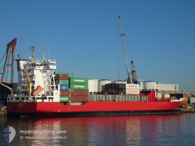
Container Ship
Current Trip
| Time Travelled | 2 days |
|---|---|
| Remaining Time | 6 h, 43 mins |
| Distance Travelled | 682.26 nm |
| Remaining Distance | 100.03 nm |
| AVG Speed | 11.4 Knots |
| MAX Speed | 12.6 Knots |
| AVG Wind | 13.4 knots |
| MAX Wind | 22.8 knots |
| MIN Temp | 17.4°C / 63.32°F |
| MAX Temp | 20.4°C / 68.72°F |
| Draught | 7.2 m |
| Position Received | 9 m ago |
Current Position
| Longitude | -3.88134° |
|---|---|
| Latitude | 36.19392° |
| Status | Under way using engine |
| Speed | 11.8 Knots |
| Course | 258° |
| Area | Alboran Sea |
| Station | T-AIS |
| Position Received | 9 m ago |
Info
Information
The current position of ELI A is in Alboran Sea with coordinates 36.19392° / -3.88134° as reported on 2024-05-17 02:46 by AIS to our vessel tracker app. The vessel's current speed is 11.8 Knots and is heading at the port of TANGER MED. The estimated time of arrival as calculated by vessel tracking app is 2024-05-17 09:39 LT
The vessel ELI A (IMO: 9326976, MMSI: 636021316) is a Container Ship that was built in 2005 ( 19 years old ). It's sailing under the flag of [LR] Liberia.
In this page you can find informations about the vessels current position, last detected port calls, and current voyage information. If the vessels is not in coverage by AIS you will find the latest position.
The current position of ELI A is detected by our AIS receivers and we are not responsible for the reliability of the data. The last position was recorded while the vessel was in Coverage by the Ais receivers of our vessel tracking app.
The current draught of ELI A as reported by AIS is 7.2 meters
Weather
| Temperature | 17.4°C / 63.32°F |
|---|---|
| Wind Speed | 20 knots |
| Direction | 265° W |
| Pressure | 1009.9 hPa |
| Humidity | 82.8 % |
| Cloud Coverage | --- |
Featured Company
Last Port Calls
| Port | Arrival | Departure | Time In Port |
|---|---|---|---|
| 2024-05-14 03:59 | 2024-05-14 15:39 | 11 h | |
| 2024-05-06 13:29 | 2024-05-07 15:06 | 1 d | |
| 2024-04-29 09:40 | 2024-04-30 05:32 | 19 h | |
| 2024-04-22 06:04 | 2024-04-23 05:57 | 23 h | |
| 2024-04-14 05:29 | 2024-04-14 19:20 | 13 h | |
| 2024-04-08 06:05 | 2024-04-09 00:35 | 18 h | |
| 2024-04-05 06:17 | 2024-04-05 14:28 | 8 h | |
| 2024-04-02 08:40 | 2024-04-03 02:14 | 17 h |
Last Trips
| Origin | Departure | Destination | Arrival | Distance | |
|---|---|---|---|---|---|
| 2024-05-07 17:06 | 2024-05-14 05:59 | 1497.42 nm | |||
| 2024-04-30 07:32 | 2024-05-06 15:29 | 1489.08 nm | |||
| 2024-04-23 07:57 | 2024-04-29 11:40 | 1536.88 nm | |||
| 2024-04-14 20:20 | 2024-04-22 08:04 | 1174.73 nm | |||
| 2024-04-09 02:35 | 2024-04-14 06:29 | 711.17 nm | |||
| 2024-04-05 16:28 | 2024-04-08 08:05 | 705.01 nm | |||
| 2024-04-03 04:14 | 2024-04-05 08:17 | 606.51 nm | |||
| 2024-02-29 15:25 | 2024-04-02 10:40 | 1806.79 nm |
Events
| Time | Event | Details | Position / Dest | Info |
|---|---|---|---|---|
| 2024-05-17 01:50 | Status Changed | Under way using engine Default |
36.22950 / -3.65667
MAPTM
|
Speed: 12 kn Course: 260° |
| 2024-05-17 01:39 | Status Changed | Default Under way using engine |
36.23646 / -3.61219
MAPTM
|
Speed: 12 kn Course: 257° |
| 2024-05-17 01:06 | Status Changed | Under way using engine Default |
36.25957 / -3.47699
MAPTM
|
Speed: 12.6 kn Course: 262° |
| 2024-05-17 00:54 | Status Changed | Default Under way using engine |
36.26413 / -3.42520
MAPTM
|
Speed: 12.6 kn Course: 261° |
| 2024-05-17 00:39 | Status Changed | Under way using engine Default |
36.27175 / -3.36090
MAPTM
|
Speed: 12.6 kn Course: 262° |
| 2024-05-17 00:32 | Status Changed | Default Under way using engine |
36.27486 / -3.33312
MAPTM
|
Speed: 12.5 kn Course: 262° |
| 2024-05-17 00:27 | Status Changed | Under way using engine Default |
36.27758 / -3.30962
MAPTM
|
Speed: 12.4 kn Course: 262° |
| 2024-05-17 00:22 | Status Changed | Default Under way using engine |
36.28012 / -3.28773
MAPTM
|
Speed: 12.4 kn Course: 261° |
| 2024-05-16 23:31 | Status Changed | Under way using engine Default |
36.30895 / -3.07227
MAPTM
|
Speed: 12.3 kn Course: 260° |
| 2024-05-16 23:22 | Status Changed | Default Under way using engine |
36.31387 / -3.03655
MAPTM
|
Speed: 12.3 kn Course: 262° |