
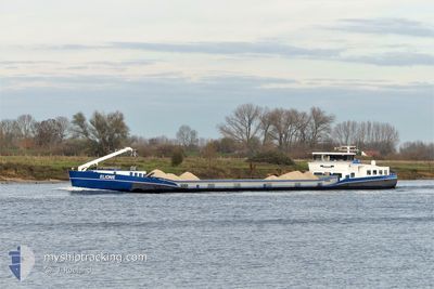
ELIONIE
Cargo
Current Trip
VLISSINGEN
| Time Travelled | 1 day |
|---|---|
| Remaining Time | --- |
| Distance Travelled | 33.79 nm |
| Remaining Distance | --- |
| AVG Speed | 7.8 Knots |
| MAX Speed | 8.6 Knots |
| AVG Wind | 7.4 knots |
| MAX Wind | 11.6 knots |
| MIN Temp | 11.4°C / 52.52°F |
| MAX Temp | 19.3°C / 66.74°F |
| Draught | 1 m |
| Position Received | 2 m ago |
Current Position
| Longitude | 5.79891° |
|---|---|
| Latitude | 51.03825° |
| Status | Moored |
| Speed | |
| Course | --- |
| Area | North Sea |
| Station | T-AIS |
| Position Received | 2 m ago |
Info
Information
The current position of ELIONIE is in North Sea with coordinates 51.03825° / 5.79891° as reported on 2024-05-18 03:50 by AIS to our vessel tracker app. The vessel's current speed is 0 Knots
The vessel ELIONIE (MMSI: 244650852) is a Cargo It's sailing under the flag of [NL] Netherlands.
In this page you can find informations about the vessels current position, last detected port calls, and current voyage information. If the vessels is not in coverage by AIS you will find the latest position.
The current position of ELIONIE is detected by our AIS receivers and we are not responsible for the reliability of the data. The last position was recorded while the vessel was in Coverage by the Ais receivers of our vessel tracking app.
The current draught of ELIONIE as reported by AIS is 1 meters
Weather
| Temperature | 12.9°C / 55.22°F |
|---|---|
| Wind Speed | 5 knots |
| Direction | 263° W |
| Pressure | 1009.3 hPa |
| Humidity | 97.6 % |
| Cloud Coverage | 100 % |
Featured Company
Last Port Calls
| Port | Arrival | Departure | Time In Port |
|---|---|---|---|
| 2024-05-15 12:27 | 2024-05-16 12:34 | 1 d | |
| 2024-05-13 18:37 | 2024-05-14 13:30 | 18 h | |
| 2024-05-08 15:02 | 2024-05-13 06:40 | 4 d | |
| 2024-05-08 07:20 | 2024-05-08 14:05 | 6 h | |
| 2024-05-07 19:08 | 2024-05-08 06:09 | 11 h | |
| 2024-05-06 19:24 | 2024-05-07 08:07 | 12 h | |
| 2024-05-03 22:11 | 2024-05-06 13:01 | 2 d | |
| 2024-05-01 15:26 | 2024-05-02 07:59 | 16 h | |
| 2024-05-01 09:30 | 2024-05-01 10:30 | 1 h | |
| 2024-04-30 11:01 | 2024-04-30 11:38 | 37 m |
Last Trips
| Origin | Departure | Destination | Arrival | Distance | |
|---|---|---|---|---|---|
| 2024-05-14 15:30 | 2024-05-15 14:27 | 27.11 nm | |||
| 2024-05-13 08:40 | 2024-05-13 20:37 | 85.25 nm | |||
| 2024-05-08 16:05 | 2024-05-08 17:02 | 6.52 nm | |||
| 2024-05-08 08:09 | 2024-05-08 09:20 | 5.44 nm | |||
| 2024-05-07 10:07 | 2024-05-07 21:08 | 63.52 nm | |||
| 2024-05-06 15:01 | 2024-05-06 21:24 | 51.74 nm | |||
| 2024-05-02 09:59 | 2024-05-04 00:11 | 96.37 nm | |||
| 2024-05-01 12:30 | 2024-05-01 17:26 | 37.86 nm | |||
| 2024-04-30 13:38 | 2024-05-01 11:30 | 56.30 nm | |||
| 2024-04-30 09:27 | 2024-04-30 13:01 | 21.20 nm |
Events
| Time | Event | Details | Position / Dest | Info |
|---|---|---|---|---|
| 2024-05-17 08:42 | Status Changed | Moored Under way using engine |
51.03825 / 5.79891
VLISSINGEN
|
Speed: Course: 511° |
| 2024-05-17 08:36 | STOP Moving | 1.44 nm, South West of BARGE TERMINAL BORN |
51.03825 / 5.79891
VLISSINGEN
|
Speed: 0.2 kn Course: 511° |
| 2024-05-17 07:39 | IN Coverage |
51.14019 / 5.87573
North Sea
|
Speed: 6.8 kn Course: 215.2° |
|
| 2024-05-17 06:38 | OUT of Coverage |
51.16329 / 5.89587
North Sea
|
Speed: 5.1 kn Course: 198.8° |
|
| 2024-05-17 06:34 | IN Coverage |
51.16521 / 5.89230
North Sea
|
Speed: 3 kn Course: 107.8° |
|
| 2024-05-17 04:24 | OUT of Coverage |
51.16555 / 5.89035
North Sea
|
Speed: Course: 296.5° |
|
| 2024-05-17 04:00 | IN Coverage |
51.16555 / 5.89035
North Sea
|
Speed: Course: 296.5° |
|
| 2024-05-17 02:12 | OUT of Coverage |
51.16555 / 5.89035
North Sea
|
Speed: Course: 296.5° |
|
| 2024-05-17 02:12 | IN Coverage |
51.16555 / 5.89035
North Sea
|
Speed: Course: 296.5° |
|
| 2024-05-16 12:34 | OUT of Coverage |
51.57350 / 6.04143
North Sea
|
Speed: 7.6 kn Course: 343.2° |