
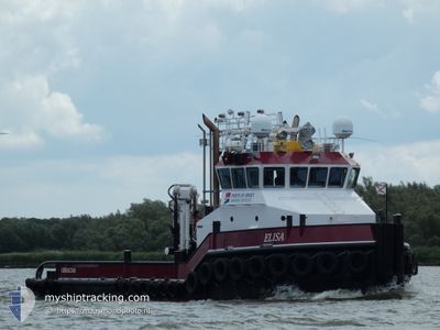
ELISA
Tug
Current Trip
| Time Travelled | 16 h, 3 mins |
|---|---|
| Remaining Time | 2 days |
| Distance Travelled | 144.54 nm |
| Remaining Distance | 471.79 nm |
| AVG Speed | 8.9 Knots |
| MAX Speed | 11.3 Knots |
| AVG Wind | 4.5 knots |
| MAX Wind | 13.8 knots |
| MIN Temp | 11.9°C / 53.42°F |
| MAX Temp | 14.6°C / 58.28°F |
| Draught | 3.2 m |
| Position Received | 2 m ago |
Current Position
| Longitude | -6.00092° |
|---|---|
| Latitude | 51.13972° |
| Status | Under way using engine |
| Speed | 9.2 Knots |
| Course | 178.8° |
| Area | Celtic Sea |
| Station | T-AIS |
| Position Received | 2 m ago |
Info
Information
The current position of ELISA is in Celtic Sea with coordinates 51.13972° / -6.00092° as reported on 2024-05-21 23:53 by AIS to our vessel tracker app. The vessel's current speed is 9.2 Knots and is heading at the port of ROTTERDAM. The estimated time of arrival as calculated by vessel tracking app is 2024-05-24 05:10 LT
The vessel ELISA (IMO: 9688879, MMSI: 236745000) is a Tug It's sailing under the flag of [GI] Gibraltar.
In this page you can find informations about the vessels current position, last detected port calls, and current voyage information. If the vessels is not in coverage by AIS you will find the latest position.
The current position of ELISA is detected by our AIS receivers and we are not responsible for the reliability of the data. The last position was recorded while the vessel was in Coverage by the Ais receivers of our vessel tracking app.
The current draught of ELISA as reported by AIS is 3.2 meters
Weather
| Temperature | 13.8°C / 56.84°F |
|---|---|
| Wind Speed | 12 knots |
| Direction | 276° W |
| Pressure | 1010.9 hPa |
| Humidity | 86.2 % |
| Cloud Coverage | 29 % |
Featured Company
Last Port Calls
| Port | Arrival | Departure | Time In Port |
|---|---|---|---|
| 2024-05-20 05:02 | 2024-05-21 07:52 | 1 d | |
| 2024-05-18 18:19 | 2024-05-19 02:33 | 8 h | |
| 2024-05-16 18:44 | 2024-05-17 10:51 | 16 h | |
| 2024-05-16 17:50 | 2024-05-16 18:09 | 18 m | |
| 2024-05-14 15:57 | 2024-05-15 04:58 | 13 h | |
| 2024-05-14 15:05 | 2024-05-14 15:19 | 14 m | |
| 2024-05-14 14:12 | 2024-05-14 14:30 | 17 m | |
| 2024-05-14 06:16 | 2024-05-14 07:20 | 1 h | |
| 2024-05-12 22:29 | 2024-05-13 10:19 | 11 h | |
| 2024-05-10 21:15 | 2024-05-11 14:44 | 17 h |
Last Trips
| Origin | Departure | Destination | Arrival | Distance | |
|---|---|---|---|---|---|
| 2024-05-19 03:33 | 2024-05-20 06:02 | 89.41 nm | |||
| 2024-05-17 11:51 | 2024-05-18 19:19 | 239.54 nm | |||
| 2024-05-16 19:09 | 2024-05-16 19:44 | 5.20 nm | |||
| 2024-05-15 05:58 | 2024-05-16 18:50 | 73.81 nm | |||
| 2024-05-14 16:19 | 2024-05-14 16:57 | 5.14 nm | |||
| 2024-05-14 15:30 | 2024-05-14 16:05 | 5.34 nm | |||
| 2024-05-14 08:20 | 2024-05-14 15:12 | 64.96 nm | |||
| 2024-05-13 11:19 | 2024-05-14 07:16 | 122.73 nm | |||
| 2024-05-11 15:44 | 2024-05-12 23:29 | 122.25 nm | |||
| 2024-05-09 13:04 | 2024-05-10 22:15 | 67.47 nm |
Events
| Time | Event | Details | Position / Dest | Info |
|---|---|---|---|---|
| 2024-05-21 22:34 | Status Changed | Under way using engine Default |
51.34129 / -5.99878
ROTTERDAM
|
Speed: 9 kn Course: 181° |
| 2024-05-21 22:02 | Status Changed | Default Under way using engine |
51.42271 / -5.99577
ROTTERDAM
|
Speed: 8.9 kn Course: 182.2° |
| 2024-05-21 21:56 | Change Sea Area | United Kingdom part of the Celtic Sea United Kingdom part of the Irish Sea and St. George's Channel |
51.43813 / -5.99492
Celtic Sea
ROTTERDAM
|
Speed: 8.9 kn Course: 182.2° |
| 2024-05-21 21:56 | Status Changed | Under way using engine Default |
51.43813 / -5.99492
ROTTERDAM
|
Speed: 8.9 kn Course: 183° |
| 2024-05-21 21:51 | IN Coverage |
51.43813 / -5.99492
Celtic Sea
ROTTERDAM
|
Speed: 8.9 kn Course: 182.2° |
|
| 2024-05-21 16:19 | Status Changed | Default Under way using engine |
52.15325 / -5.65673
ROTTERDAM
|
Speed: 8.9 kn Course: 205.1° |
| 2024-05-21 16:13 | OUT of Coverage |
52.16508 / -5.64767
Irish Sea and St. George's Channel
ROTTERDAM
|
Speed: 8.9 kn Course: 205.1° |
|
| 2024-05-21 16:03 | Status Changed | Under way using engine Default |
52.18726 / -5.63007
ROTTERDAM
|
Speed: 9.1 kn Course: 206° |
| 2024-05-21 16:02 | Status Changed | Default Under way using engine |
52.18956 / -5.62825
ROTTERDAM
|
Speed: 9.3 kn Course: 205.3° |
| 2024-05-21 15:56 | Status Changed | Under way using engine Default |
52.20384 / -5.61710
ROTTERDAM
|
Speed: 9.3 kn Course: 206° |