
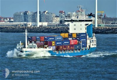
ELISABETH
Container Ship
Current Trip
| Time Travelled | 5 days |
|---|---|
| Remaining Time | 6 h, 0 mins |
| Distance Travelled | 280.68 nm |
| Remaining Distance | 42.13 nm |
| AVG Speed | 9.1 Knots |
| MAX Speed | 15.1 Knots |
| AVG Wind | 13.5 knots |
| MAX Wind | 23.5 knots |
| MIN Temp | 10.5°C / 50.9°F |
| MAX Temp | 15.4°C / 59.72°F |
| Draught | 7.1 m |
| Position Received | Now |
Current Position
| Longitude | 9.19200° |
|---|---|
| Latitude | 53.91940° |
| Status | Under way using engine |
| Speed | 7.1 Knots |
| Course | 224.9° |
| Area | Baltic Sea |
| Station | T-AIS |
| Position Received | Now |
Info
Information
The current position of ELISABETH is in Baltic Sea with coordinates 53.91940° / 9.19200° as reported on 2024-05-21 06:56 by AIS to our vessel tracker app. The vessel's current speed is 7.1 Knots and is heading at the port of HAMBURG. The estimated time of arrival as calculated by vessel tracking app is 2024-05-21 12:56 LT
The vessel ELISABETH (IMO: 9219862, MMSI: 246497000) is a Container Ship that was built in 2000 ( 24 years old ). It's sailing under the flag of [NL] Netherlands.
In this page you can find informations about the vessels current position, last detected port calls, and current voyage information. If the vessels is not in coverage by AIS you will find the latest position.
The current position of ELISABETH is detected by our AIS receivers and we are not responsible for the reliability of the data. The last position was recorded while the vessel was in Coverage by the Ais receivers of our vessel tracking app.
The current draught of ELISABETH as reported by AIS is 7.1 meters
Weather
| Temperature | 13.6°C / 56.48°F |
|---|---|
| Wind Speed | 9 knots |
| Direction | 75° ENE |
| Pressure | 1012.8 hPa |
| Humidity | 92.6 % |
| Cloud Coverage | 8 % |
Featured Company
Last Port Calls
| Port | Arrival | Departure | Time In Port |
|---|---|---|---|
| 2024-05-15 12:24 | 2024-05-15 23:02 | 10 h | |
| 2024-05-14 10:07 | 2024-05-14 22:38 | 12 h | |
| 2024-05-13 03:44 | 2024-05-13 16:17 | 12 h | |
| 2024-05-11 08:32 | 2024-05-11 17:08 | 8 h | |
| 2024-05-10 11:52 | 2024-05-10 23:38 | 11 h | |
| 2024-05-08 03:26 | 2024-05-08 15:34 | 12 h | |
| 2024-05-06 19:41 | 2024-05-07 11:55 | 16 h | |
| 2024-05-05 22:27 | 2024-05-05 22:30 | 2 m | |
| 2024-05-04 08:49 | 2024-05-05 09:17 | 1 d | |
| 2024-05-03 11:59 | 2024-05-04 01:10 | 13 h |
Most Visited Ports (Last year)
| Port | Arrivals | |
|---|---|---|
| 49 | ||
| 34 | ||
| 31 | ||
| 25 | ||
| 24 | ||
| 24 |
Last Trips
| Origin | Departure | Destination | Arrival | Distance | |
|---|---|---|---|---|---|
| 2024-05-15 00:38 | 2024-05-15 14:24 | 184.26 nm | |||
| 2024-05-13 18:17 | 2024-05-14 12:07 | 180.75 nm | |||
| 2024-05-11 19:08 | 2024-05-13 05:44 | 354.03 nm | |||
| 2024-05-11 01:38 | 2024-05-11 10:32 | 117.25 nm | |||
| 2024-05-08 17:34 | 2024-05-10 13:52 | 270.06 nm | |||
| 2024-05-07 13:55 | 2024-05-08 05:26 | 181.17 nm | |||
| 2024-05-06 00:30 | 2024-05-06 21:41 | 221.76 nm | |||
| 2024-05-05 11:17 | 2024-05-06 00:27 | 89.16 nm | |||
| 2024-05-04 03:10 | 2024-05-04 10:49 | 114.74 nm | |||
| 2024-05-02 04:33 | 2024-05-03 13:59 | 361.43 nm |
Events
| Time | Event | Details | Position / Dest | Info |
|---|---|---|---|---|
| 2024-05-21 06:04 | Status Changed | Under way using engine Default |
53.99616 / 9.29062
DEHAM VIA NOK
|
Speed: 6.6 kn Course: 189° |
| 2024-05-21 05:57 | Status Changed | Default Under way using engine |
54.00806 / 9.29508
DEHAM VIA NOK
|
Speed: 6.6 kn Course: 189.7° |
| 2024-05-21 05:52 | Status Changed | Under way using engine Default |
54.01685 / 9.29744
DEHAM VIA NOK
|
Speed: 6.5 kn Course: 190° |
| 2024-05-21 05:52 | IN Coverage |
54.01624 / 9.29732
Baltic Sea
DEHAM VIA NOK
|
Speed: 6.6 kn Course: 188.7° |
|
| 2024-05-21 04:36 | START Moving | 0.53 nm, South West of FISCHERHUTTE |
54.14905 / 9.36081
DEHAM VIA NOK
|
Speed: 5.6 kn Course: 233° |
| 2024-05-21 04:23 | STOP Moving | 0.33 nm, West of FISCHERHUTTE |
54.15102 / 9.36547
DEHAM VIA NOK
|
Speed: 0.2 kn Course: 238° |
| 2024-05-21 03:48 | Status Changed | Default Under way using engine |
54.16990 / 9.43359
DEHAM VIA NOK
|
Speed: 6.7 kn Course: 243.5° |
| 2024-05-21 03:43 | OUT of Coverage |
54.17476 / 9.44922
Baltic Sea
DEHAM VIA NOK
|
Speed: 6.7 kn Course: 243.5° |
|
| 2024-05-20 23:39 | START Moving | 3.89 nm, West of KIEL |
54.36041 / 10.05720
DEHAM VIA NOK
|
Speed: 3.9 kn Course: 251° |
| 2024-05-20 23:33 | STOP Moving | 3.81 nm, North West of KIEL |
54.36095 / 10.06018
DEHAM VIA NOK
|
Speed: 0.3 kn Course: 258° |