
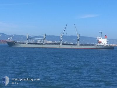
ELM K
General Cargo
Current Trip
| Time Travelled | 19 days |
|---|---|
| Remaining Time | --- |
| Distance Travelled | 832.78 nm |
| Remaining Distance | --- |
| AVG Speed | 11.8 Knots |
| MAX Speed | 23.5 Knots |
| AVG Wind | 7.1 knots |
| MAX Wind | 27 knots |
| MIN Temp | 7.5°C / 45.5°F |
| MAX Temp | 28.9°C / 84.02°F |
| Draught | 6.4 m |
| Position Received | 1 d ago |
Current Position
| Longitude | -122.76122° |
|---|---|
| Latitude | 45.74625° |
| Status | At anchor |
| Speed | 11.4 Knots |
| Course | 178.6° |
| Area | North Pacific Ocean |
| Station | T-AIS |
| Position Received | 1 d ago |
Info
Information
The current position of ELM K is in North Pacific Ocean with coordinates 45.74625° / -122.76122° as reported on 2024-06-24 01:49 by AIS to our vessel tracker app. The vessel's current speed is 11.4 Knots
The vessel ELM K (IMO: 9614294, MMSI: 373943000) is a General Cargo that was built in 2012 ( 12 years old ). It's sailing under the flag of [PA] Panama.
In this page you can find informations about the vessels current position, last detected port calls, and current voyage information. If the vessels is not in coverage by AIS you will find the latest position.
The current position of ELM K is detected by our AIS receivers and we are not responsible for the reliability of the data. The last position was recorded while the vessel was in Coverage by the Ais receivers of our vessel tracking app.
The current draught of ELM K as reported by AIS is 6.4 meters
Weather
| Temperature | 12.7°C / 54.86°F |
|---|---|
| Wind Speed | 5 knots |
| Direction | 317° NW |
| Pressure | 1014.5 hPa |
| Humidity | 80.1 % |
| Cloud Coverage | --- |
Featured Company
Events
| Time | Event | Details | Position / Dest | Info |
|---|---|---|---|---|
| 2024-06-24 02:38 | STOP Moving | 5.08 nm, North West of VANCOUVER |
45.71109 / -122.76324
US PDX
|
Speed: 0.2 kn Course: 254° |
| 2024-06-24 01:56 | Status Changed | Default At anchor |
45.73111 / -122.76157
US PDX
|
Speed: 11.4 kn Course: 178.6° |
| 2024-06-24 01:49 | OUT of Coverage |
45.74625 / -122.76122
North Pacific Ocean
|
Speed: 11.4 kn Course: 178.6° |
|
| 2024-06-24 01:39 | Status Changed | At anchor Default |
45.77941 / -122.77007
US PDX
|
Speed: 12.9 kn Course: 148° |
| 2024-06-24 01:11 | Status Changed | Default At anchor |
45.87128 / -122.78853
US PDX
|
Speed: 12.8 kn Course: 153.8° |
| 2024-06-23 20:09 | START Moving | 1.76 nm, East of ASTORIA |
46.20087 / -123.82188
US PDX
|
Speed: 3.1 kn Course: 237° |
| 2024-06-23 19:26 | Status Changed | At anchor Default |
46.19884 / -123.82503
US PDX
|
Speed: Course: 260° |
| 2024-06-23 19:23 | Status Changed | Default At anchor |
46.19881 / -123.82503
US PDX
|
Speed: 0.1 kn Course: 266° |
| 2024-06-23 13:41 | Status Changed | At anchor Default |
46.19781 / -123.83008
US PDX
|
Speed: 0.1 kn Course: 73° |
| 2024-06-23 13:38 | Status Changed | Default At anchor |
46.19776 / -123.83003
US PDX
|
Speed: 0.1 kn Course: 76° |