
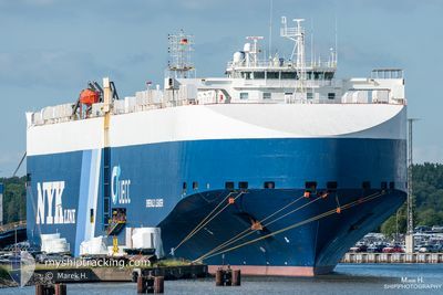
EMERALD LEADER
Vehicles Carrier
Current Trip
| Time Travelled | 7 h, 22 mins |
|---|---|
| Remaining Time | 1 day |
| Distance Travelled | 110.38 nm |
| Remaining Distance | 415.36 nm |
| AVG Speed | 14.4 Knots |
| MAX Speed | 18.4 Knots |
| AVG Wind | 22.7 knots |
| MAX Wind | 24 knots |
| MIN Temp | 11°C / 51.8°F |
| MAX Temp | 14.1°C / 57.38°F |
| Draught | 8.8 m |
| Position Received | Now |
Current Position
| Longitude | 0.82136° |
|---|---|
| Latitude | 50.69708° |
| Status | Under way using engine |
| Speed | 14.5 Knots |
| Course | 235° |
| Area | English Channel |
| Station | T-AIS |
| Position Received | Now |
Info
Information
The current position of EMERALD LEADER is in English Channel with coordinates 50.69708° / 0.82136° as reported on 2024-06-01 05:08 by AIS to our vessel tracker app. The vessel's current speed is 14.5 Knots and is heading at the port of PORTBURY. The estimated time of arrival as calculated by vessel tracking app is 2024-06-02 08:55 LT
The vessel EMERALD LEADER (IMO: 9361811, MMSI: 308688000) is a Vehicles Carrier that was built in 2007 ( 17 years old ). It's sailing under the flag of [BS] Bahamas.
In this page you can find informations about the vessels current position, last detected port calls, and current voyage information. If the vessels is not in coverage by AIS you will find the latest position.
The current position of EMERALD LEADER is detected by our AIS receivers and we are not responsible for the reliability of the data. The last position was recorded while the vessel was in Coverage by the Ais receivers of our vessel tracking app.
The current draught of EMERALD LEADER as reported by AIS is 8.8 meters
Weather
| Temperature | 11.8°C / 53.24°F |
|---|---|
| Wind Speed | 17 knots |
| Direction | 1° N |
| Pressure | 1021.3 hPa |
| Humidity | 80.9 % |
| Cloud Coverage | 100 % |
Featured Company
Last Port Calls
| Port | Arrival | Departure | Time In Port |
|---|---|---|---|
| 2024-05-30 00:33 | 2024-05-31 21:46 | 1 d | |
| 2024-05-29 09:47 | 2024-05-29 22:29 | 12 h | |
| 2024-05-19 05:54 | 2024-05-20 16:48 | 1 d | |
| 2024-05-14 09:35 | 2024-05-15 19:39 | 1 d | |
| 2024-05-12 02:06 | 2024-05-13 00:56 | 22 h | |
| 2024-05-08 19:12 | 2024-05-09 12:33 | 17 h | |
| 2024-05-04 16:24 | 2024-05-06 18:50 | 2 d | |
| 2024-04-30 18:08 | 2024-05-02 16:25 | 1 d | |
| 2024-04-29 08:05 | 2024-04-29 21:20 | 13 h | |
| 2024-04-18 00:27 | 2024-04-20 09:50 | 2 d |
Last Trips
| Origin | Departure | Destination | Arrival | Distance | |
|---|---|---|---|---|---|
| 2024-05-30 00:29 | 2024-05-30 02:33 | 21.89 nm | |||
| 2024-05-20 19:48 | 2024-05-29 11:47 | 3229.75 nm | |||
| 2024-05-15 21:39 | 2024-05-19 08:54 | 1296.92 nm | |||
| 2024-05-13 02:56 | 2024-05-14 11:35 | 534.65 nm | |||
| 2024-05-09 14:33 | 2024-05-12 04:06 | 973.39 nm | |||
| 2024-05-06 19:50 | 2024-05-08 21:12 | 709.29 nm | |||
| 2024-05-02 18:25 | 2024-05-04 17:24 | 556.00 nm | |||
| 2024-04-29 23:20 | 2024-04-30 20:08 | 66.25 nm | |||
| 2024-04-20 12:50 | 2024-04-29 10:05 | 3249.65 nm | |||
| 2024-04-16 15:16 | 2024-04-18 03:27 | 406.68 nm |
Events
| Time | Event | Details | Position / Dest | Info |
|---|---|---|---|---|
| 2024-06-01 02:56 | Change Sea Area | United Kingdom part of the English Channel United Kingdom part of the North Sea |
51.06482 / 1.47200
English Channel
BE ZEE > GB PRU
|
Speed: 18.2 kn Course: 239.9° |
| 2024-06-01 00:56 | Change Sea Area | United Kingdom part of the North Sea French part of the North Sea |
51.40021 / 2.06900
North Sea
BE ZEE > GB PRU
|
Speed: 14.7 kn Course: 303.7° |
| 2024-06-01 00:14 | Detected in Sea | French part of the North Sea |
51.34505 / 2.31739
North Sea
BE ZEE > GB PRU
|
Speed: 15.7 kn Course: 247.1° |
| 2024-05-31 21:46 | PORT DEPARTURE |
|
51.36574 / 3.18820
BE ZEE > GB PRU
|
Speed: 14.4 kn Course: 320° |
| 2024-05-31 21:35 | START Moving |
51.34049 / 3.21118
[BE] ZEEBRUGGE
|
Speed: 3.4 kn Course: 331° |
|
| 2024-05-31 20:35 | STOP Moving |
51.33349 / 3.21745
[BE] ZEEBRUGGE
|
Speed: 0.2 kn Course: 329° |
|
| 2024-05-31 20:05 | START Moving |
51.30233 / 3.23444
[BE] ZEEBRUGGE
|
Speed: 4.5 kn Course: 325° |
|
| 2024-05-31 20:01 | Status Changed | Under way using engine Moored |
51.30145 / 3.23737
[BE] ZEEBRUGGE
|
Speed: 0.4 kn Course: 329° |
| 2024-05-31 19:18 | Status Changed | Moored Default |
51.30146 / 3.23744
[BE] ZEEBRUGGE
|
Speed: Course: 332° |
| 2024-05-31 19:12 | Status Changed | Default Moored |
51.30147 / 3.23745
[BE] ZEEBRUGGE
|
Speed: Course: 332° |