
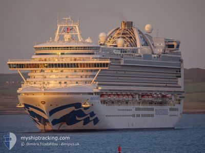
EMERALD PRINCESS
Passengers Ship
Current Trip
US PEE COGOLIN
| Time Travelled | 1 day |
|---|---|
| Remaining Time | --- |
| Distance Travelled | 805.70 nm |
| Remaining Distance | --- |
| AVG Speed | 19.6 Knots |
| MAX Speed | 20.4 Knots |
| AVG Wind | 9.4 knots |
| MAX Wind | 14 knots |
| MIN Temp | 26°C / 78.8°F |
| MAX Temp | 28.7°C / 83.66°F |
| Draught | 8.6 m |
| Position Received | 1 h, 52 m ago |
Current Position
| Longitude | -73.38162° |
|---|---|
| Latitude | 23.94336° |
| Status | Under way using engine |
| Speed | 19.3 Knots |
| Course | 299.4° |
| Area | North Atlantic Ocean |
| Station | T-AIS |
| Position Received | 1 h, 52 m ago |
Info
Information
The current position of EMERALD PRINCESS is in North Atlantic Ocean with coordinates 23.94336° / -73.38162° as reported on 2024-05-19 11:58 by AIS to our vessel tracker app. The vessel's current speed is 19.3 Knots
The vessel EMERALD PRINCESS (IMO: 9333151, MMSI: 310531000) is a Passengers Ship that was built in 2007 ( 17 years old ). It's sailing under the flag of [BM] Bermuda.
In this page you can find informations about the vessels current position, last detected port calls, and current voyage information. If the vessels is not in coverage by AIS you will find the latest position.
The current position of EMERALD PRINCESS is detected by our AIS receivers and we are not responsible for the reliability of the data. The last position was recorded while the vessel was in Coverage by the Ais receivers of our vessel tracking app.
The current draught of EMERALD PRINCESS as reported by AIS is 8.6 meters
Weather
| Temperature | 26.6°C / 79.88°F |
|---|---|
| Wind Speed | 8 knots |
| Direction | 150° SSE |
| Pressure | 1015.9 hPa |
| Humidity | 78.1 % |
| Cloud Coverage | 100 % |
Featured Company
Last Port Calls
| Port | Arrival | Departure | Time In Port |
|---|---|---|---|
| 2024-05-17 09:46 | 2024-05-17 20:20 | 10 h | |
| 2024-05-16 10:13 | 2024-05-16 21:26 | 11 h | |
| 2024-05-15 10:41 | 2024-05-15 22:09 | 11 h | |
| 2024-05-14 12:18 | 2024-05-14 23:10 | 10 h | |
| 2024-05-13 11:46 | 2024-05-13 21:19 | 9 h | |
| 2024-05-11 12:15 | 2024-05-11 20:45 | 8 h | |
| 2024-05-10 10:12 | 2024-05-10 20:22 | 10 h | |
| 2024-05-07 10:27 | 2024-05-07 20:33 | 10 h | |
| 2024-05-06 11:24 | 2024-05-06 21:57 | 10 h | |
| 2024-05-05 10:42 | 2024-05-05 22:07 | 11 h |
Most Visited Ports (Last year)
| Port | Arrivals | |
|---|---|---|
| 15 | ||
| 11 | ||
| 10 | ||
| 9 | ||
| 8 | ||
| 8 |
Last Trips
| Origin | Departure | Destination | Arrival | Distance | |
|---|---|---|---|---|---|
| 2024-05-16 17:26 | 2024-05-17 05:46 | 187.15 nm | |||
| 2024-05-15 18:09 | 2024-05-16 06:13 | 130.88 nm | |||
| 2024-05-14 19:10 | 2024-05-15 06:41 | 123.01 nm | |||
| 2024-05-13 17:19 | 2024-05-14 08:18 | 275.97 nm | |||
| 2024-05-11 16:45 | 2024-05-13 07:46 | 744.91 nm | |||
| 2024-05-10 16:22 | 2024-05-11 08:15 | 288.61 nm | |||
| 2024-05-07 16:33 | 2024-05-10 06:12 | 1007.26 nm | |||
| 2024-05-06 17:57 | 2024-05-07 06:27 | 152.71 nm | |||
| 2024-05-05 18:07 | 2024-05-06 07:24 | 132.83 nm | |||
| 2024-05-04 17:50 | 2024-05-05 06:42 | 133.22 nm |
Events
| Time | Event | Details | Position / Dest | Info |
|---|---|---|---|---|
| 2024-05-19 12:07 | Status Changed | Default Under way using engine |
23.96869 / -73.42856
US PEE COGOLIN
|
Speed: 19.3 kn Course: 299.4° |
| 2024-05-19 11:58 | OUT of Coverage |
23.94336 / -73.38162
North Atlantic Ocean
|
Speed: 19.3 kn Course: 299.4° |
|
| 2024-05-19 11:33 | Change Sea Area | Bahamas part of the North Atlantic Ocean Anguilla part of the Caribbean Sea |
23.87424 / -73.25543
North Atlantic Ocean
|
Speed: 19.6 kn Course: 302.1° |
| 2024-05-19 11:33 | Status Changed | Under way using engine Default |
23.87424 / -73.25543
US PEE COGOLIN
|
Speed: 20 kn Course: 302° |
| 2024-05-19 11:16 | IN Coverage |
23.87424 / -73.25543
North Atlantic Ocean
|
Speed: 19.6 kn Course: 302.1° |
|
| 2024-05-18 02:17 | Status Changed | Default Under way using engine |
18.05167 / -63.51667
US PEE COGOLIN
|
Speed: 19.6 kn Course: 339.4° |
| 2024-05-18 02:13 | Change Sea Area | Anguilla part of the Caribbean Sea Saint-Martin part of the Caribbean Sea |
18.03485 / -63.51008
Caribbean Sea
|
Speed: 19.6 kn Course: 339.4° |
| 2024-05-18 02:13 | OUT of Coverage |
18.03485 / -63.51008
Caribbean Sea
|
Speed: 19.6 kn Course: 339.4° |
|
| 2024-05-18 02:00 | Change Sea Area | Saint-Martin part of the Caribbean Sea Saba part of the Caribbean Sea |
17.96550 / -63.48127
Caribbean Sea
|
Speed: 19.8 kn Course: 337.2° |
| 2024-05-18 02:00 | Status Changed | Under way using engine Default |
17.96550 / -63.48127
US PEE COGOLIN
|
Speed: 20 kn Course: 335° |