
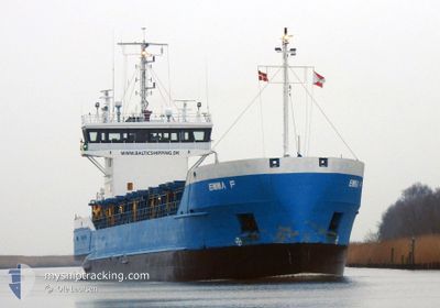
EMMA F
General Cargo
Current Trip
| Time Travelled | 1 day |
|---|---|
| Remaining Time | 2 days |
| Distance Travelled | 318.86 nm |
| Remaining Distance | 565.76 nm |
| AVG Speed | 10.1 Knots |
| MAX Speed | 10.6 Knots |
| AVG Wind | 6.3 knots |
| MAX Wind | 13.1 knots |
| MIN Temp | 11.3°C / 52.34°F |
| MAX Temp | 15.2°C / 59.36°F |
| Draught | 5.4 m |
| Position Received | 26 m ago |
Current Position
| Longitude | 16.81101° |
|---|---|
| Latitude | 56.18147° |
| Status | Under way using engine |
| Speed | 9.7 Knots |
| Course | 234° |
| Area | Baltic Sea |
| Station | T-AIS |
| Position Received | 26 m ago |
Info
Information
The current position of EMMA F is in Baltic Sea with coordinates 56.18147° / 16.81101° as reported on 2024-06-01 02:42 by AIS to our vessel tracker app. The vessel's current speed is 9.7 Knots and is heading at the port of TAU. The estimated time of arrival as calculated by vessel tracking app is 2024-06-03 13:23 LT
The vessel EMMA F (IMO: 8609618, MMSI: 305190000) is a General Cargo that was built in 1986 ( 38 years old ). It's sailing under the flag of [AG] Antigua Barbuda.
In this page you can find informations about the vessels current position, last detected port calls, and current voyage information. If the vessels is not in coverage by AIS you will find the latest position.
The current position of EMMA F is detected by our AIS receivers and we are not responsible for the reliability of the data. The last position was recorded while the vessel was in Coverage by the Ais receivers of our vessel tracking app.
The current draught of EMMA F as reported by AIS is 5.4 meters
Weather
| Temperature | 12.5°C / 54.5°F |
|---|---|
| Wind Speed | 12 knots |
| Direction | 11° N |
| Pressure | 1012.4 hPa |
| Humidity | 92.6 % |
| Cloud Coverage | 28 % |
Featured Company
Last Port Calls
| Port | Arrival | Departure | Time In Port |
|---|---|---|---|
| 2024-05-28 17:49 | 2024-05-30 18:33 | 2 d | |
| 2024-05-27 07:33 | 2024-05-27 18:05 | 10 h | |
| 2024-05-22 11:34 | 2024-05-24 06:44 | 1 d | |
| 2024-05-20 19:21 | 2024-05-21 17:42 | 22 h | |
| 2024-05-20 03:43 | 2024-05-20 12:31 | 8 h | |
| 2024-05-17 17:33 | 2024-05-19 19:02 | 2 d | |
| 2024-05-17 03:40 | 2024-05-17 13:02 | 9 h | |
| 2024-05-14 16:24 | 2024-05-15 12:46 | 20 h | |
| 2024-05-07 05:16 | 2024-05-08 18:19 | 1 d | |
| 2024-05-02 07:22 | 2024-05-04 06:02 | 1 d |
Last Trips
| Origin | Departure | Destination | Arrival | Distance | |
|---|---|---|---|---|---|
| 2024-05-27 21:05 | 2024-05-28 20:49 | 238.60 nm | |||
| 2024-05-24 08:44 | 2024-05-27 10:33 | 707.07 nm | |||
| 2024-05-21 19:42 | 2024-05-22 13:34 | 167.19 nm | |||
| 2024-05-20 14:31 | 2024-05-20 21:21 | 72.23 nm | |||
| 2024-05-19 21:02 | 2024-05-20 05:43 | 88.87 nm | |||
| 2024-05-17 15:02 | 2024-05-17 19:33 | 48.14 nm | |||
| 2024-05-15 14:46 | 2024-05-17 05:40 | 378.01 nm | |||
| 2024-05-08 20:19 | 2024-05-14 18:24 | 213.21 nm | |||
| 2024-05-04 08:02 | 2024-05-07 07:16 | 318.27 nm | |||
| 2024-04-30 17:02 | 2024-05-02 09:22 | 378.32 nm |
Events
| Time | Event | Details | Position / Dest | Info |
|---|---|---|---|---|
| 2024-06-01 02:46 | Status Changed | Default Under way using engine |
56.17514 / 16.79621
NOTAU
|
Speed: 9.7 kn Course: 234° |
| 2024-06-01 02:42 | Status Changed | Under way using engine Default |
56.18147 / 16.81101
NOTAU
|
Speed: 9.8 kn Course: 231° |
| 2024-06-01 02:14 | Status Changed | Default Under way using engine |
56.22926 / 16.91858
NOTAU
|
Speed: 9.7 kn Course: 233.4° |
| 2024-06-01 02:11 | Status Changed | Under way using engine Default |
56.23480 / 16.93120
NOTAU
|
Speed: 9.7 kn Course: 234° |
| 2024-06-01 01:54 | Status Changed | Default Under way using engine |
56.26215 / 16.99505
NOTAU
|
Speed: 9.7 kn Course: 231° |
| 2024-06-01 00:29 | Status Changed | Under way using engine Default |
56.40388 / 17.31782
NOTAU
|
Speed: 9.5 kn Course: 232° |
| 2024-06-01 00:14 | IN Coverage |
56.40388 / 17.31782
Baltic Sea
NOTAU
|
Speed: 9.6 kn Course: 231.2° |
|
| 2024-05-31 12:02 | Status Changed | Default Under way using engine |
58.00831 / 19.54747
NOTAU
|
Speed: 10.3 kn Course: 202.8° |
| 2024-05-31 11:56 | OUT of Coverage |
58.02522 / 19.56040
Baltic Sea
NOTAU
|
Speed: 10.3 kn Course: 202.8° |
|
| 2024-05-31 11:47 | Status Changed | Under way using engine Default |
58.04899 / 19.57880
NOTAU
|
Speed: 10.3 kn Course: 202° |