
EMPERY
Tanker
Current Trip
| Time Travelled | 3 days |
|---|---|
| Remaining Time | --- |
| Distance Travelled | 1108.82 nm |
| Remaining Distance | --- |
| AVG Speed | 14.5 Knots |
| MAX Speed | 17.8 Knots |
| AVG Wind | 17.5 knots |
| MAX Wind | 28 knots |
| MIN Temp | 21.1°C / 69.98°F |
| MAX Temp | 31.7°C / 89.06°F |
| Draught | 9.2 m |
| Position Received | 2 d ago |
Current Position
| Longitude | -70.26760° |
|---|---|
| Latitude | 37.74338° |
| Status | Under way using engine |
| Speed | 12.4 Knots |
| Course | 86.4° |
| Area | North Atlantic Ocean |
| Station | T-AIS |
| Position Received | 2 d ago |
Info
Information
The current position of EMPERY is in North Atlantic Ocean with coordinates 37.74338° / -70.26760° as reported on 2024-06-26 17:12 by AIS to our vessel tracker app. The vessel's current speed is 12.4 Knots and is heading at the port of RAFNES. The estimated time of arrival as calculated by vessel tracking app is 2024-07-07 04:00 LT
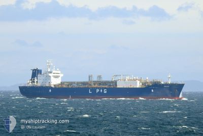
The vessel EMPERY (IMO: 9744910, MMSI: 564011000) is a Tanker It's sailing under the flag of [SG] Singapore.
In this page you can find informations about the vessels current position, last detected port calls, and current voyage information. If the vessels is not in coverage by AIS you will find the latest position.
The current position of EMPERY is detected by our AIS receivers and we are not responsible for the reliability of the data. The last position was recorded while the vessel was in Coverage by the Ais receivers of our vessel tracking app.
The current draught of EMPERY as reported by AIS is 9.2 meters
Weather
| Temperature | 22.2°C / 71.96°F |
|---|---|
| Wind Speed | 24 knots |
| Direction | 189° S |
| Pressure | 1018.2 hPa |
| Humidity | 90.4 % |
| Cloud Coverage | 100 % |
Featured Company
Last Port Calls
| Port | Arrival | Departure | Time In Port |
|---|---|---|---|
| 2024-06-24 15:23 | 2024-06-25 16:19 | 1 d | |
| 2024-06-11 04:26 | 2024-06-12 06:45 | 1 d | |
| 2024-05-28 08:47 | 2024-05-29 22:20 | 1 d | |
| 2024-05-14 20:51 | 2024-05-15 13:19 | 16 h | |
| 2024-05-12 04:20 | 2024-05-13 09:37 | 1 d | |
| 2024-05-09 02:26 | 2024-05-11 00:59 | 1 d | |
| 2024-04-23 09:54 | 2024-04-25 05:38 | 1 d | |
| 2024-04-07 00:07 | 2024-04-08 13:11 | 1 d |
Most Visited Ports (Last year)
| Port | Arrivals | |
|---|---|---|
| 9 | ||
| 7 | ||
| 5 | ||
| 2 | ||
| 2 | ||
| 1 |
Last Trips
| Origin | Departure | Destination | Arrival | Distance | |
|---|---|---|---|---|---|
| 2024-06-12 08:45 | 2024-06-24 11:23 | 3925.97 nm | |||
| 2024-05-29 18:20 | 2024-06-11 06:26 | 3809.75 nm | |||
| 2024-05-15 15:19 | 2024-05-28 04:47 | 3944.88 nm | |||
| 2024-05-13 10:37 | 2024-05-14 22:51 | 480.77 nm | |||
| 2024-05-11 01:59 | 2024-05-12 05:20 | 182.14 nm | |||
| 2024-04-25 01:38 | 2024-05-09 03:26 | 4135.28 nm | |||
| 2024-04-08 14:11 | 2024-04-23 05:54 | 4674.47 nm | |||
| 2024-03-19 03:19 | 2024-04-07 01:07 | 4104.67 nm |
Events
| Time | Event | Details | Position / Dest | Info |
|---|---|---|---|---|
| 2024-06-26 17:13 | Status Changed | Default Under way using engine |
37.74349 / -70.26324
NORAF
|
Speed: 12.4 kn Course: 86.4° |
| 2024-06-26 17:12 | OUT of Coverage |
37.74338 / -70.26760
North Atlantic Ocean
NORAF
|
Speed: 12.4 kn Course: 86.4° |
|
| 2024-06-26 15:52 | Detected in Sea | High seas of the North Atlantic Ocean |
37.73780 / -70.65432
North Atlantic Ocean
NORAF
|
Speed: 15.6 kn Course: 89.5° |
| 2024-06-26 15:52 | Status Changed | Under way using engine Default |
37.73780 / -70.65432
NORAF
|
Speed: 14.8 kn Course: 107° |
| 2024-06-26 15:52 | IN Coverage |
37.73780 / -70.65432
North Atlantic Ocean
NORAF
|
Speed: 15.6 kn Course: 89.5° |
|
| 2024-06-26 07:20 | Status Changed | Default Under way using engine |
37.99242 / -73.42331
NORAF
|
Speed: 14.6 kn Course: 99.6° |
| 2024-06-26 07:14 | OUT of Coverage |
37.99599 / -73.45006
North Atlantic Ocean
NORAF
|
Speed: 14.6 kn Course: 99.6° |
|
| 2024-06-26 07:06 | Status Changed | Under way using engine Default |
38.00194 / -73.49421
NORAF
|
Speed: 14.8 kn Course: 100° |
| 2024-06-26 06:57 | IN Coverage |
38.00155 / -73.49115
North Atlantic Ocean
NORAF
|
Speed: 14.7 kn Course: 99.2° |
|
| 2024-06-26 05:43 | OUT of Coverage |
38.13186 / -73.89574
North Atlantic Ocean
NORAF
|
Speed: 15.3 kn Course: 115.8° |