
EMPIRE STATE
Other Type
Current Trip
| Time Travelled | --- |
|---|---|
| Remaining Time | --- |
| Distance Travelled | --- |
| Remaining Distance | --- |
| AVG Speed | --- |
| MAX Speed | --- |
| AVG Wind | --- |
| MAX Wind | --- |
| MIN Temp | --- |
| MAX Temp | --- |
| Draught | 7.1 m |
| Position Received | 5 d ago |
Current Position
| Longitude | -76.77687° |
|---|---|
| Latitude | 26.69229° |
| Status | Under way using engine |
| Speed | 12.5 Knots |
| Course | 130.5° |
| Area | North Atlantic Ocean |
| Station | T-AIS |
| Position Received | 5 d ago |
Info
Information
The current position of EMPIRE STATE is in North Atlantic Ocean with coordinates 26.69229° / -76.77687° as reported on 2024-06-16 19:25 by AIS to our vessel tracker app. The vessel's current speed is 12.5 Knots
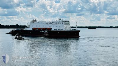
The vessel EMPIRE STATE (IMO: 9910313, MMSI: 366991519) is a Other Type It's sailing under the flag of [US] USA.
In this page you can find informations about the vessels current position, last detected port calls, and current voyage information. If the vessels is not in coverage by AIS you will find the latest position.
The current position of EMPIRE STATE is detected by our AIS receivers and we are not responsible for the reliability of the data. The last position was recorded while the vessel was in Coverage by the Ais receivers of our vessel tracking app.
The current draught of EMPIRE STATE as reported by AIS is 7.1 meters
Weather
| Temperature | 27.7°C / 81.86°F |
|---|---|
| Wind Speed | 10 knots |
| Direction | 43° NE |
| Pressure | 1016.7 hPa |
| Humidity | 74.7 % |
| Cloud Coverage | 98 % |
Featured Company
Last Port Calls
Most Visited Ports (Last year)
| Port | Arrivals | |
|---|---|---|
| 1 | ||
| 1 |
Last Trips
| Origin | Departure | Destination | Arrival | Distance |
|---|
Events
| Time | Event | Details | Position / Dest | Info |
|---|---|---|---|---|
| 2024-06-16 19:25 | OUT of Coverage |
26.69229 / -76.77687
North Atlantic Ocean
|
Speed: 12.5 kn Course: 130.5° |
|
| 2024-06-16 19:00 | IN Coverage |
26.74592 / -76.85299
North Atlantic Ocean
|
Speed: 12.3 kn Course: 131.4° |
|
| 2024-06-16 03:45 | OUT of Coverage |
26.56619 / -79.47251
North Atlantic Ocean
|
Speed: 14.3 kn Course: 305.9° |
|
| 2024-06-16 03:38 | IN Coverage |
26.54862 / -79.44639
North Atlantic Ocean
|
Speed: 14.2 kn Course: 307.1° |
|
| 2024-06-16 00:40 | OUT of Coverage |
26.26853 / -78.84283
North Atlantic Ocean
|
Speed: 12.5 kn Course: 287.2° |
|
| 2024-06-15 23:25 | Detected in Sea | Bahamas part of the North Atlantic Ocean |
26.23774 / -78.57030
North Atlantic Ocean
|
Speed: 12 kn Course: 266.8° |
| 2024-06-15 23:25 | IN Coverage |
26.23774 / -78.57030
North Atlantic Ocean
|
Speed: 12 kn Course: 266.8° |
|
| 2024-06-12 03:36 | OUT of Coverage |
40.20944 / -71.70249
North Atlantic Ocean
NASSAU,BAHAMAS
|
Speed: 12.5 kn Course: 186.2° |
|
| 2024-06-12 02:59 | Draught Changed | 7.1 10 |
40.34039 / -71.71352
NASSAU,BAHAMAS
|
Speed: 12.7 kn Course: 175.8° |
| 2024-06-12 02:59 | Destination Changed | NASSAU,BAHAMAS MONTAUK ANCHORAGE |
40.34039 / -71.71352
NASSAU,BAHAMAS
|
Speed: 12.7 kn Course: 175.8° |