
EMS HIGHWAY
Vehicles Carrier
Current Trip
| Time Travelled | 1 day |
|---|---|
| Remaining Time | 23 h, 52 mins |
| Distance Travelled | 481.29 nm |
| Remaining Distance | 304.46 nm |
| AVG Speed | 10.4 Knots |
| MAX Speed | 15.4 Knots |
| AVG Wind | 9.8 knots |
| MAX Wind | 20.9 knots |
| MIN Temp | 12.2°C / 53.96°F |
| MAX Temp | 18.2°C / 64.76°F |
| Draught | 5.2 m |
| Position Received | Now |
Current Position
| Longitude | 7.04728° |
|---|---|
| Latitude | 53.94402° |
| Status | Under way using engine |
| Speed | 13.3 Knots |
| Course | 256.5° |
| Area | North Sea |
| Station | T-AIS |
| Position Received | Now |
Info
Information
The current position of EMS HIGHWAY is in North Sea with coordinates 53.94402° / 7.04728° as reported on 2024-06-02 19:24 by AIS to our vessel tracker app. The vessel's current speed is 13.3 Knots and is heading at the port of TILBURY. The estimated time of arrival as calculated by vessel tracking app is 2024-06-03 19:17 LT
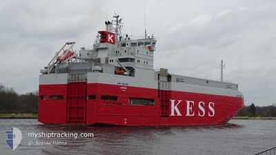
The vessel EMS HIGHWAY (IMO: 9195133, MMSI: 212882000) is a Vehicles Carrier that was built in 1999 ( 25 years old ). It's sailing under the flag of [CY] Cyprus.
In this page you can find informations about the vessels current position, last detected port calls, and current voyage information. If the vessels is not in coverage by AIS you will find the latest position.
The current position of EMS HIGHWAY is detected by our AIS receivers and we are not responsible for the reliability of the data. The last position was recorded while the vessel was in Coverage by the Ais receivers of our vessel tracking app.
The current draught of EMS HIGHWAY as reported by AIS is 5.2 meters
Weather
| Temperature | 13.4°C / 56.12°F |
|---|---|
| Wind Speed | 19 knots |
| Direction | 331° NNW |
| Pressure | 1020.5 hPa |
| Humidity | 75.9 % |
| Cloud Coverage | 13 % |
Featured Company
Last Port Calls
| Port | Arrival | Departure | Time In Port |
|---|---|---|---|
| 2024-05-31 12:59 | 2024-06-01 00:07 | 11 h | |
| 2024-05-30 04:27 | 2024-05-30 13:52 | 9 h | |
| 2024-05-29 03:09 | 2024-05-29 13:00 | 9 h | |
| 2024-05-28 11:15 | 2024-05-28 18:41 | 7 h | |
| 2024-05-25 18:33 | 2024-05-26 13:51 | 19 h | |
| 2024-05-25 04:16 | 2024-05-25 04:51 | 34 m | |
| 2024-05-24 16:53 | 2024-05-24 17:12 | 19 m | |
| 2024-05-22 20:29 | 2024-05-23 15:51 | 19 h | |
| 2024-05-21 10:34 | 2024-05-22 00:01 | 13 h | |
| 2024-05-19 21:38 | 2024-05-20 12:42 | 15 h |
Last Trips
| Origin | Departure | Destination | Arrival | Distance | |
|---|---|---|---|---|---|
| 2024-05-30 15:52 | 2024-05-31 14:59 | 337.73 nm | |||
| 2024-05-29 15:00 | 2024-05-30 06:27 | 165.68 nm | |||
| 2024-05-28 20:41 | 2024-05-29 05:09 | 98.16 nm | |||
| 2024-05-26 15:51 | 2024-05-28 13:15 | 669.68 nm | |||
| 2024-05-25 05:51 | 2024-05-25 20:33 | 206.39 nm | |||
| 2024-05-24 18:12 | 2024-05-25 05:16 | 0.99 nm | |||
| 2024-05-23 17:51 | 2024-05-24 17:53 | 277.32 nm | |||
| 2024-05-22 01:01 | 2024-05-22 22:29 | 278.61 nm | |||
| 2024-05-20 14:42 | 2024-05-21 11:34 | 282.96 nm | |||
| 2024-05-18 14:07 | 2024-05-19 23:38 | 456.69 nm |
Events
| Time | Event | Details | Position / Dest | Info |
|---|---|---|---|---|
| 2024-06-02 13:18 | START Moving | 0.9 nm, South West of BRUNSBUETTEL |
53.89252 / 9.14185
TILBURY
|
Speed: 4.7 kn Course: 227° |
| 2024-06-02 13:16 | Detected in Sea | German part of the North Sea |
53.89350 / 9.14388
North Sea
TILBURY
|
Speed: 1.9 kn Course: 235.7° |
| 2024-06-02 12:42 | STOP Moving | 0.78 nm, South West of BRUNSBUETTEL |
53.89377 / 9.14450
TILBURY
|
Speed: 0.3 kn Course: 227° |
| 2024-06-02 12:22 | START Moving | 0.05 nm, South of BRUNSBUETTEL |
53.90217 / 9.15948
TILBURY
|
Speed: 3.1 kn Course: 228° |
| 2024-06-02 11:40 | STOP Moving | 0.43 nm, North East of BRUNSBUETTEL |
53.90697 / 9.17005
TILBURY
|
Speed: 0.3 kn Course: 287° |
| 2024-06-02 03:27 | START Moving | 1.42 nm, South West of STICKENHΟRN SPORT |
54.36575 / 10.14010
TILBURY
|
Speed: 3.1 kn Course: 284° |
| 2024-06-02 02:55 | STOP Moving | 1.37 nm, South West of STICKENHΟRN SPORT |
54.36520 / 10.14345
TILBURY
|
Speed: 0.2 kn Course: 282° |
| 2024-06-01 23:47 | Change Sea Area | German part of the Baltic Sea Danish part of the Baltic Sea |
54.56557 / 10.56450
Baltic Sea
TILBURY
|
Speed: 4.9 kn Course: 245.2° |
| 2024-06-01 22:32 | Detected in Sea | Danish part of the Baltic Sea |
54.58718 / 10.80608
Baltic Sea
TILBURY
|
Speed: 11.7 kn Course: 263.5° |
| 2024-06-01 21:08 | Change Sea Area | German part of the Baltic Sea Danish part of the Baltic Sea |
54.56260 / 11.32177
Baltic Sea
TILBURY
|
Speed: 13.9 kn Course: 294.4° |