
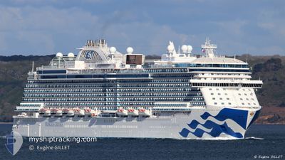
ENCHANTED PRINCESS
Passenger
Current Trip
| Time Travelled | 45 mins |
|---|---|
| Remaining Time | 17 h, 9 mins |
| Distance Travelled | 8.15 nm |
| Remaining Distance | 217.73 nm |
| AVG Speed | 12.1 Knots |
| MAX Speed | 14.2 Knots |
| AVG Wind | 7 knots |
| MAX Wind | 7 knots |
| MIN Temp | 30.4°C / 86.72°F |
| MAX Temp | 30.6°C / 87.08°F |
| Draught | 8.6 m |
| Position Received | Now |
Current Position
| Longitude | -87.06039° |
|---|---|
| Latitude | 20.38580° |
| Status | Under way using engine |
| Speed | 13.9 Knots |
| Course | 189.7° |
| Area | Caribbean Sea |
| Station | T-AIS |
| Position Received | Now |
Info
Information
The current position of ENCHANTED PRINCESS is in Caribbean Sea with coordinates 20.38580° / -87.06039° as reported on 2024-05-20 22:04 by AIS to our vessel tracker app. The vessel's current speed is 13.9 Knots and is heading at the port of BELIZE CITY. The estimated time of arrival as calculated by vessel tracking app is 2024-05-21 15:14 LT
The vessel ENCHANTED PRINCESS (IMO: 9807126, MMSI: 310791000) is a Passenger It's sailing under the flag of [BM] Bermuda.
In this page you can find informations about the vessels current position, last detected port calls, and current voyage information. If the vessels is not in coverage by AIS you will find the latest position.
The current position of ENCHANTED PRINCESS is detected by our AIS receivers and we are not responsible for the reliability of the data. The last position was recorded while the vessel was in Coverage by the Ais receivers of our vessel tracking app.
The current draught of ENCHANTED PRINCESS as reported by AIS is 8.6 meters
Weather
| Temperature | 30.4°C / 86.72°F |
|---|---|
| Wind Speed | 7 knots |
| Direction | 169° S |
| Pressure | 1009.2 hPa |
| Humidity | 66.2 % |
| Cloud Coverage | 18 % |
Featured Company
Last Port Calls
| Port | Arrival | Departure | Time In Port |
|---|---|---|---|
| 2024-05-20 11:13 | 2024-05-20 21:20 | 10 h | |
| 2024-05-18 09:22 | 2024-05-18 19:20 | 9 h | |
| 2024-05-15 11:18 | 2024-05-16 01:12 | 13 h | |
| 2024-05-14 12:58 | 2024-05-15 01:26 | 12 h | |
| 2024-05-12 11:59 | 2024-05-12 20:09 | 8 h | |
| 2024-05-11 09:32 | 2024-05-11 19:26 | 9 h | |
| 2024-05-09 11:42 | 2024-05-09 21:12 | 9 h | |
| 2024-05-08 13:06 | 2024-05-08 22:46 | 9 h | |
| 2024-05-07 12:22 | 2024-05-07 23:44 | 11 h | |
| 2024-05-06 11:14 | 2024-05-06 21:20 | 10 h |
Most Visited Ports (Last year)
| Port | Arrivals | |
|---|---|---|
| 19 | ||
| 16 | ||
| 15 | ||
| 12 | ||
| 11 | ||
| 9 |
Last Trips
| Origin | Departure | Destination | Arrival | Distance | |
|---|---|---|---|---|---|
| 2024-05-18 15:20 | 2024-05-20 06:13 | 548.58 nm | |||
| 2024-05-15 21:12 | 2024-05-18 05:22 | 922.34 nm | |||
| 2024-05-14 21:26 | 2024-05-15 07:18 | 108.11 nm | |||
| 2024-05-12 16:09 | 2024-05-14 08:58 | 741.72 nm | |||
| 2024-05-11 15:26 | 2024-05-12 07:59 | 284.77 nm | |||
| 2024-05-09 16:12 | 2024-05-11 05:32 | 670.00 nm | |||
| 2024-05-08 16:46 | 2024-05-09 06:42 | 170.42 nm | |||
| 2024-05-07 17:44 | 2024-05-08 07:06 | 132.85 nm | |||
| 2024-05-06 16:20 | 2024-05-07 06:22 | 241.95 nm | |||
| 2024-05-04 15:23 | 2024-05-06 06:14 | 544.07 nm |
Events
| Time | Event | Details | Position / Dest | Info |
|---|---|---|---|---|
| 2024-05-20 21:20 | PORT DEPARTURE |
|
20.48006 / -86.98167
BZBZE
|
Speed: 1.9 kn Course: 202° |
| 2024-05-20 21:19 | Change Sea Area | Mexican part of the Caribbean Sea United States part of the North Atlantic Ocean |
20.47968 / -86.98138
Caribbean Sea
BZBZE
|
Speed: 2.3 kn Course: 330° |
| 2024-05-20 21:17 | START Moving |
20.47731 / -86.97996
[MX] COZUMEL
|
Speed: 3.6 kn Course: 153° |
|
| 2024-05-20 21:11 | Status Changed | Under way using engine Moored |
20.47572 / -86.97866
[MX] COZUMEL
|
Speed: Course: 169° |
| 2024-05-20 18:04 | Status Changed | Moored Default |
20.47573 / -86.97865
[MX] COZUMEL
|
Speed: Course: 169° |
| 2024-05-20 17:43 | Status Changed | Default Moored |
20.47573 / -86.97865
[MX] COZUMEL
|
Speed: Course: 169° |
| 2024-05-20 17:19 | Destination Changed | BZBZE MXCZM |
20.47573 / -86.97865
[MX] COZUMEL
|
Speed: Course: 169° |
| 2024-05-20 17:19 | ETA Changed | 2024/05/21 11:00 2024/05/20 11:00 |
20.47573 / -86.97865
[MX] COZUMEL
|
Speed: Course: 169° |
| 2024-05-20 12:29 | ETA Changed | 2024/05/20 11:00 2024/05/20 09:00 |
20.47572 / -86.97865
[MX] COZUMEL
|
Speed: Course: 169° |
| 2024-05-20 12:25 | Status Changed | Moored Default |
20.47572 / -86.97865
[MX] COZUMEL
|
Speed: Course: 169° |